mail_outline sales@mediastorehouse.com
389 items
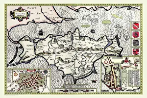
Old Map of The Isle of Wight 1611 by John SpeedA facimile of John Speeds historical map of the Isle of Wight originally published for the " Theatre of the Empire of Great Britain"
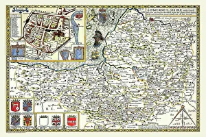
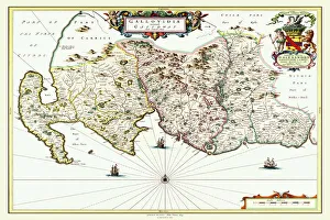
Old County Map of Somersetshire 1611 by John SpeedA facimile of John Speeds historical map of Somersetshire originally published for the " Theatre of the Empire of Great Britain"
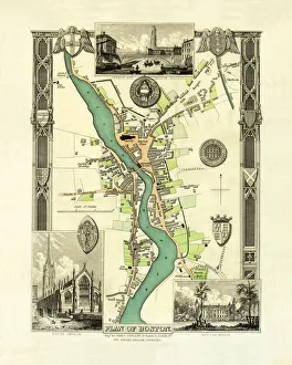
Old Map of Boston England 1836 by Thomas MouleThis is a fine decorative reproduction Map of The Town of Boston from the First Edition series of Thomas Moule Maps, originally Published in 1836
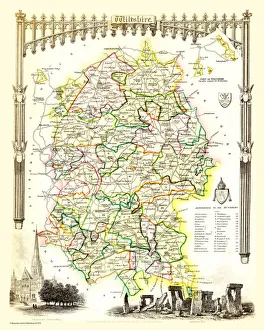
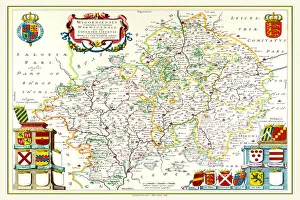
Old County Map of Wiltshire 1836 by Thomas MouleThis is a fine decorative reproduction County Map of Wiltshire from the First Edition series of Thomas Moule Maps, originally Published in 1836
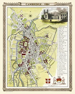
Old Map of Cambridge 1804 by Cole and RoperAn attractive and detailed early 19th century reproduction town plan of Cambridge 1804. First published by Cole and Roper as a finely engraved series of county maps
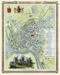
Old Map of Exeter 1805 by Cole and RoperAn attractive and detailed early 19th century reproduction town plan of Exeter 1805. First published by Cole and Roper as a finely engraved series of county maps
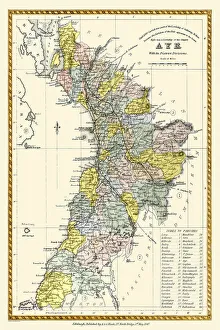
Old County Map of Ayr Scotland 1847 by A&C BlackA finely detailed facimile remastered in full colour from an antique original map of Ayr featured in A&C Blacks Atlas of 1847
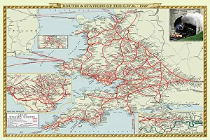
Old Map of the Routes and Stations of the Great Western Railway 1927Completely remastered from an original fold up map published in 1927, this reproduction map shows all the routes and stations of the Great Western Railway
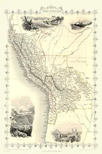
Old Map of Peru and Bolivia 1851 by John TallisA fine facimile artworked from an antique original map of Peru and Bolivia, issued as part of the 1851 edition of John Tallis and Companys " The Illustrated Atlas
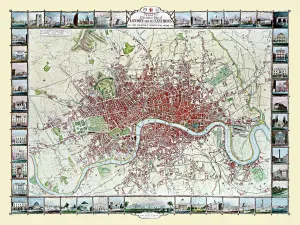
Old Map of London 1851 by John TallisCommemorating the Great Exhibition of Industry of All Nations 1851, this magnificent plan of London, re-created and art worked directly from the antique original
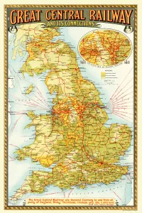
Old Map of the Great Central Railway and its Connections 1903This is a colourful and detailed reproduction map of " The Great Central Railway 1903" showing the lines and stations, with enlarged section showing the Northern Manufacturing Districts
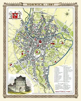
Old Map of Norwich 1807 by Cole and RoperAn attractive and detailed early 19th century reproduction plan of the City of Norwich 1807. First published by Cole and Roper as a finely engraved series of county maps
Old County Map of Warwickshire 1648 by Johan Blaeu from the Atlas NovusThis detailed and most attractive reproduction map of Warwickshire has been carefully art worked from a scan of an antique original
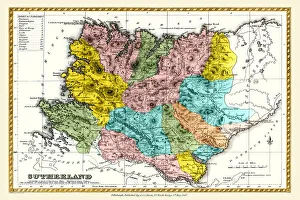
Old County Map of Sutherland Scotland 1847 by A&C BlackA finely detailed facimile remastered in full colour from an antique original map of Sutherland featured in A&C Blacks Atlas of 1847
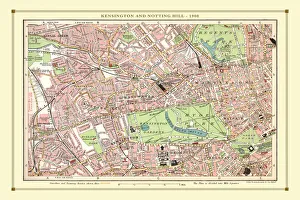
Old Street Map of Kensington and Notting Hill 1908Detailed colour Street Plan of London from 1908 covering the area around Kensington and Notting Hill. The image has been remastered from Bartholomews Handy Atlas of London and Suburbs 1908
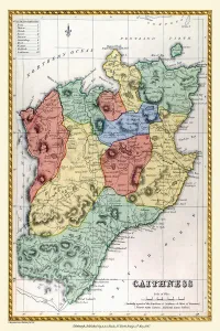
Old County Map of Caithness Scotland 1847 by A&C BlackA finely detailed facimile remastered in full colour from an antique original map of Caithness featured in A&C Blacks Atlas of 1847
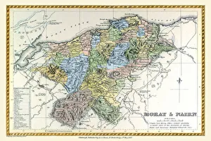
Old County Map of Moray and Nairn Scotland 1847 by A&C BlackA finely detailed facimile remastered in full colour from an antique original map of Moray and Nairn featured in A&C Blacks Atlas of 1847
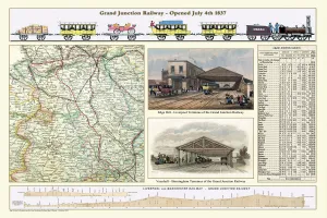
Old Map of the Grand Junction Railway 1837RW0003
Old Map Titled "Travelling on the Liverpool to Manchester Railway 1830"RW0039
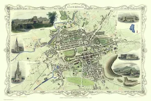
Old Map of Edinburgh Scotland 1851 by John TallisThis Victorian map of Edinburgh in Scotland by John Tallis is dominated with a view to the top right across Edinburgh from the north- west towards Edinburgh Castle
Old County Map of Suffolk 1836 by Thomas MouleThis is a fine decorative reproduction County Map of Suffolk from the First Edition series of Thomas Moule Maps, originally Published in 1836
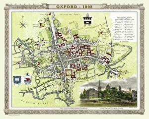
Old Map of Oxford 1808 by Cole and RoperAn attractive and detailed early 19th century reproduction plan of the City of Oxford 1808. First published by Cole and Roper as a finely engraved series of county maps
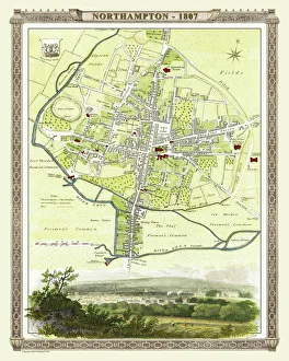
Old Map of Northampton 1807 by Cole and RoperAn attractive and detailed early 19th century reproduction town plan of Northampton 1807. First published by Cole and Roper as a finely engraved series of county maps
Old County Map of Renfrewshire Scotland 1654 by Johan Blaue from the Atlas NovusThis detailed and most attractive reproduction map of Renfrewshire, Scotland, has been carefully art worked from a scan of an antique original
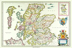
Old Map of Scotland 1635 by Willem & Johan Blaeu from the Theatrum Orbis TerrarumThis detailed and most attractive reproduction map of Scotland has been carefully art worked from a scan of an antique original
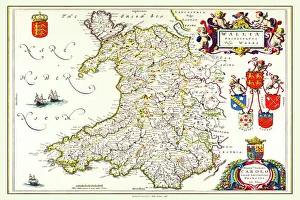
Old Map of Wales 1648 by Johan Blaeu from the Atlas NovusThis detailed and most attractive reproduction map of Wales has been carefully art worked from a scan of an antique original
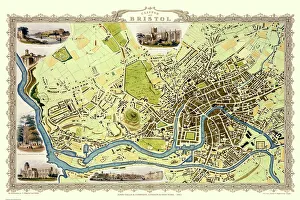
Old Map of Bristol 1851 by John TallisThis 1851 John Tallis map of Bristol shows the new course of the River Avon and the Floating Harbour. At Clifton Down the famous suspension bridge is yet to be constructed
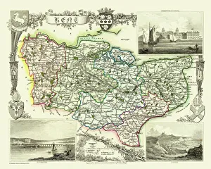
Old County Map of Kent 1836 by Thomas MouleThis is a fine decorative reproduction County Map of Kent from the First Edition series of Thomas Moule Maps, originally Published in 1836
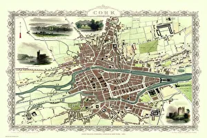
Old Map of Cork Ireland 1851 by John TallisIn this Victorian map of Cork in southern Ireland by John Tallis the North and South channels of the River Lee flow through the centre of the plan with the extensive Barracks dominating
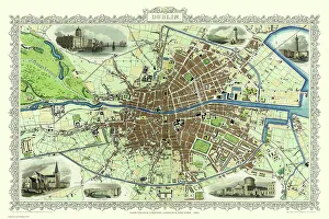
Old Map of Dublin Ireland 1851 by John TallisThis most attractive 19th Century map of Dublin in Southern Ireland by John Tallis 1851 shows all of Dublins districts, the Grand Canal networks and the arrival of the railways
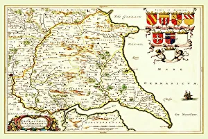
Old County Map of the East Riding of Yorkshire 1648 by Johan Blaeu from the Atlas NovusThis detailed and most attractive reproduction map of the East Riding of Yorkshire has been carefully art worked from a scan of an antique original
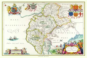
Old County Map of Cumbria 1648 by Johan Blaeu from the Atlas NovusThis detailed and most attractive reproduction map of Cumbria has been carefully art worked from a scan of an antique original
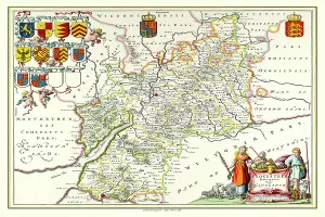
Old County Map of Gloucestershire 1648 by Johan Blaeu from the Atlas NovusThis detailed and most attractive reproduction map of Gloucestershire has been carefully art worked from a scan of an antique original
Old Map of Galloway Scotland 1654 by Johan Blaeu from the Atlas NovusThis detailed and most attractive reproduction map of Galloway has been carefully art worked from a scan of an antique original
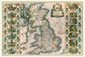
Old Map of Anglo Saxon Britain by John SpeedA facimile of John Speeds historical map of the Saxon Heptarchy originally published for the " Theatre of the Empire of Great Britain"
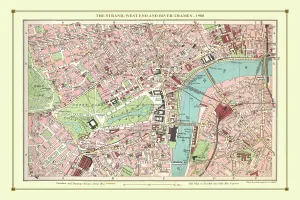
Old Street Map of The Strand, West End and River Thames 1908Detailed colour Street Plan of London from 1908 covering the area around The Strand, The West End and the River Thames.The image has been remastered from Bartholomews Handy Atlas of London
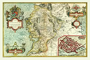
Old Map of The Province of Connacht, Ireland 1611 by John SpeedA facimile of John Speeds historical map of the Province of Connacht originally published for the " Theatre of the Empire of Great Britain"
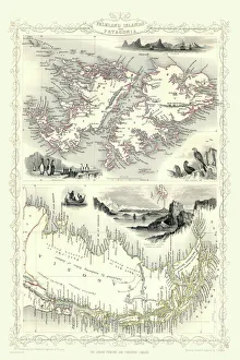
Old Map of Falkland Islands and Patagonia 1851 by John TallisA fine facimile artworked from an antique original map of the Falkland Islands and Patagonia, issued as part of the 1851 edition of John Tallis and Companys " The Illustrated Atlas
Old Map of Newcastle upon Tyne 1851 by John TallisNewcastle 1851, Gateshead is to the bottom of the John Tallis 1851 plan of Newcastle in Tyne and Wear with the famous High Level Railway crossing the River Tyne into Newcastle Central station
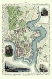
Old Map of Southampton 1851 by John TallisThe River Itchen dominates the 1851 John Tallis plan of Southampton in Hampshire with The Parks covering a great expanse to the top left
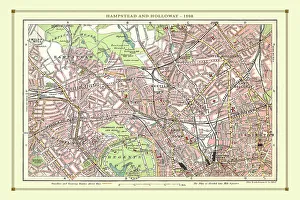
Old Street Map of Hamstead, Holloway and Islington 1908Detailed colour Street Plan of London from 1908 covering the area around Hamstead, Holloway and Islington. The image has been remastered from Bartholomews Handy Atlas of London and Suburbs 1908
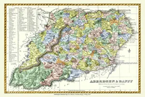
Old County Map of Aberdeen and Banff Scotland 1847 by A&C BlackA finely detailed facimile remastered in full colour from an antique original map of Aberdeen and Banff featured in A&C Blacks Atlas of 1847
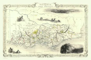
Victoria, or Port Phillip 1851A fine facimile artworked from an antique original map of Victoria, or Port Phillip, Australia, issued as part of the 1851 edition of John Tallis and Companys " The Illustrated Atlas
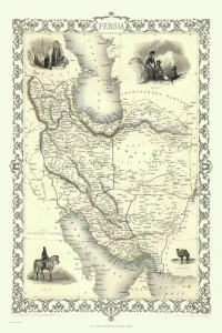
Persia, or Iran 1851A fine facimile artworked from an antique original map of Persia, or later (1935) Iran issued as part of the 1851 edition of John Tallis and Companys " The Illustrated Atlas
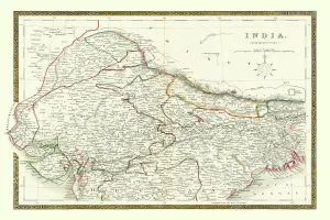
Old Map of Northern India 1852 by Henry George CollinsThis is a finely detailed map of Northern India remastered from a rare Atlas of the World published in 1852 by Henry George Collins
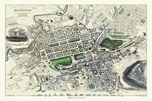
Old Map of Edinburgh 1834 by the S. D. U. KF006
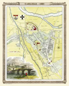
Old Map of Carlisle 1805 by Cole and RoperAn attractive and detailed early 19th century reproduction town plan of Carlisle 1805. First published by Cole and Roper as a finely engraved series of county maps
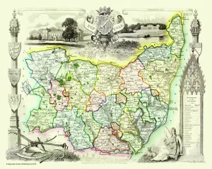
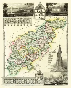
Old County Map of Northamptonshire 1836 by Thomas MouleThis is a fine decorative reproduction County Map of Northamptonshire from the First Edition series of Thomas Moule Maps, originally Published in 1836