mail_outline sales@mediastorehouse.com
389 items
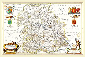
Old County Map of Shropshire 1648 by Johan Blaeu from the Atlas NovusThis detailed and most attractive reproduction map of Shropshire has been carefully art worked from a scan of an antique original
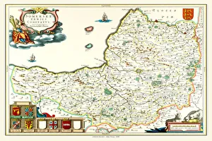
Old County Map of Somersetshire 1648 by Johan Blaeu from the Atlas NovusThis detailed and most attractive reproduction map of Somersetshire has been carefully art worked from a scan of an antique original
Old County Map of Staffordshire 1648 by Johan Blaeu from the Atlas NovusThis detailed and most attractive reproduction map of Staffordshire has been carefully art worked from a scan of an antique original
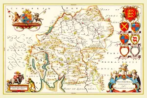
Old County Map of Westmoreland 1648 by Johan Blaeu from the Atlas NovusThis detailed and most attractive reproduction map of Westmoreland has been carefully art worked from a scan of an antique original
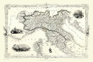
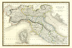
Northern Italy 1851A fine facimile artworked from an antique original map of Northern Italy, issued as part of the 1851 edition of John Tallis and Companys " The Illustrated Atlas
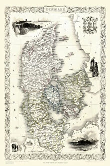
Denmark 1851A fine facimile artworked from an antique original map of Denmark, issued as part of the 1851 edition of John Tallis and Companys " The Illustrated Atlas and Modern History of the World"
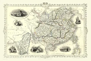
China & Burma 1851A fine facimile artworked from an antique original map of China and Burma, issued as part of the 1851 edition of John Tallis and Companys " The Illustrated Atlas
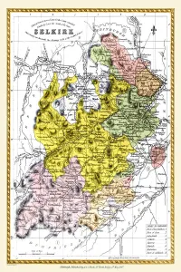
Old County Map of Selkirk Scotland 1847 by A&C BlackA finely detailed facimile remastered in full colour from an antique original map of Selkirk featured in A&C Blacks Atlas of 1847
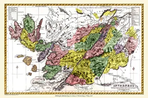
Old County Map of Inverness Scotland 1847 by A&C BlackA finely detailed facimile remastered in full colour from an antique original map of Inverness featured in A&C Blacks Atlas of 1847
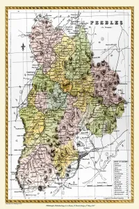
Old County Map of Peebles Scotland 1847 by A&C BlackA finely detailed facimile remastered in full colour from an antique original map of Peebles featured in A&C Blacks Atlas of 1847
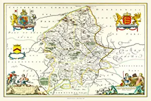
Old County Map of Oxfordshire 1611 by John SpeedA facimile of John Speeds historical map of Oxfordshire originally published for the " Theatre of the Empire of Great Britain", an atlas to accompany " a history of Great Britain"
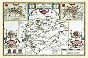
Old County Map of Rutlandshire 1611 by John SpeedA facimile of John Speeds historical map of Rutlandshire originally published for the " Theatre of the Empire of Great Britain", an atlas to accompany " a history of Great Britain"
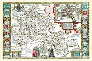
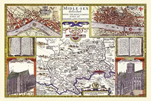
Old County Map of Middlesex by John SpeedA facimile of John Speeds historical map of Middlesex originally published for the " Theatre of the Empire of Great Britain", an atlas to accompany " a history of Great Britain"
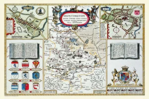
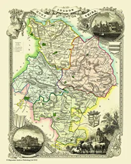
Old County Map of Huntingdonshire 1611 by John SpeedA facimile of John Speeds historical map of Huntingdonshire originally published for the " Theatre of the Empire of Great Britain"
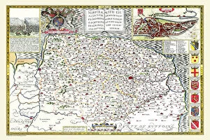
Old County Map of Norfolk 1611 by John SpeedA facimile of John Speeds historical map of Norfolk originally published for the " Theatre of the Empire of Great Britain", an atlas to accompany " a history of Great Britain"
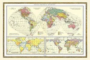
Old Map of the World 1942WMY1942
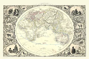
Eastern Hemisphere 1851A fine facimile artworked from an antique original map of The Eastern Hemisphere, issued as part of the 1851 edition of John Tallis and Companys " The Illustrated Atlas
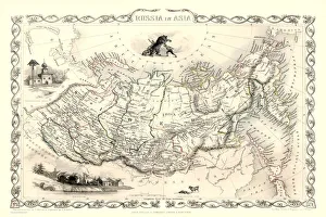
Russia in Asia 1851A fine facimile artworked from an antique original map of Russia in Europe, issued as part of the 1851 edition of John Tallis and Companys " The Illustrated Atlas
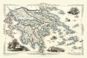
Greece 1851A fine facimile artworked from an antique original map of Greece, issued as part of the 1851 edition of John Tallis and Companys " The Illustrated Atlas and Modern History of the World"
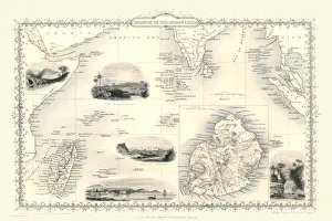
Islands in the Indian Ocean 1851A fine facimile artworked from an antique original map of the Islands in the Indian Ocean, issued as part of the 1851 edition of John Tallis and Companys " The Illustrated Atlas
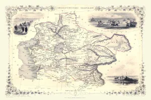
Old County Map of Huntingdonshire 1836 by Thomas MouleThis is a fine decorative reproduction County Map of Huntingdonshire from the First Edition series of Thomas Moule Maps, originally Published in 1836
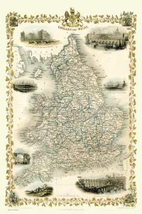
England & Wales 1851A fine facimile artworked from an antique original map of England and Wales, issued as part of the 1851 edition of John Tallis and Companys " The Illustrated Atlas
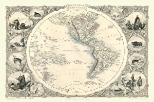
Western Hemisphere 1851A fine facimile artworked from an antique original map of The Western Hemisphere, issued as part of the 1851 edition of John Tallis and Companys " The Illustrated Atlas
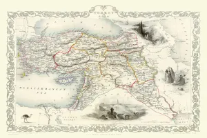
Turkey in Asia 1851A fine facimile artworked from an antique original map of Turkey in Asia, issued as part of the 1851 edition of John Tallis and Companys " The Illustrated Atlas
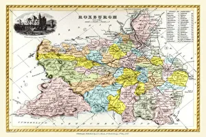
Old County Map of Roxburgh Scotland 1847 by A&C BlackA finely detailed facimile remastered in full colour from an antique original map of Roxburgh featured in A&C Blacks Atlas of 1847
Old Map of Northern Italy 1852 by Henry George CollinsThis is a finely detailed map of Northern Italy remastered from a rare Atlas of the World published in 1852 by Henry George Collins
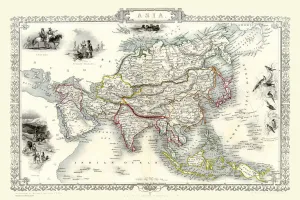
Asia 1851A fine facimile artworked from an antique original map of the Continent of Asia, issued as part of the 1851 edition of John Tallis and Companys " The Illustrated Atlas
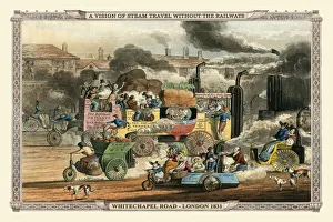
A Vision of Steam Travel Without The Railways - White Chapel 1830 ( Alkens Illustrations of Modern Prophect)A satirical prediction of the evolution of steam-powered transport by Henry Alken, showing White Chapel Road taken over by a variety of vehicles
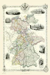
Germany 1851A fine facimile artworked from an antique original map of Germany, issued as part of the 1851 edition of John Tallis and Companys " The Illustrated Atlas and Modern History of the World"
Independent Tartary 1851A fine facimile artworked from an antique original map of the Independant Tartary, issued as part of the 1851 edition of John Tallis and Companys " The Illustrated Atlas
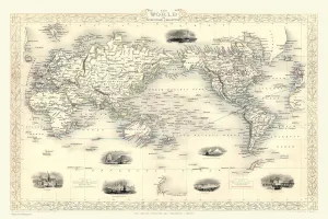
The World on Mercators Projection 1851A fine facimile artworked from an antique original map of The World on Mercators Projection, issued as part of the 1851 edition of John Tallis and Companys " The Illustrated Atlas
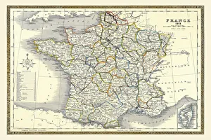
Old Map of France 1852 by Henry George CollinsThis is a finely detailed map of France remastered from a rare Atlas of the World published in 1852 by Henry George Collins
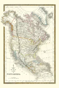
Old Map of North America 1852 by Henry George CollinsThis is a finely detailed map of North America remastered from a rare Atlas of the World published in 1852 by Henry George Collins
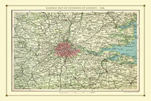
Old Map of the Railways of the Environs of London 1908 by BartholomewRW0033
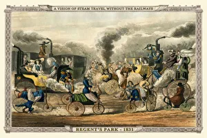
A Vision of Steam Travel Without The Railways - Regents Park 1831 (Alkens Illustrations of Modern Prophecy)A satirical prediction of the evolution of steam-powered transport by Henry Alken, showing Regents Park taken over by a variety of vehicles
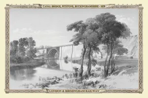
Views on the London to Birmingham Railway - Canal Bridge at Pitstone 1839VR0005
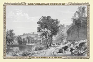
Views on the London to Birmingham Railway - Jackdaw Hill at Linslade 1839VR0006
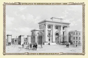
Views on the London to Birmingham Railway - Entrance to Birmingham Station 1839VRS0001
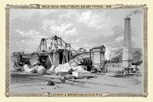
Views on the London to Birmingham Railway - Head Gear on the Great Shaft Kilsby Tunnel 1838VR0016
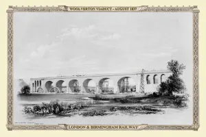
Views on the London to Birmingham Railway - Woolverton Viaduct 1837VR0014
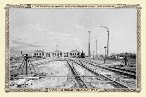
Views on the London to Birmingham Railway - Locomotive Engine Houses and Chimneys 1838VR0001
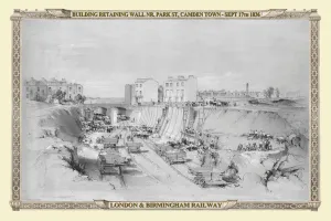
Views on the London to Birmingham Railway - Building the Retaining Walls at Camden Town 1836VR0015
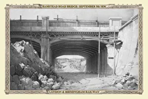
Views on the London to Birmingham Railway - Hamstead Road Bridge 1836VR0017
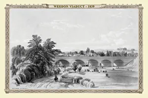
Views on the London to Birmingham Railway - Weedon Viaduct 1839VR0004
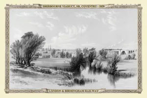
Views on the London to Birmingham Railway - Sherbourne Viaduct near Coventry 1839VR0010
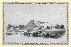
Views on the London to Birmingham Railway - Making the Embankment at Woolverton Valley 1837VR0012
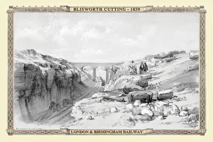
Views on the London to Birmingham Railway - Blisworth Cutting 1839VR0003
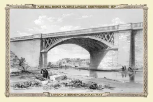
Views on the London to Birmingham Railway - Nash Mill Bridge near Kings Langley 1839VR0002