mail_outline sales@mediastorehouse.com
Choose a picture from our Images Dated 5th October 2020 Collection for your Wall Art and Photo Gifts
6 items
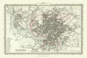
Old Map of Bristol 1866 by Fullarton & CoThis is an interesting and detailed reproduction Victorian town plan of Bristol which was originally published in John Marius Wilsons The Imperial Gazeteer of England and Wales (A.Fullarton & co)
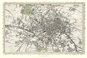
Old Map of Leeds 1866 by Fullarton & CoThis is an interesting and detailed reproduction Victorian town plan of Leeds which was originally published in John Marius Wilsons The Imperial Gazeteer of England and Wales (A.Fullarton & co)
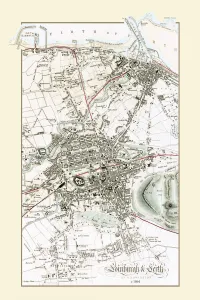
Old Map of Edinburgh and Leith 1864 by G. W. SwansonSplendid reproduction map of Edinburgh originally drawn and engraved by G.H.Swanson. The plan of Edinburgh and Leith shows exceptional detail
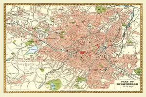
Old Map of Birmingham 1893 from the Comprehensive Gazetteer Atlas of England and WalesThis detailed reproduction plan of Birmingham has been re-worked from an antique originally published in the oComprehensive Gazetteer of England and Waleso 1893
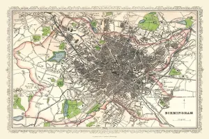
Old Map of Birmingham 1866 by Fullarton & CoThis detailed reproduction plan of Birmingham has been re-worked from an antique originally published in the 1860,s by Archibold Fullarton & Company
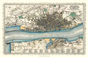
Old Map of Liverpool 1866 by Fullarton & CoThis is an interesting and detailed reproduction Victorian town plan of Liverpool which was originally published in John Marius Wilsons The Imperial Gazeteer of England and Wales (A. Fullarton & co)