mail_outline sales@mediastorehouse.com
Choose a picture from our February Collection for your Wall Art and Photo Gifts
4 items
3 Feb 2021 Collection21 items
14 Feb 2021 Collection3 items
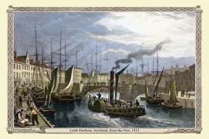
Leith Harbour near Edinburgh Scotland, from the Pier 1831" Leith Harbour, from the Pier" engraved by T.Higham after a picture by Thomas Shepherd, published in Edinburgh in the Nineteenth Century, 1831
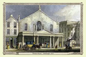
Theatre Royal, Edinburgh, 1831" Theatre Royal, Edinburgh" engraved by W.Wallis after a picture by Thomas Shepherd, published in Edinburgh in the Nineteenth Century, 1831