mail_outline sales@mediastorehouse.com
183 items
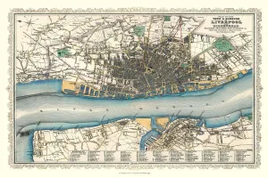
Old Map of Liverpool 1866 by Fullarton & CoThis is an interesting and detailed reproduction Victorian town plan of Liverpool which was originally published in John Marius Wilsons The Imperial Gazeteer of England and Wales (A. Fullarton & co)
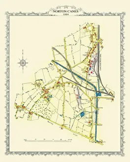
Old Map of the Village of Norton Canes in Staffordshire 1884PL033
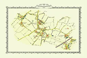
Old Map of the Village of Hammerwich in Staffordshire 1884PL047
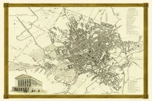
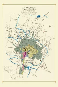
Old Map of Birmingham 1834 by John Dower and William OrrA highly detailed reproduction city map of Birmingham originally published in London, 1834. Interestingly it shows the planned route of the Grand Junction Railway coming into the North of Birmingham
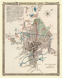
Old Map of Birmingham 1816J077
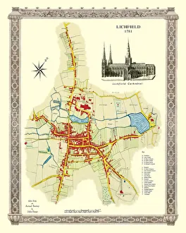
Old Map of Lichfield with inset view of Lichfield Cathedral surveyed in 1781J035
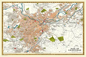
Old Map of Sheffield 1893 from the Comprehensive Gazetteer Atlas of England and WalesJ112
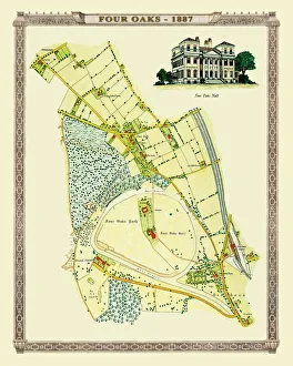
Old Map of the Village of Foar Oaks near Sutton Coldfield 1884PL008
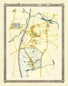
Old Map of the Village of Shenstone near Lichfield 1898PL013
Old Map of the Village of Walmley near Sutton Coldfield 1886PL020
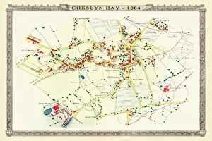
Old Map of the Village of Cheslyn Hay in Staffordshire 1884PL022
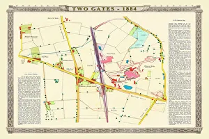
Old Map of the Village of Two Gates near Tamworth in Staffordshire 1884PL019
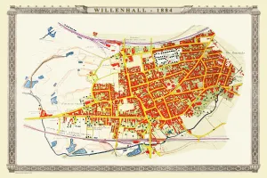
Old Map of the Town of Willenhall in the West Midlands 1884PL024
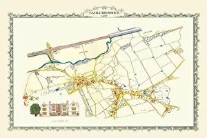
Old Map of Castle Bromwich near Birmingham 1897PL023
Old Map of Birmingham 1825J078
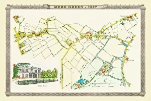
Old Map of Mere Green to Little Sutton in the West Midlands 1884PL027
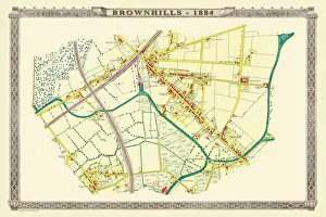
Old Map of the Village of Brownhills near Walsall 1884PL037
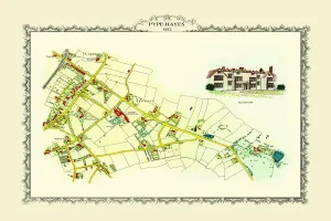
Old Map of The Chester Road to Pype Hayes near Erdington1884PL029
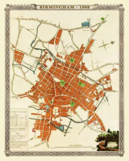
Old Map of Birmingham 1808J074
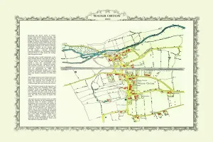
Old Map of the Village of Water Orton in Warwickshire 1882PL028-010-24X16
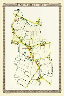
Old Map of the Village of Great Wyrley in Staffordshire 1884PL026
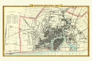
Old Map of Kingston Upon Hull 1862 by Fullarton & CoThis is an interesting and detailed reproduction Victorian town plan of Kingston-upon-Hull which was originally published in John Marius Wilsons The Imperial Gazeteer of England and Wales
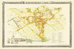
Old Map of Wednesbury Town in the Black Country 1846J023
Old Map of Chester 1795 by John StockdaleAn interesting, very detailed, reproduction 18th century street plan of the City of Chester Engraved for and published John Stockdale
Old Map of Birmingham Surveyed in 1750 by Thomas HansonJ071
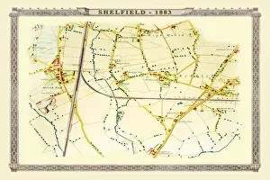
Old map of the Village of Shelfield near Walsall 1886PL012
Old Map of Liverpool 1725J119
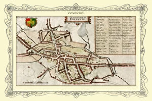
Old Map of Coventry 1730J102
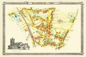
Old Map of the Village of Bloxwich near Walsall 1884PL002
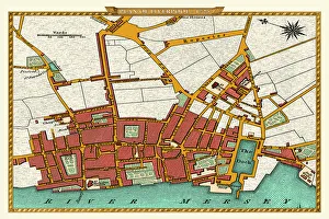
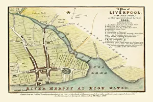
Old map of Liverpool 1650 by Thomas KayeAn interesting map originally published in 1829 by Thomas Kaye, this reproduction map represents the town of Liverpool in 1650
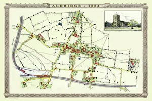
Old Map of the Village of Aldridge in Staffordshire1884PL001
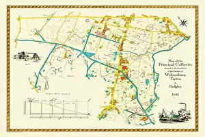
Old Map of the Collieries of Tipton, Sedgley and Wednesbury 1848PL005
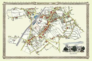
Old Map of the Village of Erdington in the West Midlands 1884PL007
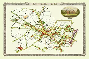
Old Map of Cannock Town in Staffordshire 1886PL004
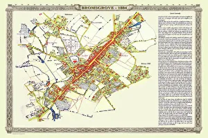
Old Map of the Town of Bromsgrove in Worcestershire 1884PL003
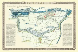
Old Map of Drayton Park and Drayton Bassett in Staffordshire 1886PL006
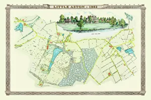
Old Map of the Village of Little Aston in the West Midlands 1886PL009
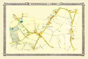
Old Map of the Village of Stonnall in the West Midlands 1884PL014
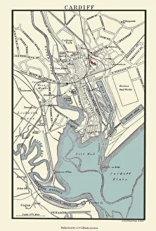
Old Map of Cardiff 1890 by A&C BlackJ133