Home > British Town And City Plans > English & Welsh PORTFOLIO
Tote Bag : Old Map of Birmingham 1851 by John Tallis


![]()
Home Decor from MapSeeker
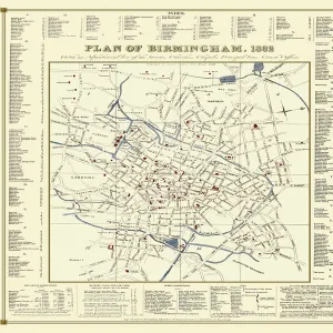
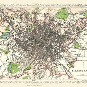
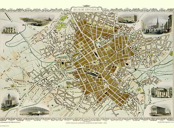
Old Map of Birmingham 1851 by John Tallis
This attractive plan of mid Victorian Birmingham in the Midlands by John Tallis 1851 shows the first railways and important canal network. The work is attractively presented with eight illustrations. These are the Theatre Royal, King Edward School, School of Design, Town Hall, the London and North Western Railway Station and St Phillips Church. At the top left there is a view across Birmingham from Highgate. Finishing the work there is a busy scene from Birminghams famous Bull Ring
Media ID 20347868
Birmingham Birmingham City Birmingham City Map Birmingham Map Birmingham Town Plan Historic Birmingham Map Historic Map John Tallis John Tallis Map Map Of Birmingham Old Map Of Birmingham Old Town Plan Tallis Map Town Plan Of Birmingham
Canvas Tote Bag
Our tote bags are made from soft, durable, poly-poplin fabric and include a one inch (2.5cm) black strap for easy carrying on your shoulder. All seams are double-stitched for added durability. Each tote bag is machine-washable in cold water and is printed on both sides using the same image. Approximate size of bag is 50x33cm (20"x13")
Our tote bags are made from soft durable fabric and include a strap for easy carrying
Estimated Product Size is 50cm x 32.7cm (19.7" x 12.9")
These are individually made so all sizes are approximate
MADE IN THE UK
Safe Shipping with 30 Day Money Back Guarantee
FREE PERSONALISATION*
We are proud to offer a range of customisation features including Personalised Captions, Color Filters and Picture Zoom Tools
SECURE PAYMENTS
We happily accept a wide range of payment options so you can pay for the things you need in the way that is most convenient for you
* Options may vary by product and licensing agreement. Zoomed Pictures can be adjusted in the Cart.