
Home > British Town And City Plans > English & Welsh PORTFOLIO

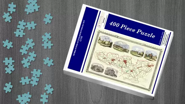
Jigsaw Puzzle : Old Map of Stoke on Trent and the Potteries 1831

Old Map of Stoke on Trent and the Potteries 1831


-
+
£29.99

We accept all major credit cards


Cards
Background Images
Mounted Prints
Fine Art Prints
Canvas Prints
Home Decor
Metal Prints


Jigsaw Puzzles from MapSeeker

Old Map of Stoke on Trent and the Potteries 1831

G148

Media ID 20347092

Historic Map Old Town Plan Town Plan


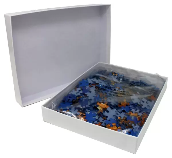
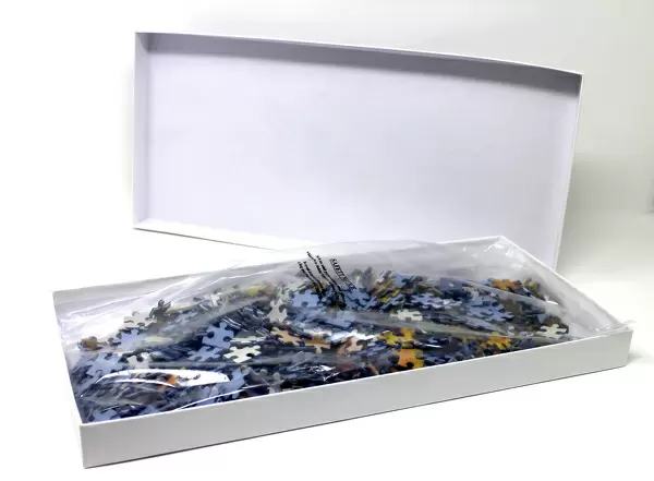
Jigsaw Puzzle (400 Pieces)

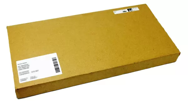
400 piece puzzles are custom made in the UK and hand-finished on 100% recycled 1.5 mm millboard. There is a level of repetition in jigsaw shapes with each matching piece away from its pair. The completed puzzle measures 31x47cm and is delivered packaged in an attractive presentation box specially designed to fit most letter box slots

Jigsaw Puzzles are an ideal gift for any occasion

Estimated Product Size is 47.2cm x 31.5cm (18.6" x 12.4")

These are individually made so all sizes are approximate

Artwork printed orientated as per the preview above, with landscape (horizontal) or portrait (vertical) orientation to match the source image.


MADE IN THE UK
Safe Shipping with 30 Day Money Back Guarantee

FREE PERSONALISATION*
We are proud to offer a range of customisation features including Personalised Captions, Color Filters and Picture Zoom Tools

SECURE PAYMENTS
We happily accept a wide range of payment options so you can pay for the things you need in the way that is most convenient for you

* Options may vary by product and licensing agreement. Zoomed Pictures can be adjusted in the Cart.


globe_uk
Made in UK
thumb_up
Professional quality finish
diamond
Made with high-grade materials
inventory_2
Carefully packed to aid safe arrival


Related Images


The Historic Map of Scotland "Scotland of Old"
Old Map of Perth Scotland 1851 by John Tallis
Old Map of Leeds 1851 by John Tallis
Old Map of Bristol 1903
Map of the Clans and Tartans of Scotland
Pictorial Story Map of Scotland
Old Map of The Isle of Wight 1836 by Thomas Moule
Old County Map of Cambridgeshire 1836 by Thomas Moule
Old Map of the Isle of Islay Scotland 1654 by Johan Blaeu from the Atlas Novus
Old Map of Bath 1851 by John Tallis
Old Map of Sheffield 1851 by John Tallis
Old Map of Aberdeen 1851 by John Tallis

+

Shipping

+

Choices

+

Guaranteed