Home > British Town And City Plans > English & Welsh PORTFOLIO
Mounted Print : Old Street Map of London South and River Thames 1908


![]()
Mounted Prints from MapSeeker
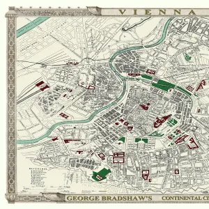
Old Street Map of London South and River Thames 1908
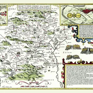
Detailed colour Street Plan of London from 1908. The street map features London South wiith the River Thames from Vauxhall Bridge to the London Docks and features Westminster, the Houses of Parliament. The area South of the Thames includes the London Boroughs of Lambeth, Walworth, Newington and Bermongsey
Media ID 20347791
© Mapseeker Publishing Ltd, Collins Bartholomew Ltd
London Street Plan Map Of Central London Old London Street Map Old Map Of London Central Street Plan
10"x8" Mount with 8"x6" Print
Printed on 8"x6" paper and suitable for use in a 10"x8" frame (frame not included). Prints are mounted with card both front and back. Featuring a custom cut aperture to match chosen image. Professional 234gsm Fujifilm Crystal Archive DP II paper.
Photo prints supplied in custom cut card mount ready for framing
Estimated Image Size (if not cropped) is 20.3cm x 13.5cm (8" x 5.3")
Estimated Product Size is 25.4cm x 20.3cm (10" x 8")
These are individually made so all sizes are approximate
Artwork printed orientated as per the preview above, with landscape (horizontal) orientation to match the source image.
MADE IN THE UK
Safe Shipping with 30 Day Money Back Guarantee
FREE PERSONALISATION*
We are proud to offer a range of customisation features including Personalised Captions, Color Filters and Picture Zoom Tools
SECURE PAYMENTS
We happily accept a wide range of payment options so you can pay for the things you need in the way that is most convenient for you
* Options may vary by product and licensing agreement. Zoomed Pictures can be adjusted in the Cart.