Home > British Town And City Plans > English & Welsh PORTFOLIO
Metal Print : Old Street Map of London South and River Thames 1908


![]()
Metal Prints from MapSeeker
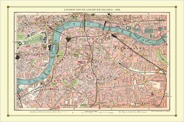
Old Street Map of London South and River Thames 1908
Detailed colour Street Plan of London from 1908. The street map features London South wiith the River Thames from Vauxhall Bridge to the London Docks and features Westminster, the Houses of Parliament. The area South of the Thames includes the London Boroughs of Lambeth, Walworth, Newington and Bermongsey
Media ID 20347791
© Mapseeker Publishing Ltd, Collins Bartholomew Ltd
London Street Plan Map Of Central London Old London Street Map Old Map Of London Central Street Plan
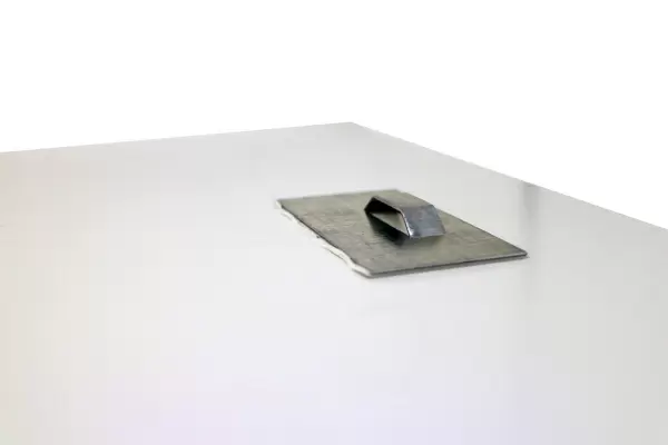
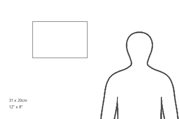
12"x8" (30x20cm) Metal Print
Your image is printed photographically and bonded to a 3.5mm thick, Dibond board (black polyethylene sandwiched between two sheets of white coated aluminium). The panel is then sealed with a gloss protective covering. Supplied complete with a wall mount which holds the print 10mm from the wall.
Made with durable metal and luxurious printing techniques, metal prints bring images to life and add a modern touch to any space
Estimated Product Size is 30.5cm x 20.3cm (12" x 8")
These are individually made so all sizes are approximate
Artwork printed orientated as per the preview above, with landscape (horizontal) or portrait (vertical) orientation to match the source image.
MADE IN THE UK
Safe Shipping with 30 Day Money Back Guarantee
FREE PERSONALISATION*
We are proud to offer a range of customisation features including Personalised Captions, Color Filters and Picture Zoom Tools
SECURE PAYMENTS
We happily accept a wide range of payment options so you can pay for the things you need in the way that is most convenient for you
* Options may vary by product and licensing agreement. Zoomed Pictures can be adjusted in the Cart.