mail_outline sales@mediastorehouse.com
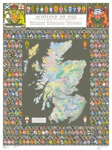
The Historic Map of Scotland "Scotland of Old"Now republished at its original full size, the Scotland of Old Map, also known as the Bartholomew Clan Map of Scotland, features " The Lands", " The Arms"
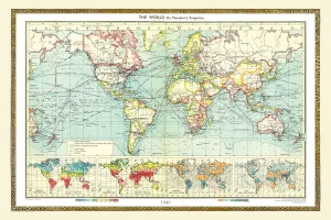
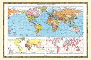
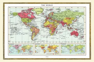
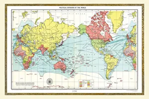
Old Map of the World 1980WMY1980
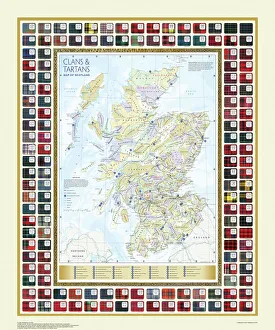
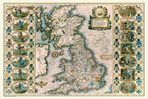
Map of the Clans and Tartans of ScotlandThis map of Scotland indicates the general sphere of influence held by the clans and considerable families at the beginning of the 17th century
Pictorial History Map of Ireland 1963PH005
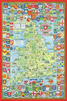
Pictorial History Map of England and Wales 1963This is a wonderful map illustrating the history of England and Wales drawn by Leslie Bullock and published in 1963 by Collins Bartholomew as a fold up map
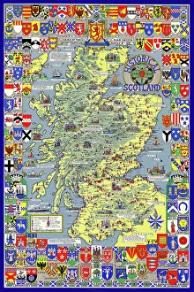
Pictorial History Map of Scotland 1963This is a wonderful pictorial map illustrating the history of Scotland drawn by Leslie Bullock and published in 1963 by Collins Bartholomew as a fold up map
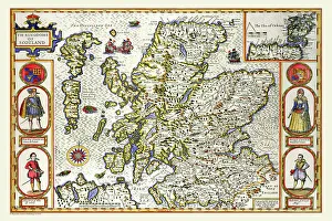
Old Map of Scotland 1611 by John SpeedA facimile of John Speeds historical map of Scotland originally published for the " Theatre of the Empire of Great Britain", an atlas to accompany " a history of Great Britain"
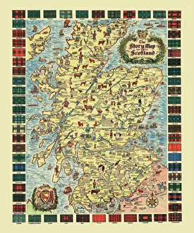
Pictorial Story Map of ScotlandThis map has been remastered from an original published by Colortext, it was one of a series they labelled aeStory MapAE. It combines pictorial images
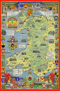
Pictorial History Map of Wales and Monmouth 1966This is a wonderful pictorial map illustrating the history of Wales drawn by Leslie Bullock and published in c1966 by Collins Bartholomew as a fold up map
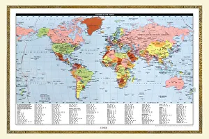
Old Map of the World 1988WMY1988
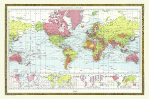
Old Map of the World 1963WMY1963
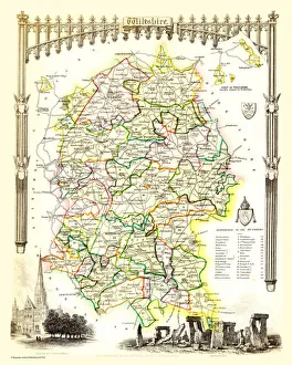
Old County Map of Wiltshire 1836 by Thomas MouleThis is a fine decorative reproduction County Map of Wiltshire from the First Edition series of Thomas Moule Maps, originally Published in 1836
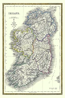
Old Map of Ireland 1852 by Henry George CollinsThis is a finely detailed map of Ireland remastered from a rare Atlas of the World published in 1852 by Henry George Collins
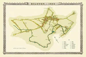
Old Map of Bilston 1832J036
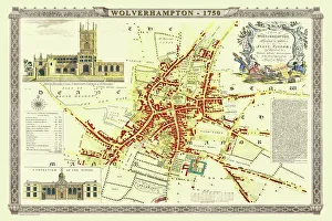
Old Map of Wolverhampton 1750 by Isaac TaylorJ066
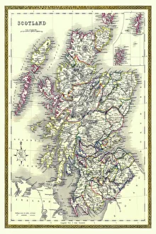
Old Map of Scotland 1852 by Henry George CollinsThis is a finely detailed map of Scotland remastered from a rare Atlas of the World published in 1852 by Henry George Collins
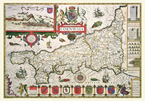
Old County Map of Cornwall 1611 by John SpeedA facimile of John Speeds historical map of Cornwall originally published for the " Theatre of the Empire of Great Britain", an atlas to accompany " a history of Great Britain"
Old Map of Anglo Saxon Britain by John SpeedA facimile of John Speeds historical map of the Saxon Heptarchy originally published for the " Theatre of the Empire of Great Britain"
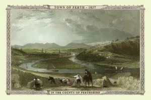
View of the Town of Perth, County Perthshire, Scotland 1837VSC0001
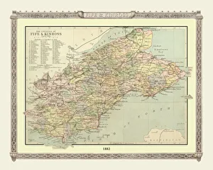
Old Map of the Counties of Fife and Kinross from the Philips Handy Atlas of 1882PHA014
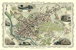
Old Map of Exeter 1851 by John TallisThe River Exe skirts the South West of this plan of Exeter in Devon by John Tallis 1851 with the Exe Bridge providing direct access through the heart of Exeter
Old Map of Edinburgh and Leith 1864 by G. W. SwansonSplendid reproduction map of Edinburgh originally drawn and engraved by G.H.Swanson. The plan of Edinburgh and Leith shows exceptional detail
Old County Map of Derbyshire 1611 by John SpeedA facimile of John Speeds historical map of Derbyshire originally published for the " Theatre of the Empire of Great Britain", an atlas to accompany " a history of Great Britain"
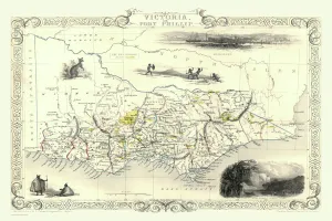
Victoria, or Port Phillip 1851A fine facimile artworked from an antique original map of Victoria, or Port Phillip, Australia, issued as part of the 1851 edition of John Tallis and Companys " The Illustrated Atlas
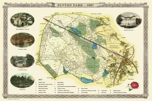
Old Map of Sutton Park near Sutton Coldfield 1885PL017
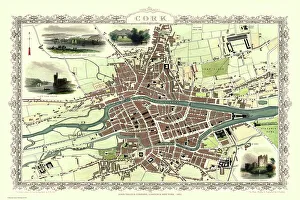
Old Map of Cork Ireland 1851 by John TallisIn this Victorian map of Cork in southern Ireland by John Tallis the North and South channels of the River Lee flow through the centre of the plan with the extensive Barracks dominating
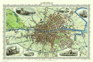
Old Map of Dublin Ireland 1851 by John TallisThis most attractive 19th Century map of Dublin in Southern Ireland by John Tallis 1851 shows all of Dublins districts, the Grand Canal networks and the arrival of the railways
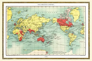
United Nations Map of The World 1948PH006
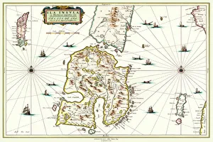
Old Map of the Isle of Islay Scotland 1654 by Johan Blaeu from the Atlas NovusThis detailed and most attractive reproduction map of The Isle of Islay has been carefully art worked from a scan of an antique original
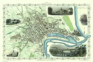
Old Map of Aberdeen 1851 by John TallisAberdeen in Scotland nestled on the River Dee with its famous Victorian Park and Harbour, John TallisAEs 1851 town plan perfectly captures this historic Scottish town during mid Victorian times
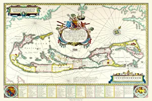
Old Map of The Island of Bermuda 1635 by Willem & Johan Blaue from the Theatrum Orbis TerrarumThis detailed and most attractive reproduction map of The Island of Bermuda has been carefully art worked from a scan of an antique original
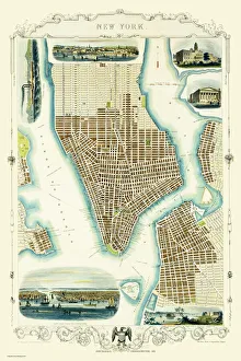
Old Map of New York United States of America 1851 by John TallisThis is a most attractive yet detailed plan 1851 by John Tallis of New York and districts of Jersey, Panovia, Hoboken, Brooklyn and Williamsburgh in the U.S.A
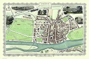
Old Map of Perth Scotland 1851 by John TallisThis 1851 John Tallis Victorian map of Perth in Scotland shows town sandwiched between the South Inch and North Inch. The plan shows only one bridge across the River Tay into Perth
Old Map of the World 1945WMY1945
Old Map of the World 1970WMY1970
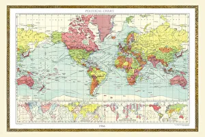
Old Map of the World 1965WMY1965
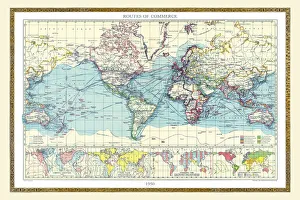
Old Map of the World 1950WMY1950
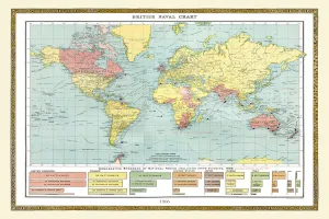
Old Map of the World 1908WMY1908
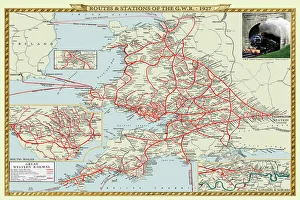
Old Map of the Routes and Stations of the Great Western Railway 1927Completely remastered from an original fold up map published in 1927, this reproduction map shows all the routes and stations of the Great Western Railway
Old Map of the World 1940WMY1940
Old Map of the World 1958WMY1958
Old Map of the World 1966WMY1966
Old Map of the World 1982WMY1982
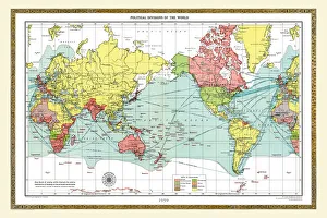
Old Map of the World 1959WMY1959
Old Map of the World 1906WMY1906
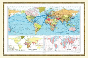
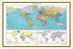
Old Map of the World 1973WMY1973
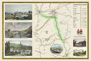
Old Railway Map of The Severn Valley Railway 1887This picturesque image captures the scenic route of the historic Severn Valley Railway as it was during Queen Victorias Golden Jubilee year, 1887
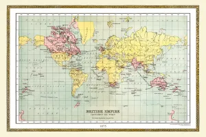
Old Map of the World 1875THE WORLD THAT WAS 1875 - Britain under Disraeli buys the Suez Canal to protect the sea route to India. USA expands settlement into Oregon. Egyptian invasion of Ethiopia