mail_outline sales@mediastorehouse.com
Astronomy, Celestial and Star Charts Collection13 items
England and Counties PORTFOLIO Collection111 items
20th Century PORTFOLIO Collection2 items
16th to 19th Century PORTFOLIO Collection4 items
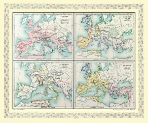
Map of Europe showing the Barbarian Migrations and how Europe appeared between Ad 451 and AD 500 on 4 map panelsEHISM002
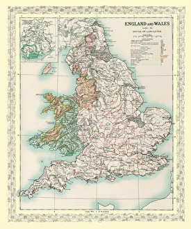
Map of England and Wales as it appeared under the House of LancasterBHISM005
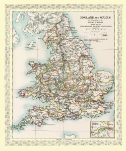
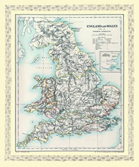
Map of England and Wales as it appeared after the Accession of The House of TuderBHISM003
Map of Europe showing how it appeared after the Peace of Westphalia 1648ADEHIST009
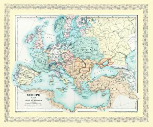
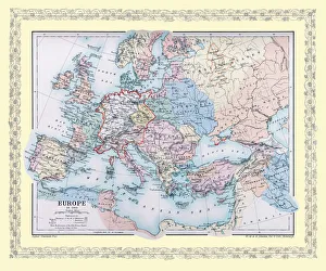
Map of Europe showing how it appeared in the year AD 1360EHIST007
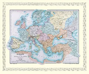
Map of Europe showing how it appeared at the time of the Restoration of the Empire in the Wwest by Otto The Great ADEHIST005
Map of England and Wales as it appeared before the Norman ConquestBHISM002
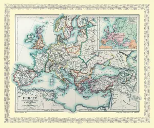
Map of Europe showing how it appeared at the time of the Accession of The Emperor Charles V in AD 1519EHIST008
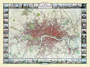
Old Map of London 1851 by John TallisCommemorating the Great Exhibition of Industry of All Nations 1851, this magnificent plan of London, re-created and art worked directly from the antique original
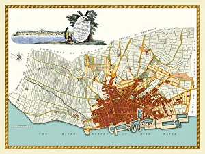
Old Map of Liverpool 1785 by Surveyed by Charles EyesThis most impressive reproduction map has been completely art worked in full colour from the very rare antique original, large, black and white, detailed plan of Liverpool published by Charles Eyes
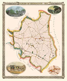
Old Map of The Parish of Erdington 1833J129
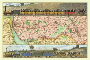
Old Map Titled "Travelling on the Liverpool to Manchester Railway 1830"RW0039
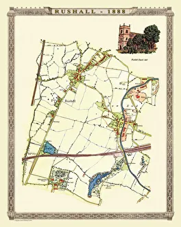
Old Map of Rushall to Daw End near Walsall 1888PL011
Old Map of the City of Bath 1836 by Thomas MouleThis is a fine decorative reproduction Map of The City of Bath from the First Edition series of Thomas Moule Maps, originally Published in 1836
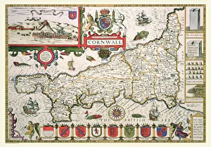
Old County Map of Cornwall 1611 by John SpeedA facimile of John Speeds historical map of Cornwall originally published for the " Theatre of the Empire of Great Britain", an atlas to accompany " a history of Great Britain"
Old Map of the Environs of London 1836 by Thomas MouleThis is a fine decorative reproduction Map of The Environs of London from the First Edition series of Thomas Moule Maps, originally Published in 1836
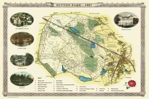
Old Map of Sutton Park near Sutton Coldfield 1885PL017
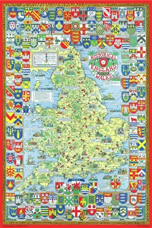
Pictorial History Map of England and Wales 1963This is a wonderful map illustrating the history of England and Wales drawn by Leslie Bullock and published in 1963 by Collins Bartholomew as a fold up map
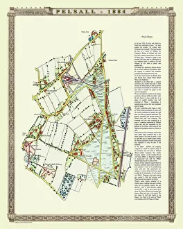
Old Map of the Village of Pelsall near Walsall 1884PL010
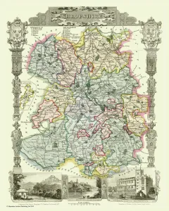
Old County Map of Shropshire 1836 by Thomas MouleThis is a fine decorative reproduction County Map of Shropshire from the First Edition series of Thomas Moule Maps, originally Published in 1836
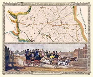
Old Map of the Turnpike Road u Erdington 1833 with Stagecoaches at "The Green"J130
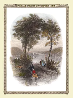
View of Passage, County Waterford in Ireland c1840VIR0001
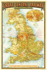
Old Map of the Great Central Railway and its Connections 1903This is a colourful and detailed reproduction map of " The Great Central Railway 1903" showing the lines and stations, with enlarged section showing the Northern Manufacturing Districts
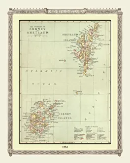
Old Map of the Orkney and Shetland Isles from the Philips Handy Atlas of 1882PHA022
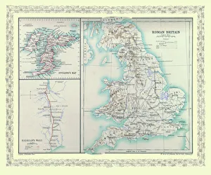
Map of Britain as it appeared in Roman TimesBHISM001
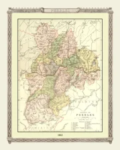
Old Map of the County of Peebles from the Philips Handy Atlas of 1882PHA023
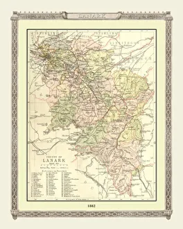
Old Map of the County of Lanark from the Philips Handy Atlas of 1882PHA020
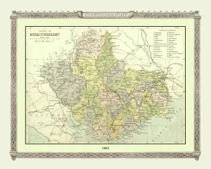
Old Map of the County of Kirkcudbright from the Philips Handy Atlas of 1882PHA019
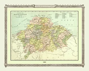
Old Map of the County of Haddington from the Philips Handy Atlas of 1882PHA016
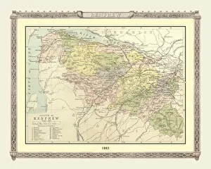
Old Map of the County of Renfrew from the Philips Handy Atlas of 1882PHA025
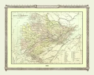
Old Map of the Counties of Ross and Cromarty from the Philips Handy Atlas of 1882PHA026
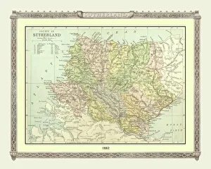
Old Map of the County of Sutherland from the Philips Handy Atlas of 1882PHA030
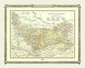
Old Map of the Counties of Stirling and Clackmannan from the Philips Handy Atlas of 1882PHA029
Old Map of the Environs of Edinburgh from the Philips Handy Atlas of 1882PHA011
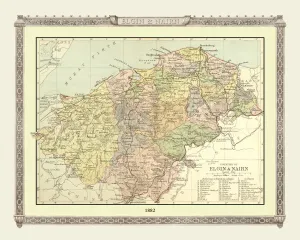
Old Map of the Counties of Elgin and Nairn from the Philips Handy Atlas of 1882PHA013
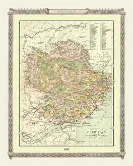
Old Map of the County of Forfar from the Philips Handy Atlas of 1882PHA015
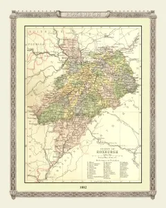
Old Map of the County of Roxburgh from the Philips Handy Atlas of 1882PHA027
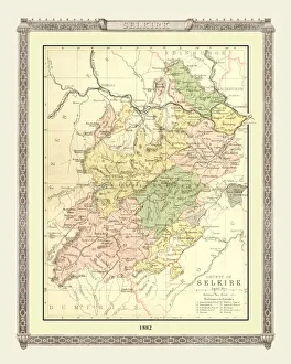
Old Map of the County of Selkirk from the Philips Handy Atlas of 1882PHA028
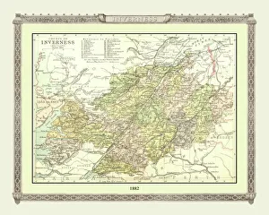
Old Map of the County of Inverness from the Philips Handy Atlas of 1882PHA017
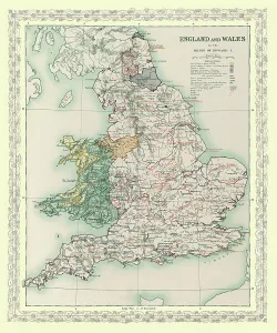
Map of England and Wales as it appeared in the Reign of Edward IBHISM004
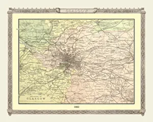
Old Map of the Environs of Glasgow from the Philips Handy Atlas of 1882PHA012
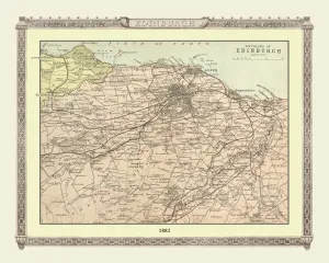
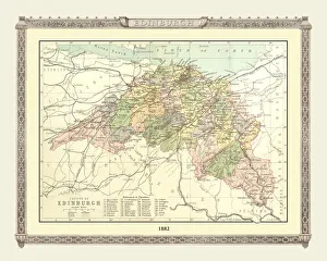
Old Map of the County of Edinburgh from the Philips Handy Atlas of 1882PHA010
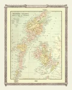
Old Map of the Western Isles from the Philips Handy Atlas of 1882PHA031
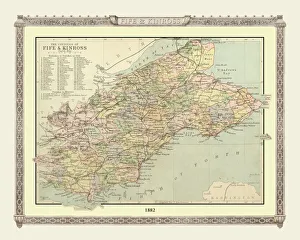
Old Map of the Counties of Fife and Kinross from the Philips Handy Atlas of 1882PHA014