mail_outline sales@mediastorehouse.com
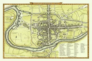
Old Map of Chester 1795 by John StockdaleAn interesting, very detailed, reproduction 18th century street plan of the City of Chester Engraved for and published John Stockdale
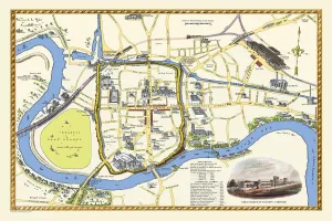
Pictorial Plan of Chester by W. Willis c1865This is a superb republishing in full colour of the pictorial map created by W.Willis in the 1860 s. Pictographs of buildings dot the map, including a most impressive view of Chester Railway Station
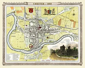
Old Map of Chester 1805 by Cole and RoperAn attractive and detailed early 19th century reproduction town plan of Chester 1805. First published by Cole and Roper as a finely engraved series of county maps