mail_outline sales@mediastorehouse.com
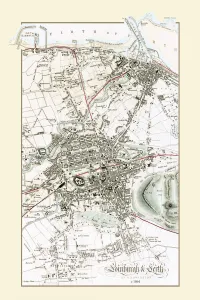
Old Map of Edinburgh and Leith 1864 by G. W. SwansonSplendid reproduction map of Edinburgh originally drawn and engraved by G.H.Swanson. The plan of Edinburgh and Leith shows exceptional detail
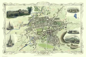
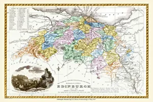
Old Map of Edinburgh Scotland 1851 by John TallisThis Victorian map of Edinburgh in Scotland by John Tallis is dominated with a view to the top right across Edinburgh from the north- west towards Edinburgh Castle
Old Map of Edinburgh 1834 by the S. D. U. KF006
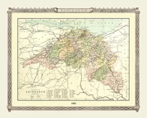
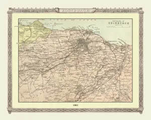
Old Map of the County of Edinburgh from the Philips Handy Atlas of 1882PHA010
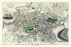
Old County Map of Edinburgh Scotland 1847 by A&C BlackA finely detailed facimile remastered in full colour from an antique original map of Edinburgh featured in A&C Blacks Atlas of 1847
Old Map of the Environs of Edinburgh from the Philips Handy Atlas of 1882PHA011