mail_outline sales@mediastorehouse.com
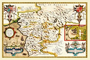
Old County Map of Merionethshire 1611 by John SpeedA facimile of John Speeds historical map of Merionethshire originally published for the " Theatre of the Empire of Great Britain"
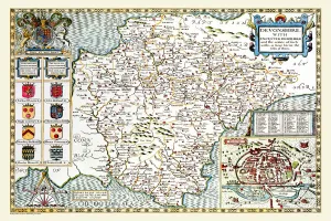
Old County Map of Devonshire 1611 by John SpeedA facimile of John Speeds historical map of Devonshire originally published for the " Theatre of the Empire of Great Britain", an atlas to accompany " a history of Great Britain"
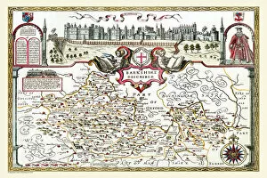
Old County Map of Berkshire 1611 by John SpeedA facimile of John Speeds historical map of Berkshire originally published for the " Theatre of the Empire of Great Britain", an atlas to accompany " a history of Great Britain"
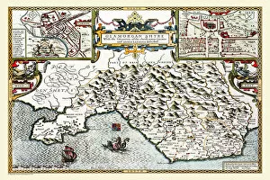
Old County Map of Glamorganshire, Wales 1611 by John SpeedA facimile of John Speeds historical map of Glamorganshire originally published for the " Theatre of the Empire of Great Britain"
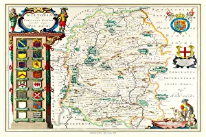
Old County Map of Wiltshire 1648 by Johan Blaeu from the Atlas NovusThis detailed and most attractive reproduction map of Wiltshire has been carefully art worked from a scan of an antique original
Old County Map of Shropshire 1648 by Johan Blaeu from the Atlas NovusThis detailed and most attractive reproduction map of Shropshire has been carefully art worked from a scan of an antique original
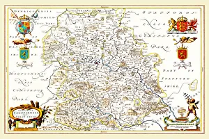
Old County Map of Staffordshire 1648 by Johan Blaeu from the Atlas NovusThis detailed and most attractive reproduction map of Staffordshire has been carefully art worked from a scan of an antique original
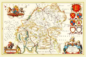
Old County Map of Westmoreland 1648 by Johan Blaeu from the Atlas NovusThis detailed and most attractive reproduction map of Westmoreland has been carefully art worked from a scan of an antique original
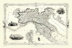
Northern Italy 1851A fine facimile artworked from an antique original map of Northern Italy, issued as part of the 1851 edition of John Tallis and Companys " The Illustrated Atlas
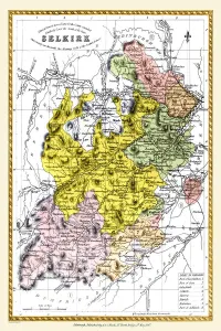
Old County Map of Selkirk Scotland 1847 by A&C BlackA finely detailed facimile remastered in full colour from an antique original map of Selkirk featured in A&C Blacks Atlas of 1847
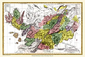
Old County Map of Inverness Scotland 1847 by A&C BlackA finely detailed facimile remastered in full colour from an antique original map of Inverness featured in A&C Blacks Atlas of 1847
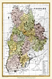
Old County Map of Peebles Scotland 1847 by A&C BlackA finely detailed facimile remastered in full colour from an antique original map of Peebles featured in A&C Blacks Atlas of 1847
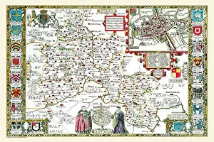
Old County Map of Oxfordshire 1611 by John SpeedA facimile of John Speeds historical map of Oxfordshire originally published for the " Theatre of the Empire of Great Britain", an atlas to accompany " a history of Great Britain"
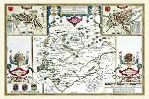
Old County Map of Rutlandshire 1611 by John SpeedA facimile of John Speeds historical map of Rutlandshire originally published for the " Theatre of the Empire of Great Britain", an atlas to accompany " a history of Great Britain"
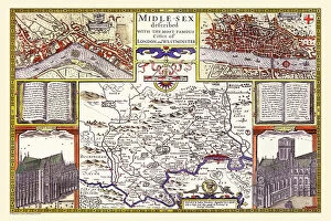
Old County Map of Middlesex by John SpeedA facimile of John Speeds historical map of Middlesex originally published for the " Theatre of the Empire of Great Britain", an atlas to accompany " a history of Great Britain"
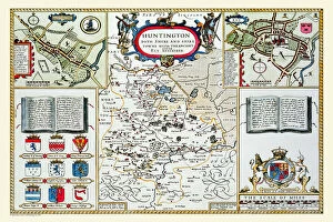
Old County Map of Huntingdonshire 1611 by John SpeedA facimile of John Speeds historical map of Huntingdonshire originally published for the " Theatre of the Empire of Great Britain"
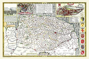
Old County Map of Norfolk 1611 by John SpeedA facimile of John Speeds historical map of Norfolk originally published for the " Theatre of the Empire of Great Britain", an atlas to accompany " a history of Great Britain"
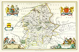
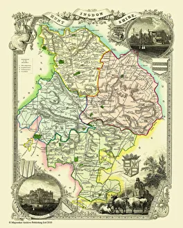
Old County Map of Huntingdonshire 1836 by Thomas MouleThis is a fine decorative reproduction County Map of Huntingdonshire from the First Edition series of Thomas Moule Maps, originally Published in 1836
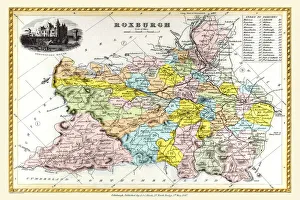
Old County Map of Roxburgh Scotland 1847 by A&C BlackA finely detailed facimile remastered in full colour from an antique original map of Roxburgh featured in A&C Blacks Atlas of 1847
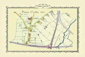
Old Map of Perrry Crofts near Tamworth 1884PL059
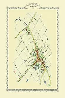
Old Map of the Village of Warton in the County of Warwickshire 1882PL062
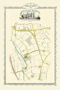
Old Map of Reddicap Heath near Sutton Coldfield 1884PL048
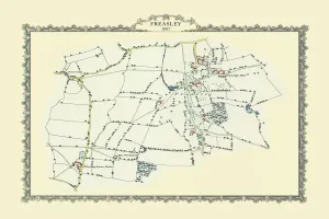
Old Map of the Village of Freasley near Tanmworth 1884PL054
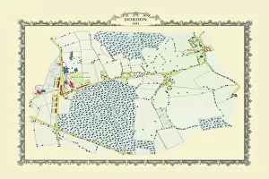
Old Map of the Village of Dordan in Warwickshire 1883PL053
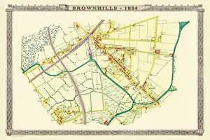
Old Map of the Village of Brownhills near Walsall 1884PL037
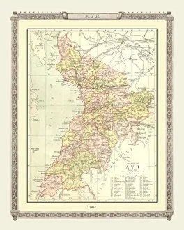
Old Map of the County of Ayr from the Philips Handy Atlas of 1882PHA004