mail_outline sales@mediastorehouse.com
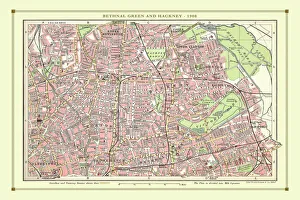
Old Street Map of Bethnal Green and Hackney 1908Detailed colour Street Plan of London from 1908 covering the area around Bethnal Green and Hackney. The image has been remastered from Bartholomews Handy Atlas of London and Suburbs 1908
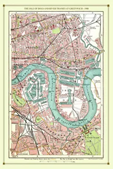
Old Street Map of The Isle of Dogs and River Thames at Greenwich 1908Detailed colour Street Plan of London from 1908 covering the area around The Isle of Dogs and The River Thames at Greenwich.The image has been remastered from Bartholomews Handy Atlas of London
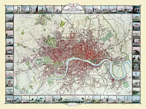
Old Map of London 1851 by John TallisCommemorating the Great Exhibition of Industry of All Nations 1851, this magnificent plan of London, re-created and art worked directly from the antique original
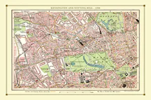
Old Street Map of Kensington and Notting Hill 1908Detailed colour Street Plan of London from 1908 covering the area around Kensington and Notting Hill. The image has been remastered from Bartholomews Handy Atlas of London and Suburbs 1908
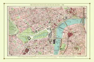
Old Street Map of The Strand, West End and River Thames 1908Detailed colour Street Plan of London from 1908 covering the area around The Strand, The West End and the River Thames.The image has been remastered from Bartholomews Handy Atlas of London
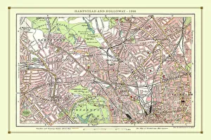
Old Street Map of Hamstead, Holloway and Islington 1908Detailed colour Street Plan of London from 1908 covering the area around Hamstead, Holloway and Islington. The image has been remastered from Bartholomews Handy Atlas of London and Suburbs 1908
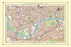
Old Street Map of Chelsea, Putney and River Thames 1908Detailed colour Street Plan of London from 1908 covering the area around Chelsea, Putney and the River Thames. The image has been remastered from Bartholomews Handy Atlas of London and Suburbs 1908
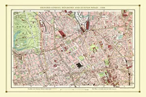
Old Street Map of Oxford Street, Holborn and Euston Road 1908Detailed colour Street Plan of London from 1908 covering the area around Oxford Street, Holborn and Euston Road.The image has been remastered from Bartholomews Handy Atlas of London and Suburbs 1908
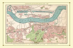
Old Street Map of Woolwich and Thames Docklands 1908Detailed colour Street Plan of London from 1908 covering the area around Woolwich and the Thames Docklands.The image has been remastered from Bartholomews Handy Atlas of London and Suburbs 1908
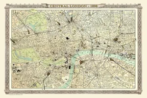
Old Map of Central London 1898 from the Royal Atlas by BartholomewA fine very detailed plan of Central London from 1898 remastered from an original contained within " The Royal Atlas of England and Wales" ; edited by J.G
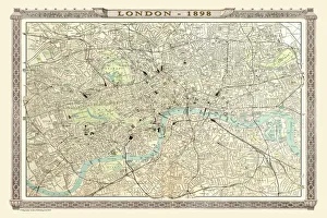
Old Map of London 1898 from the Royal Atlas by BartholomewA fine very detailed plan of the City of London remastered from an original contained within " The Royal Atlas of England and Wales" ; edited by J.G
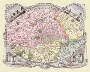
Old Map of the Environs of London 1836 by Thomas MouleThis is a fine decorative reproduction Map of The Environs of London from the First Edition series of Thomas Moule Maps, originally Published in 1836