mail_outline sales@mediastorehouse.com
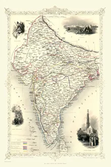
British India 1851A fine facimile artworked from an antique original map of British India, issued as part of the 1851 edition of John Tallis and Companys " The Illustrated Atlas
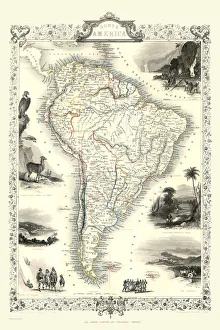
Old Map of South America 1851 by John TallisA fine facimile artworked from an antique original map of South America, issued as part of the 1851 edition of John Tallis and Companys " The Illustrated Atlas
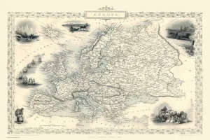
Europe 1851A fine facimile artworked from an antique original map of Europe, issued as part of the 1851 edition of John Tallis and Companys " The Illustrated Atlas and Modern History of the World"
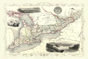
Old Map of West Canada 1851 by John TallisA fine facimile artworked from an antique original map of West Canada, issued as part of the 1851 edition of John Tallis and Companys " The Illustrated Atlas and Modern History of the World"
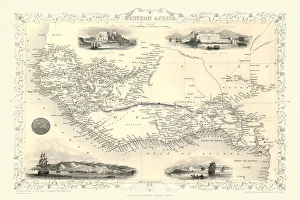
Western Africa 1851A fine facimile artworked from an antique original map of Western Africa, issued as part of the 1851 edition of John Tallis and Companys " The Illustrated Atlas
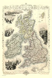
British Isles 1851A fine facimile artworked from an antique original map of The British Isles, issued as part of the 1851 edition of John Tallis and Companys " The Illustrated Atlas
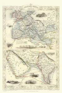
Overland Route to India 1851A fine facimile artworked from an antique original map of the Overland Route to India, issued as part of the 1851 edition of John Tallis and Companys " The Illustrated Atlas
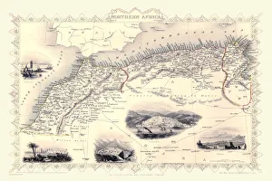
Old Map of Northern Africa 1851 by John TallisA fine facimile artworked from an antique original map of Northern Africa, issued as part of the 1851 edition of John Tallis and Companys " The Illustrated Atlas
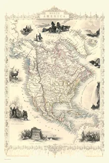
Old Map of North America 1851 by John TallisA fine reproduction artworked from an antique original map of North America, issued as part of the 1851 edition of John Tallis and Companys " The Illustrated Atlas
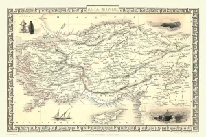
Asia Minor 1851A fine facimile artworked from an antique original map of Asia Minor, issued as part of the 1851 edition of John Tallis and Companys " The Illustrated Atlas and Modern History of the World"
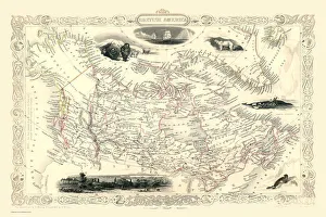
Old Map of British America, or Canada 1851 by John TallisA fine facimile artworked from an antique original map of British America or Canada, issued as part of the 1851 edition of John Tallis and Companys " The Illustrated Atlas
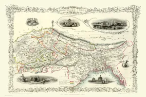
Northern India 1851A fine facimile artworked from an antique original map of Northern India, issued as part of the 1851 edition of John Tallis and Companys " The Illustrated Atlas
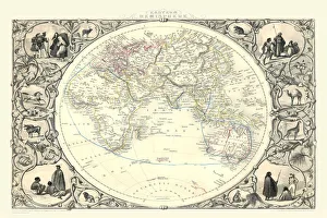
Eastern Hemisphere 1851A fine facimile artworked from an antique original map of The Eastern Hemisphere, issued as part of the 1851 edition of John Tallis and Companys " The Illustrated Atlas
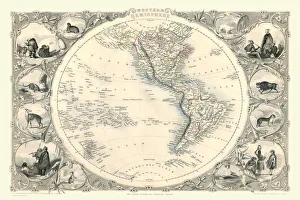
Western Hemisphere 1851A fine facimile artworked from an antique original map of The Western Hemisphere, issued as part of the 1851 edition of John Tallis and Companys " The Illustrated Atlas
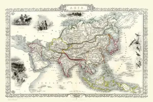
Asia 1851A fine facimile artworked from an antique original map of the Continent of Asia, issued as part of the 1851 edition of John Tallis and Companys " The Illustrated Atlas