Home > Maps of the Americas > Maps of the United States of America
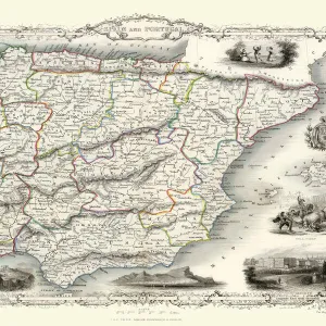
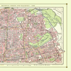
Old Map of Mexico, California & Texas 1851by John Tallis

![]()
Wall Art and Photo Gifts from MapSeeker
Old Map of Mexico, California & Texas 1851by John Tallis
A fine facimile artworked from an antique original map of Mexico, California and Texas, issued as part of the 1851 edition of John Tallis and Companys " The Illustrated Atlas and Modern History of the World"
Media ID 20347465
© Mapseeker Publishing Ltd
John Tallis John Tallis Map Tallis Map
FEATURES IN THESE COLLECTIONS
> Maps of the Americas
> Maps of Central and South America
> Maps of the Americas
> Maps of the United States of America
MADE IN THE UK
Safe Shipping with 30 Day Money Back Guarantee
FREE PERSONALISATION*
We are proud to offer a range of customisation features including Personalised Captions, Color Filters and Picture Zoom Tools
SECURE PAYMENTS
We happily accept a wide range of payment options so you can pay for the things you need in the way that is most convenient for you
* Options may vary by product and licensing agreement. Zoomed Pictures can be adjusted in the Basket.