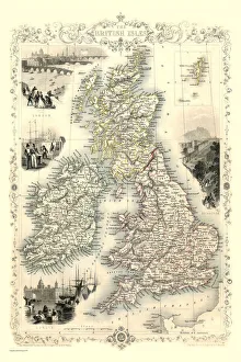
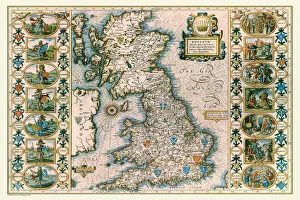
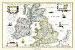
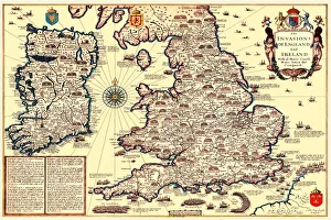
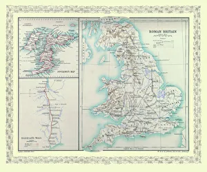
British Isles Map PORTFOLIO Gallery
Available as Framed Prints, Photos, Wall Art and Gift Items
Maps Of The British Isles Including Ireland
Choose from 5 pictures in our British Isles Map PORTFOLIO collection for your Wall Art or Photo Gift. Popular choices include Framed Prints, Canvas Prints, Posters and Jigsaw Puzzles. All professionally made for quick delivery.
Folded Maps
Books & Atlases
Maps from the British Isles
> British Isles Map PORTFOLIO
> England with Wales PORTFOLIO
> England and Counties PORTFOLIO
> Wales and Counties PORTFOLIO
> Scotland and Counties PORTFOLIO
> Ireland and Provinces PORTFOLIO
> Islands around Britain PORTFOLIO
British Town And City Plans
Old Views and Vistas
Maps of Africa and Oceana
Maps of the Americas
Maps of Europe
Maps of Asia and Middle East
Maps Showing the World
Old Railway and Canal Map Collection
Pictorial Maps and Pictorial History
British History Related and Military
All Images

Old Map of The British Isles 1635 by Willem & Johan Blaeu from the Theatrum Orbis Terrarum
This detailed and most attractive reproduction map of The British Isles has been carefully art worked from a scan of an antique original. The famous firm of Dutch cartographers and publishers was established in the late 16th century by Willem Janszoon Blaeu in Amsterdam. Blaeu was a maker of globes and scientific instruments and purchased some of his early map plates from Jodocus Hondius. From this small beginning was to emerge one of the largest and most prolific map publishing houses of the seventeenth century