mail_outline sales@mediastorehouse.com
111 items
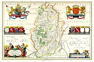
Old County Map of Nottinghamshire 1648 by Johan Blaeu from the Atlas NovusThis detailed and most attractive reproduction map of Nottinghamshire has been carefully art worked from a scan of an antique original
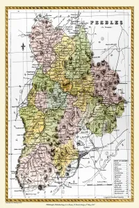
Old County Map of Peebles Scotland 1847 by A&C BlackA finely detailed facimile remastered in full colour from an antique original map of Peebles featured in A&C Blacks Atlas of 1847
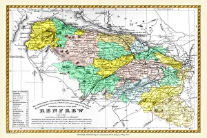
Old County Map of Renfrew Scotland 1847 by A&C BlackA finely detailed facimile remastered in full colour from an antique original map of Renfrewshire featured in A&C Blacks Atlas of 1847
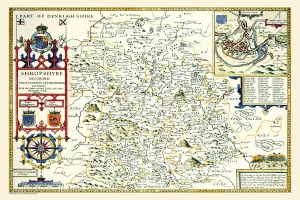
Old County Map of Shropshire 1611 by John SpeedA facimile of John Speeds historical map of Shropshire originally published for the " Theatre of the Empire of Great Britain", an atlas to accompany " a history of Great Britain"
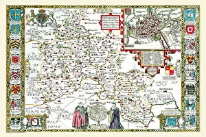
Old County Map of Oxfordshire 1611 by John SpeedA facimile of John Speeds historical map of Oxfordshire originally published for the " Theatre of the Empire of Great Britain", an atlas to accompany " a history of Great Britain"
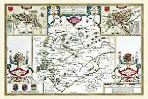
Old County Map of Rutlandshire 1611 by John SpeedA facimile of John Speeds historical map of Rutlandshire originally published for the " Theatre of the Empire of Great Britain", an atlas to accompany " a history of Great Britain"
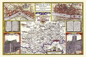
Old County Map of Middlesex by John SpeedA facimile of John Speeds historical map of Middlesex originally published for the " Theatre of the Empire of Great Britain", an atlas to accompany " a history of Great Britain"
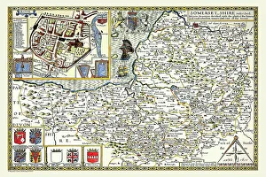
Old County Map of Somersetshire 1611 by John SpeedA facimile of John Speeds historical map of Somersetshire originally published for the " Theatre of the Empire of Great Britain"
Old County Map of Staffordshire 1611 by John SpeedA facimile of John Speeds historical map of Staffordshire originally published for the " Theatre of the Empire of Great Britain"
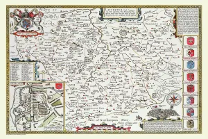
Old County Map of Leicestershire 1611 by John SpeedA facimile of John Speeds historical map of Leicestershire originally published for the " Theatre of the Empire of Great Britain"
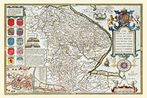
Old County Map of Lincolnshire 1611 by John SpeedA facimile of John Speeds historical map of Lincolnshire originally published for the " Theatre of the Empire of Great Britain", an atlas to accompany " a history of Great Britain"
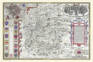
OldCounty Map of Wiltshire 1611 by John SpeedA facimile of John Speeds historical map of Wiltshire published for the " Theatre of the Empire of Great Britain", an atlas to accompany " a history of Great Britain"
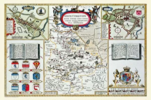
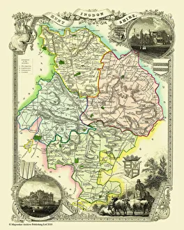
Old County Map of Huntingdonshire 1611 by John SpeedA facimile of John Speeds historical map of Huntingdonshire originally published for the " Theatre of the Empire of Great Britain"
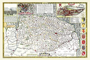
Old County Map of Norfolk 1611 by John SpeedA facimile of John Speeds historical map of Norfolk originally published for the " Theatre of the Empire of Great Britain", an atlas to accompany " a history of Great Britain"
Old County Map of Huntingdonshire 1836 by Thomas MouleThis is a fine decorative reproduction County Map of Huntingdonshire from the First Edition series of Thomas Moule Maps, originally Published in 1836