Home > Old Railway and Canal Map Collection > Early Coaching Routes and Canal Maps
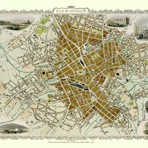
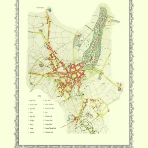
John Hancoxs Map of the Birmingham Canal Navigations 1864

![]()
Wall Art and Photo Gifts from MapSeeker
John Hancoxs Map of the Birmingham Canal Navigations 1864
This detailed map of the Birmingham Canal Navigations also shows the recently constructed Railways across the region, making it a valuable resource for Canal, Railway and Local History enthusiasts. It has been completely remastered in colour by mapseeker working from a rare antique original first published in 1864
Media ID 20354630
© Mapseeker Publishing Ltd
MADE IN THE USA
Safe Shipping with 30 Day Money Back Guarantee
FREE PERSONALISATION*
We are proud to offer a range of customisation features including Personalised Captions, Color Filters and Picture Zoom Tools
SECURE PAYMENTS
We happily accept a wide range of payment options so you can pay for the things you need in the way that is most convenient for you
* Options may vary by product and licensing agreement. Zoomed Pictures can be adjusted in the Cart.