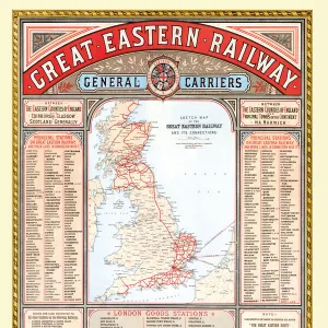
Home > Old Railway and Canal Map Collection > Old Railway Maps PORTFOLIO
Old Map of the Great Central Railway and its Connections 1903

![]()
Wall Art and Photo Gifts from MapSeeker
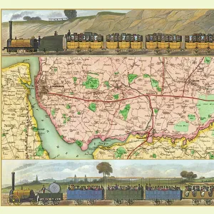
Old Map of the Great Central Railway and its Connections 1903
This is a colourful and detailed reproduction map of " The Great Central Railway 1903" showing the lines and stations, with enlarged section showing the Northern Manufacturing Districts. Visual Application of colour differentiates manufacturing districts, agricultural districts, upland pasture and moorland. The map also shows the principal canals that were by now in decline due to the success of the railways. Shipping connections are also marked with distances from principal sea ports
Media ID 20348221
© Mapseeker Publishing Ltd
Historic Railway Map Old Railway Map Railway Map
MADE IN THE USA
Safe Shipping with 30 Day Money Back Guarantee
FREE PERSONALISATION*
We are proud to offer a range of customisation features including Personalised Captions, Color Filters and Picture Zoom Tools
SECURE PAYMENTS
We happily accept a wide range of payment options so you can pay for the things you need in the way that is most convenient for you
* Options may vary by product and licensing agreement. Zoomed Pictures can be adjusted in the Cart.