Framed Print > Old Views and Vistas > 19th & 20th Century Railway Views
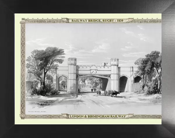
Framed Print : Views on the London to Birmingham Railway - Railway Bridge at Rugby 1839


![]()
Framed Photos from MapSeeker
Views on the London to Birmingham Railway - Railway Bridge at Rugby 1839
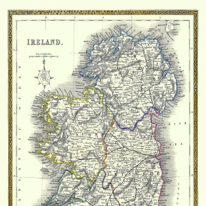
A finely detailed facimile remastered in full colour from an antique original map of " Dumbartonshire" featured in A&C Blacks Atlas of 1847. Each Parish is numbered using an index table, colour rendition beautifully differentiating all of the Parishes. As well as principal roads, towns, villages and hamlets, these county maps of Scotland feature key battle sites marked with two crossed swords and the date of the battle. Dumbarton comes from the Scottish Gaelic Dšn Breatainn meaning " fort of the Britons".... Dumbartonshire County Council, set up under the Local Government (Scotland) Act 1889, adopted the spelling " Dunbartonshire" by 1914, a fact recognised by the Local Government (Scotland) Act 1947
Media ID 20346856
Birmingham To London Railway London To Birmingham Railway Railway View
18"x14" Modern Frame
16x12 Print in an MDF Wooden Frame with 180 gsm Satin Finish Paper. Glazed using shatter proof thin plexiglass. Frame thickness is 1 inch and depth 0.75 inch. Fluted cardboard backing held with clips. Supplied ready to hang with sawtooth hanger and rubber bumpers. Spot clean with a damp cloth. Packaged foam wrapped in a card.
Contemporary Framed and Mounted Prints - Professionally Made and Ready to Hang
Estimated Image Size (if not cropped) is 40.6cm x 35.6cm (16" x 14")
Estimated Product Size is 45.7cm x 35.6cm (18" x 14")
These are individually made so all sizes are approximate
Artwork printed orientated as per the preview above, with landscape (horizontal) orientation to match the source image.
MADE IN THE USA
Safe Shipping with 30 Day Money Back Guarantee
FREE PERSONALISATION*
We are proud to offer a range of customisation features including Personalised Captions, Color Filters and Picture Zoom Tools
SECURE PAYMENTS
We happily accept a wide range of payment options so you can pay for the things you need in the way that is most convenient for you
* Options may vary by product and licensing agreement. Zoomed Pictures can be adjusted in the Cart.