mail_outline sales@mediastorehouse.com
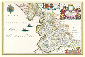
Old County Map of Lancashire 1648 by Johan Blaeu from the Atlas NovusThis detailed and most attractive reproduction map of Lancashire has been carefully art worked from a scan of an antique original
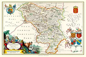
Old County Map of Derbyshire 1648 by Johan Blaeu from the Atlas NovusThis detailed and most attractive reproduction map of Derbyshire has been carefully art worked from a scan of an antique original
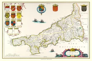
Old County Map of Cornwall 1648 by Johan Blaeu from the Atlas NovusThis detailed and most attractive reproduction map of Cornwall has been carefully art worked from a scan of an antique original
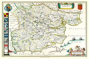
Old County Map of Essex 1648 by Johan Blaeu from the Atlas NovusThis detailed and most attractive reproduction map of Essex has been carefully art worked from a scan of an antique original
Old County Map of Hampshire 1648 by Johan Blaeu from the Atlas NovusThis detailed and most attractive reproduction map of Hampshire has been carefully art worked from a scan of an antique original
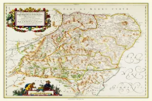
Old County Map of Aberdeen and Banff 1654 by Johan Blaeu from the Atlas NovusThis detailed and most attractive reproduction map of Aberdeen and Banff has been carefully art worked from a scan of an antique original
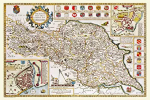
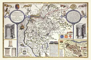
Old County Map of Yorkshire North and East Riding 1611 by John SpeedA facimile of John Speeds historical map of Yorkshire North and East Riding originally published for the " Theatre of the Empire of Great Britain"
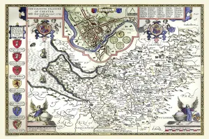
Old County Map of Cheshire 1611 by John SpeedA facimile of John Speeds historical map of Cheshire originally published for the " Theatre of the Empire of Great Britain", an atlas to accompany " a history of Great Britain"
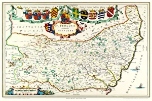
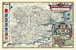
Old County Map of Suffolk 1648 by Johan Blaeu from the Atlas NovusThis detailed and most attractive reproduction map of Suffolk has been carefully art worked from a scan of an antique original
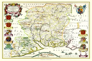
Old County Map of Buckinghamshire 1611 by John SpeedA fine reproduction of John Speeds historical map of Buckinghamshire originally published for the " Theatre of the Empire of Great Britain"
Old County Map of Sussex 1611 by John SpeedA facimile of John Speeds historical map of Sussex originally published for the " Theatre of the Empire of Great Britain", an atlas to accompany " a history of Great Britain"
Old County Map of Durham 1611 by John SpeedA facimile of John Speeds historical map of Durham originally published for the " Theatre of the Empire of Great Britain", an atlas to accompany " a history of Great Britain"
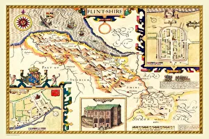
Old County Map of Flintshire 1611 by John SpeedA facimile of John Speeds historical map of Flintshire originally published for the " Theatre of the Empire of Great Britain", an atlas to accompany " a history of Great Britain"
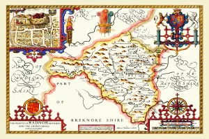
Old County Map of Radnorshire, Wales 1611 by John SpeedA facimile of John Speeds historical map of Radnorshire originally published for the " Theatre of the Empire of Great Britain", an atlas to accompany " a history of Great Britain"
Old County Map of Essex 1611 by John SpeedA facimile of John Speeds historical map of Essex originally published for the " Theatre of the Empire of Great Britain", an atlas to accompany " a history of Great Britain"
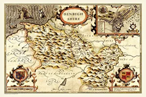
Old County Map of Denbighshire 1611 by John SpeedA facimile of John Speeds historical map of Denbighshire originally published for the " Theatre of the Empire of Great Britain", an atlas to accompany " a history of Great Britain"
Old County Map of Cumberland 1611 by John SpeedA facimile of John Speeds historical map of Cumberland originally published for the " Theatre of the Empire of Great Britain", an atlas to accompany " a history of Great Britain"
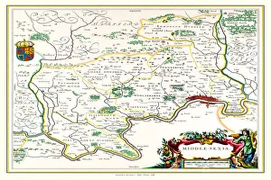
Old County Map of Middlesex 1648 by Johan Blaue from the Atlas NovusThis detailed and most attractive reproduction map of Middlesex has been carefully art worked from a scan of an antique original
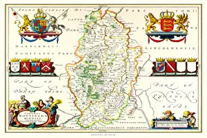
Old County Map of Nottinghamshire 1648 by Johan Blaeu from the Atlas NovusThis detailed and most attractive reproduction map of Nottinghamshire has been carefully art worked from a scan of an antique original
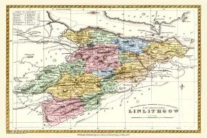
Old County Map of Linlithgow Scotland 1847 by A&C BlackA finely detailed facimile remastered in full colour from an antique original map of Linlithgow featured in A&C Blacks Atlas of 1847
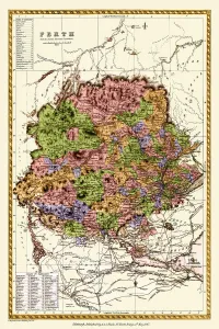
Old County Map of Perth Scotland 1847 by A&C BlackA finely detailed facimile remastered in full colour from an antique original map of Perthshire featured in A&C Blacks Atlas of 1847
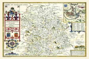
Old County Map of Shropshire 1611 by John SpeedA facimile of John Speeds historical map of Shropshire originally published for the " Theatre of the Empire of Great Britain", an atlas to accompany " a history of Great Britain"
Old County Map of Staffordshire 1611 by John SpeedA facimile of John Speeds historical map of Staffordshire originally published for the " Theatre of the Empire of Great Britain"
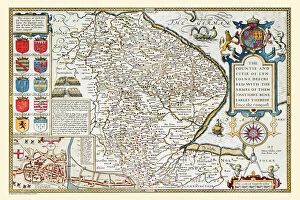
Old County Map of Lincolnshire 1611 by John SpeedA facimile of John Speeds historical map of Lincolnshire originally published for the " Theatre of the Empire of Great Britain", an atlas to accompany " a history of Great Britain"
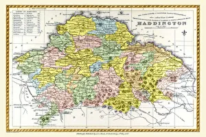
Old County Map of Haddington Scotland 1847 by A&C BlackA finely detailed facimile remastered in full colour from an antique original map of Haddington featured in A&C Blacks Atlas of 1847
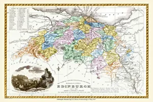
Old County Map of Edinburgh Scotland 1847 by A&C BlackA finely detailed facimile remastered in full colour from an antique original map of Edinburgh featured in A&C Blacks Atlas of 1847
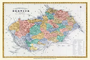
Old County Map of Berwick Scotland 1847 by A&C BlackA finely detailed facimile remastered in full colour from an antique original map of Berwick featured in A&C Blacks Atlas of 1847
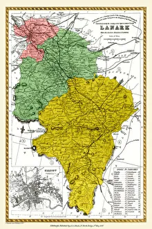
Old County Map of Lanark Scotland 1847 by A&C BlackA finely detailed facimile remastered in full colour from an antique original map of Lanarkshire featured in A&C Blacks Atlas of 1847
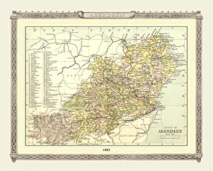
Old Map of the County of Aberdeen from the Philips Handy Atlas of 1882PHA002
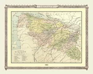
Old Map of the County of Renfrew from the Philips Handy Atlas of 1882PHA025
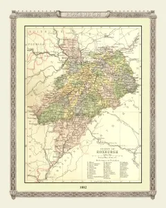
Old Map of the County of Roxburgh from the Philips Handy Atlas of 1882PHA027
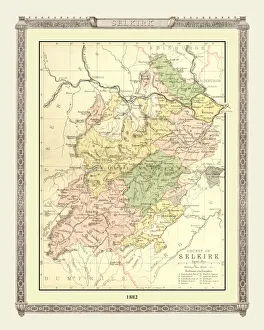
Old Map of the County of Selkirk from the Philips Handy Atlas of 1882PHA028
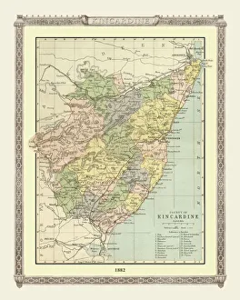
Old Map of the County of Kincardine from the Philips Handy Atlas of 1882PHA018
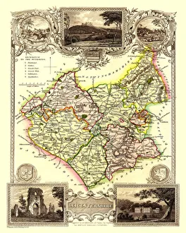
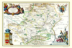
Old County Map of Herefordshire 1836 by Thomas MouleThis is a fine decorative reproduction County Map of Herefordshire from the First Edition series of Thomas Moule Maps, originally Published in 1836
Old County Map of Westmoreland 1836 by Thomas MouleThis is a fine decorative reproduction County Map of Westmoreland from the First Edition series of Thomas Moule Maps, originally Published in 1836
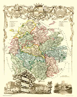
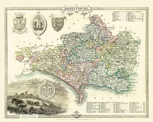
Old County Map of Dorsetshire 1836 by Thomas MouleThis is a fine decorative reproduction County Map of Dorsetshire from the First Edition series of Thomas Moule Maps, originally Published in 1836
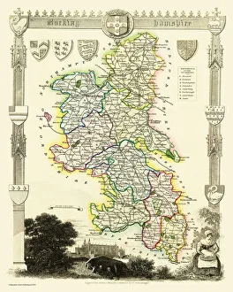
Old County Map of Buckinghamshire 1836 by Thomas MouleThis is a fine decorative reproduction County Map of Buckinghamshire from the First Edition series of Thomas Moule Maps, originally Published in 1836
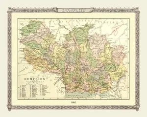
Old Map of the County of Dumfries from the Philips Handy Atlas of 1882PHA009
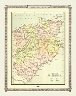
Old Map of the County of Caithness from the Philips Handy Atlas of 1882PHA007
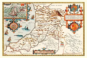
Old County Map of Cardiganshire 1611 by John SpeedA facimile of John Speeds historical map of Cardiganshire originally published for the " Theatre of the Empire of Great Britain"
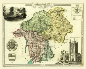
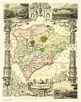
Old County Map of Rutlandshire 1836 by Thomas MouleThis is a fine decorative reproduction County Map of Rutlandshire from the First Edition series of Thomas Moule Maps, originally Published in 1836
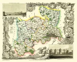
Old County Map of Middlesex 1836 by Thomas MouleThis is a fine decorative reproduction County Map of Middlesex from the First Edition series of Thomas Moule Maps, originally Published in 1836
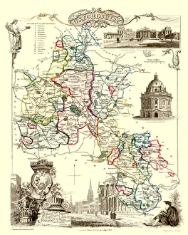
Old County Map of Oxfordshire 1836 by Thomas MouleThis is a fine decorative reproduction County Map of Oxfordshire from the First Edition series of Thomas Moule Maps, originally Published in 1836
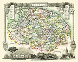
Old County Map of Norfolk 1836 by Thomas MouleThis is a fine decorative reproduction County Map of Norfolk from the First Edition series of Thomas Moule Maps, originally Published in 1836
Old County Map of Leicestershire 1836 by Thomas MouleThis is a fine decorative reproduction County Map of Leicestershire from the First Edition series of Thomas Moule Maps, originally Published in 1836
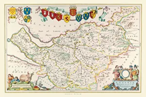
Old County Map of Cheshire 1648 by Johan Blaeu from the Atlas NovusThis detailed and most attractive reproduction map of Cheshire has been carefully art worked from a scan of an antique original
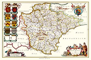
Old County Map of Devonshire 1648 by Johan Blaeu from the Atlas NovusThis detailed and most attractive reproduction map of Devonshire has been carefully art worked from a scan of an antique original
Old County Map of Hertfordshire 1648 by Johan Blaeu from the Atlas NovusThis detailed and most attractive reproduction map of Hertfordshire has been carefully art worked from a scan of an antique original