mail_outline sales@mediastorehouse.com
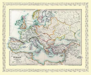
Map of Europe showing how it appeared at the time of the Third Crusade AD 1190EHIST006
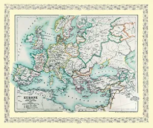
Map of Europe showing how it appeared in the year AD 1740EHIST010
Map of Europe showing how it appeared in the time of Charles the Great AD 768 - AD 814EHIST004
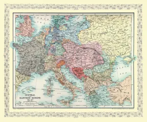
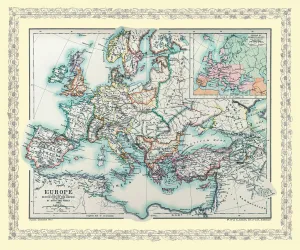
Map of Central Europe and Eastern Europe as it appeared between AD 1863 and AD 1897EHIST013
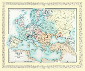
Map of Europe showing the Barbarian Migrations and how Europe appeared between Ad 451 and AD 500 on 4 map panelsEHISM002
Map of Europe showing how it appeared after the Peace of Westphalia 1648ADEHIST009
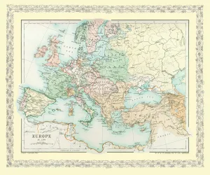
Map of Europe showing how it appeared in the year AD 1360EHIST007
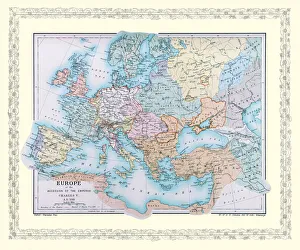
Map of Europe showing how it appeared at the time of the Accession of The Emperor Charles V in AD 1519EHIST008
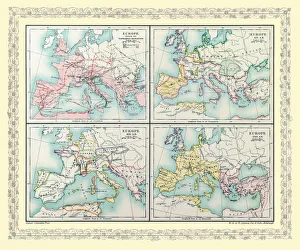
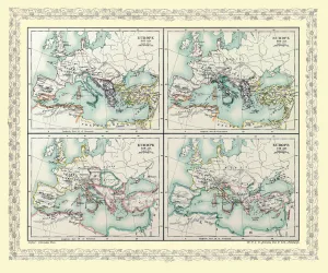
Map of Europe showing how it appeared between AD 565 and AD 720 on 4 map panels for each periodEHIST003
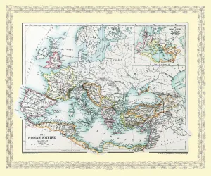
Map of Europe as it appeared in Roman Times circa AD 350EHISM001
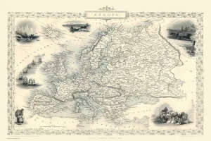
Europe 1851A fine facimile artworked from an antique original map of Europe, issued as part of the 1851 edition of John Tallis and Companys " The Illustrated Atlas and Modern History of the World"
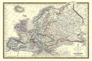
Old Map of Europe 1852 by Henry George CollinsThis is a finely detailed map of Europe remastered from a rare Atlas of the World published in 1852 by Henry George Collins
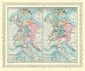
Two Maps of Central Europe that illustrate how the region looked during the years of conflict between AD 1795EHIST011
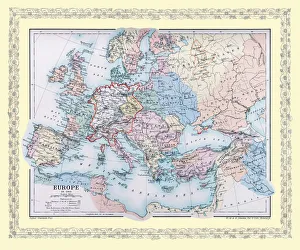
Map of Europe showing how it appeared at the time of the Restoration of the Empire in the Wwest by Otto The Great ADEHIST005