Home > Maps of Europe > Old Maps of Europe

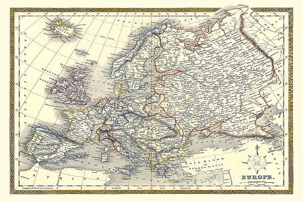
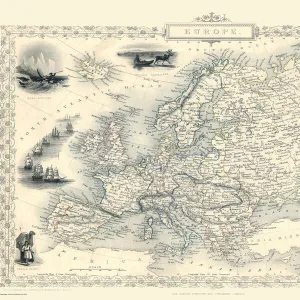
Old Map of Europe 1852 by Henry George Collins

Old Map of Europe 1852 by Henry George Collins


Choose Your Product


We accept all major payment options so you can pay for the things you need in the way that is most convenient for you

MapSeeker Photo Prints and Wall Art

Old Map of Europe 1852 by Henry George Collins

This is a finely detailed map of Europe remastered from a rare Atlas of the World published in 1852 by Henry George Collins. Although these Henry Collins produced maps of the highest quality in his time unfortunately not the same could be said in terms of his business success. His maps were later obtained by the famous Stanford Map Company and used in their publications

Media ID 20347285

© Mapseeker Publishing Ltd

Collins Collins Atlas Collins Atlas Map Collins Map Continental Map Europe Europe Map Map Of Europe Old Continental Map

Your artwork will be printed orientated as per the preview above, with landscape (horizontal) or portrait (vertical) orientation to match the source image


Made in UK
Safe Shipping, Easy Returns

FREE PERSONALISATION
We are proud to offer a range of customisation including Cropping, Captions, and Filters. Zoom Cropping can be adjusted in the basket

SECURE PAYMENTS
We accept all major payment options so you can pay for the things you need in the way that is most convenient for you


redeem
Beautiful Photo Prints and Gifts
image
Professionally printed
inventory
Photo Prints are in stock
thumb_up
Professional Quality Finish
diamond
Made With High Grade Materials
inventory_2
Carefully Packed To Aid Safe Arrival


Similar Pictures


Old County Map of Dunbartonshire, formally called Dumbartonshire, Scotland 1847 by A&C Black
Pictorial Story Map of Scotland
Old Map of Switzerland 1852 by Henry George Collins
Old Map of Greece with the Ionian Isles 1852 by Henry George Collins
Old Map of Northern Italy 1852 by Henry George Collins
Russia in Europe 1851
Old County Map of Ross and Cromarty Scotland 1847 by A&C Black
Europe 1851
Europe 1851
Old Map of The Americas 1635 by Willem & Johan Blaue from the Theatrum Orbis Terrarum
Old Map of Anglo Saxon Britain by John Speed
Old Map of the Isle of Islay Scotland 1654 by Johan Blaeu from the Atlas Novus
Old Map of Cardiff 1890 by A&C Black

+

Shipping

+

Choices

+

Guarantee