mail_outline sales@mediastorehouse.com
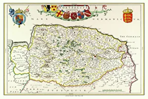
Old County Map of Norfolk 1648 by Johan Blaeu from the Atlas NovusThis detailed and most attractive reproduction map of Norfolk has been carefully art worked from a scan of an antique original
Old County Map of Leicestershire 1611 by John SpeedA facimile of John Speeds historical map of Leicestershire originally published for the " Theatre of the Empire of Great Britain"
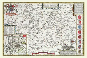
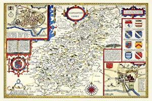
Old County Map of Northamptonshire 1611 by John SpeedA facimile of John Speeds historical map of Northamptonshire originally published for the " Theatre of the Empire of Great Britain"
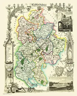
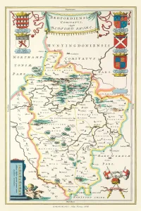
Old County Map of Bedfordshire 1836 by Thomas MouleThis is a fine decorative reproduction County Map of Bedfordshire from the First Edition series of Thomas Moule Maps, originally Published in 1836
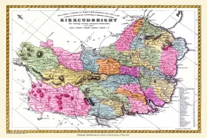
Old County Map of Kurkcudbright Scotland 1847 by A&C BlackA finely detailed facimile remastered in full colour from an antique original map of Kurkcudbright featured in A&C Blacks Atlas of 1847
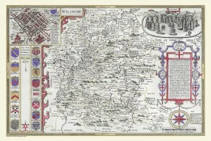
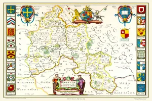
OldCounty Map of Wiltshire 1611 by John SpeedA facimile of John Speeds historical map of Wiltshire published for the " Theatre of the Empire of Great Britain", an atlas to accompany " a history of Great Britain"
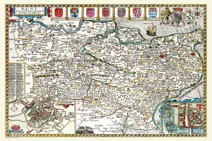
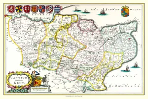
Old County Map of Kent 1611 by John SpeedA facimile of John Speeds historical map of Kent originally published for the " Theatre of the Empire of Great Britain", an atlas to accompany " a history of Great Britain"
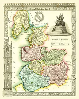
Old County Map of Lancashire 1836 by Thomas MouleThis is a fine decorative reproduction County Map of Lancashire from the First Edition series of Thomas Moule Maps, originally Published in 1836
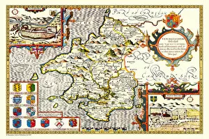
Old County Map of Kent 1648 by Johan Blaeu from the Atlas NovusThis detailed and most attractive reproduction map of Kent has been carefully art worked from a scan of an antique original
Old County Map of Pembrokeshire, Wales 1611 by John SpeedA facimile of John Speeds historical map of Pembrokeshire originally published for the " Theatre of the Empire of Great Britain"
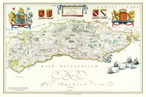
Old County Map of Sussex 1648 by Johan Blaeu from the Atlas NovusThis detailed and most attractive reproduction map of Sussex has been carefully art worked from a scan of an antique original
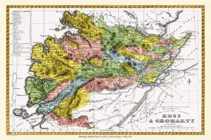
Old County Map of Ross and Cromarty Scotland 1847 by A&C BlackA finely detailed facimile remastered in full colour from an antique original map of Ross and Cromarty featured in A&C Blacks Atlas of 1847
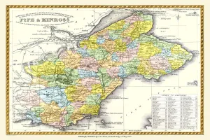
Old County Map of Fife and Kinross Scotland 1847 by A&C BlackA finely detailed facimile remastered in full colour from an antique original map of Fife and Kinross featured in A&C Blacks Atlas of 1847
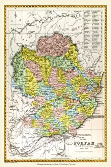
Old County Map of Forfar Scotland 1847 by A&C BlackA finely detailed facimile remastered in full colour from an antique original map of Forfar featured in A&C Blacks Atlas of 1847
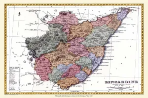
Old County Map of Kincardine Scotland 1847 by A&C BlackA finely detailed facimile remastered in full colour from an antique original map of Kincardine featured in A&C Blacks Atlas of 1847
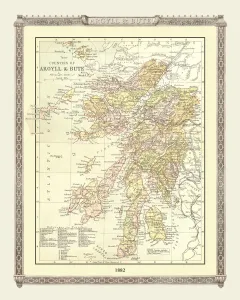
Old Map of the Counties of Argyll and Bute from the Philips Handy Atlas of 1882PHA003
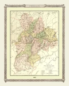
Old Map of the County of Peebles from the Philips Handy Atlas of 1882PHA023
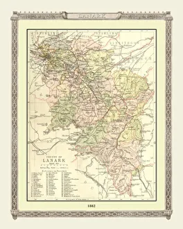
Old Map of the County of Lanark from the Philips Handy Atlas of 1882PHA020
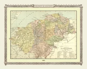
Old Map of the Counties of Elgin and Nairn from the Philips Handy Atlas of 1882PHA013
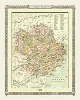
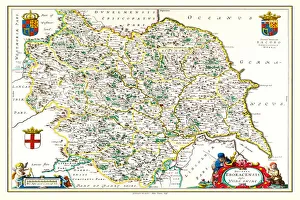
Old Map of the County of Forfar from the Philips Handy Atlas of 1882PHA015
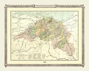
Old Map of the County of Edinburgh from the Philips Handy Atlas of 1882PHA010
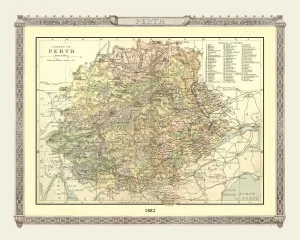
Old Map of the County of Perth from the Philips Handy Atlas of 1882PHA024
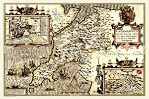
Old County Map of Caernarvonshire, Wales 1611 by John SpeedA facimile of John Speeds historical map of Caernarvonshire originally published for the " Theatre of the Empire of Great Britain"
Old County Map of Buckinghamshire 1648 by Johan Blaeu from the Atlas NovusThis detailed and most attractive reproduction map of Buckinghamshire has been carefully art worked from a scan of an antique original
Old County Map of Bedfordshire 1648 by Johan Blaeu from the Atlas NovusThis detailed and most attractive reproduction map of Bedfordshire has been carefully art worked from a scan of an antique original
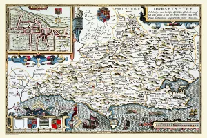
Old County Map of Dorsetshire 1611 by John SpeedA facimile of John Speeds historical map of Dorsetshire originally published for the " Theatre of the Empire of Great Britain", an atlas to accompany " a history of Great Britain"
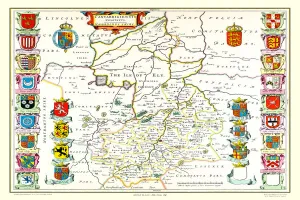
Old County Map of Cambridgeshire 1648 by Johan Blaeu from the Atlas NovusThis detailed and most attractive reproduction map of Cambridgeshire has been carefully art worked from a scan of an antique original
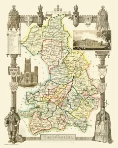
Old County Map of Cambridgeshire 1836 by Thomas MouleThis is a fine decorative reproduction County Map of Cambridgeshire from the First Edition series of Thomas Moule Maps, originally Published in 1836
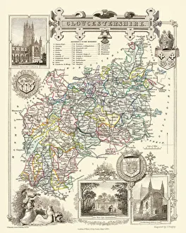
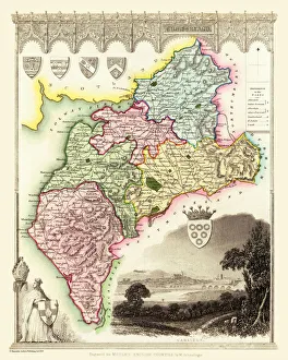
Old County Map of Gloucestershire 1836 by Thomas MouleThis is a fine decorative reproduction County Map of Gloucestershire from the First Edition series of Thomas Moule Maps, originally Published in 1836
Old County Map of Berkshire 1836 by Thomas MouleThis is a fine decorative reproduction County Map of Berkshire from the First Edition series of Thomas Moule Maps, originally Published in 1836
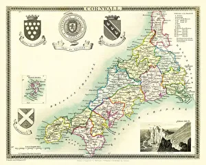
Old County Map of Cornwall 1836 by Thomas MouleThis is a fine decorative reproduction County Map of Cornwall from the First Edition series of Thomas Moule Maps, originally Published in 1836
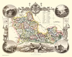
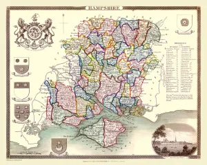
Old County Map of Hampshire 1836 by Thomas MouleThis is a fine decorative reproduction County Map of Hampshire from the First Edition series of Thomas Moule Maps, originally Published in 1836
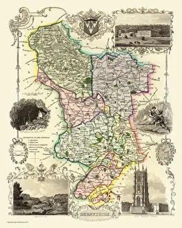
Old County Map of Derbyshire 1836 by Thomas MouleThis is a fine decorative reproduction County Map of Derbyshire from the First Edition series of Thomas Moule Maps, originally Published in 1836
Old County Map of Cumberland 1836 by Thomas MouleThis is a fine decorative reproduction County Map of Cumberland from the First Edition series of Thomas Moule Maps, originally Published in 1836
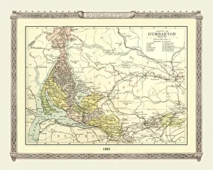
Old Map of the County of Dumbarton from the Philips Handy Atlas of 1882PHA008
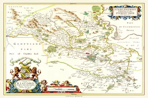
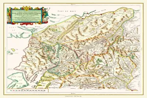
Old County Map of Sterlingshire 1654 by Johan Blaue from the Atlas NovusThis detailed and most attractive reproduction map of Sterlingshire, Scotland, has been carefully art worked from a scan of an antique original
Old County Map of Oxfordshire 1648 by Johan Blaeu from the Atlas NovusThis detailed and most attractive reproduction map of Oxfordshire has been carefully art worked from a scan of an antique original
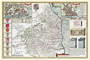
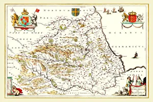
Old County Map of Northumberland 1611 by John SpeedA facimile of John Speeds historical map of Northumberland originally published for the " Theatre of the Empire of Great Britain"
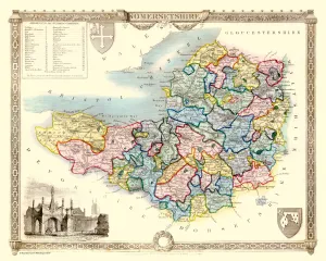
Old County Map of Somersetshire 1836 by Thomas MouleThis is a fine decorative reproduction County Map of Somersetshire from the First Edition series of Thomas Moule Maps, originally Published in 1836
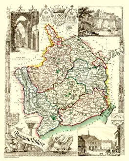
Old County Map of Monmouthshire 1836 by Thomas MouleThis is a fine decorative reproduction County Map of Monmouthshire from the First Edition series of Thomas Moule Maps, originally Published in 1836
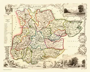
Old County Map of Essex 1836 by Thomas MouleThis is a fine decorative reproduction County Map of Essex from the First Edition series of Thomas Moule Maps, originally Published in 1836
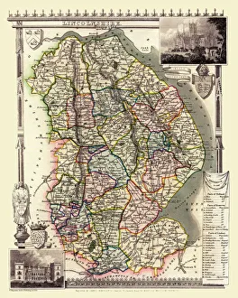
Old County Map of Lincolnshire 1836 by Thomas MouleThis is a fine decorative reproduction County Map of Lincolnshire from the First Edition series of Thomas Moule Maps, originally Published in 1836
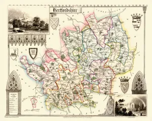
Old County Map of Hertfordshire 1836 by Thomas MouleThis is a fine decorative reproduction County Map of Hertfordshire from the First Edition series of Thomas Moule Maps, originally Published in 1836
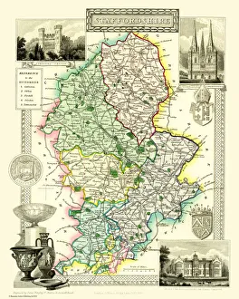
Old County Map of Staffordshire 1836 by Thomas MouleThis is a fine decorative reproduction County Map of Staffordshire from the First Edition series of Thomas Moule Maps, originally Published in 1836
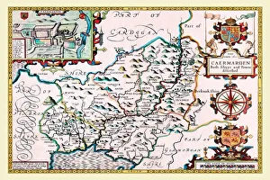
Old County Map of Carmarthenshire 1611 by John SpeedA facimile of John Speeds historical map of Carmarthenshire originally published for the " Theatre of the Empire of Great Britain"
Old County Map of Durham 1648 by Johan Blaeu from the Atlas NovusThis detailed and most attractive reproduction map of Durham has been carefully art worked from a scan of an antique original
Old County Map of Yorkshire 1648 by Johan Blaeu from the Atlas NovusThis detailed and most attractive reproduction map of Yorkshire has been carefully art worked from a scan of an antique original
Old County Map of Inverness-shire 1654 by Johan Blaeu from the Atlas NovusThis detailed and most attractive reproduction map of Inverness-shire has been carefully art worked from a scan of an antique original