Home > Maps from the British Isles > British Coastal Surveys PORTFOLIO
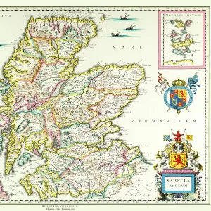
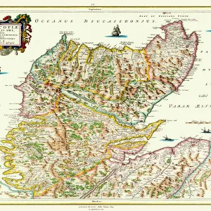
Early Coastal Survey Map of The West Coast of Scotland 1796

![]()
Wall Art and Photo Gifts from MapSeeker
Early Coastal Survey Map of The West Coast of Scotland 1796
This is a colour reproduction of the attractive coastal chart of the West Coast of Scotland from the Firth of Clyde to Ardnamurchan originally produced by Stuart Amos Arnold
Media ID 20347999
FEATURES IN THESE COLLECTIONS
> Maps from the British Isles
> British Coastal Surveys PORTFOLIO
> Maps from the British Isles
> Scotland and Counties PORTFOLIO
MADE IN THE UK
Safe Shipping with 30 Day Money Back Guarantee
FREE PERSONALISATION*
We are proud to offer a range of customisation features including Personalised Captions, Color Filters and Picture Zoom Tools
SECURE PAYMENTS
We happily accept a wide range of payment options so you can pay for the things you need in the way that is most convenient for you
* Options may vary by product and licensing agreement. Zoomed Pictures can be adjusted in the Basket.