Home > British Town And City Plans > English & Welsh PORTFOLIO
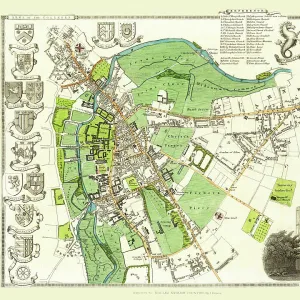
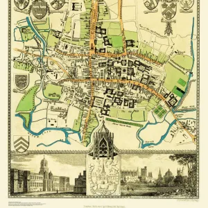
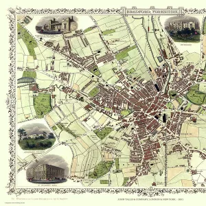
Old Map of Oxford 1808 by Cole and Roper

![]()
Wall Art and Photo Gifts from MapSeeker
Old Map of Oxford 1808 by Cole and Roper
An attractive and detailed early 19th century reproduction plan of the City of Oxford 1808. First published by Cole and Roper as a finely engraved series of county maps and town plans which were initially issued in parts and then together as The British Atlas in 1810
Media ID 20348108
© Mapseeker Publishing Ltd
Cole And Roper Historic Map Old Town Plan
MADE IN THE UK
Safe Shipping with 30 Day Money Back Guarantee
FREE PERSONALISATION*
We are proud to offer a range of customisation features including Personalised Captions, Color Filters and Picture Zoom Tools
SECURE PAYMENTS
We happily accept a wide range of payment options so you can pay for the things you need in the way that is most convenient for you
* Options may vary by product and licensing agreement. Zoomed Pictures can be adjusted in the Basket.