mail_outline sales@mediastorehouse.com
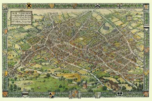
A Conjectural Picture Map of Birmingham In 1730This is a striking colourful picture map of Birmingham in 1730, originally imagined & drawn from city records by Bernard Sleigh and lettered by I.A. Ellis, 1923
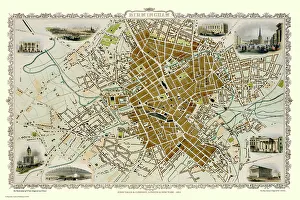
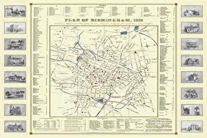
Old Map of Birmingham 1851 by John TallisThis attractive plan of mid Victorian Birmingham in the Midlands by John Tallis 1851 shows the first railways and important canal network. The work is attractively presented with eight illustrations
Old Map of Birmingham Surveyed in 1750 by Thomas HansonJ071
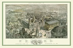
Birds Eye View of Birmingham In 1886This is a striking panoramic view originally published as a supplement to The Graphic, September 4, 1886. There is an accompanying key block that can be used to identify 35 areas including streets
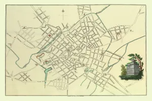
Old Map of Birmingham 1795 by C. PyeJ073
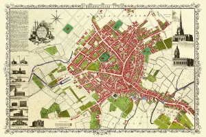
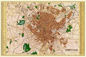
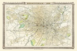
Old Map of Birmingham 1893 from the Comprehensive Gazetteer Atlas of England and WalesThis detailed reproduction plan of Birmingham has been re-worked from an antique originally published in the oComprehensive Gazetteer of England and Waleso 1893
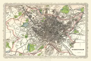
Old Map of Birmingham 1883==
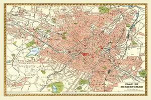
Old Map of Birmingham 1866 by Fullarton & CoThis detailed reproduction plan of Birmingham has been re-worked from an antique originally published in the 1860,s by Archibold Fullarton & Company
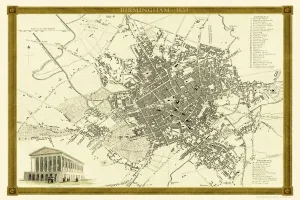
Old Map of Birmingham 1832 by James DrakeJ069
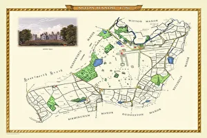
Old Map of Aston Manor near Birmingham 1796J122
Old Map of Birmingham 1898 from the Royal Atlas by BartholomewA fine very detailed plan of the City of Birmingham remastered from an original contained within " The Royal Atlas of England and Wales" ; edited by J.G
Old Map of Birmingham 1834 by John Dower and William OrrA highly detailed reproduction city map of Birmingham originally published in London, 1834. Interestingly it shows the planned route of the Grand Junction Railway coming into the North of Birmingham
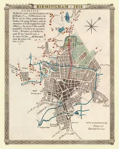
Old Map of Birmingham 1816J077
Old Map of Birmingham 1825J078
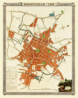
Old Map of Birmingham 1808J074