mail_outline sales@mediastorehouse.com
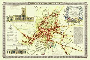
Old Map of Wolverhampton 1750 by Isaac TaylorJ066
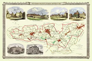
Old Map of Stoke on Trent and the Potteries 1831G148
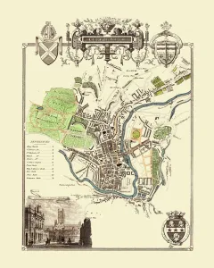
Old Map of the City of Cambridge 1836 by Thomas MouleThis is a fine decorative reproduction Map of The City of Cambridge from the First Edition series of Thomas Moule Maps, originally Published in 1836
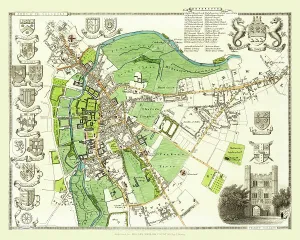
Old Map of Cheltenham 1825 by Griffith sFine reproduction in full colour of Griffiths new historical description of Cheltenham and its vicinity originally published in 1825
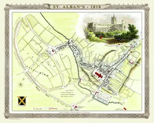
Old Map of St Albans 1810 by Cole and RoperAn attractive and detailed early 19th century reproduction town plan of St Albans 1810. First published by Cole and Roper as a finely engraved series of county maps
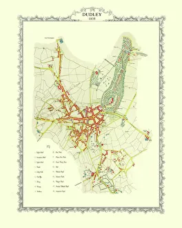
Old Map of Dudley 1835J037
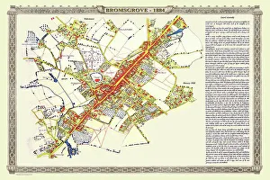
Old Map of the Town of Bromsgrove in Worcestershire 1884PL003
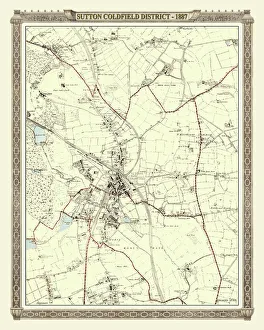
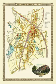
Old Map of the District of Sutton Coldfield in the West Midlands 1887PL016
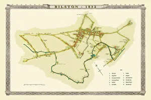
Old Map of Bilston 1832J036
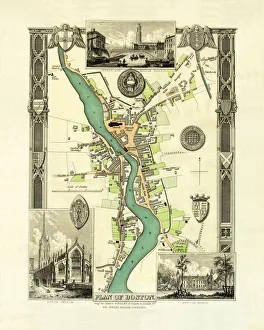
Old Map of Boston England 1836 by Thomas MouleThis is a fine decorative reproduction Map of The Town of Boston from the First Edition series of Thomas Moule Maps, originally Published in 1836
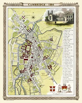
Old Map of Cambridge 1804 by Cole and RoperAn attractive and detailed early 19th century reproduction town plan of Cambridge 1804. First published by Cole and Roper as a finely engraved series of county maps
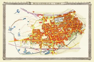
Old Map of the Town of Willenhall in the West Midlands 1884PL024
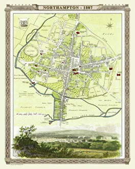
Old Map of Northampton 1807 by Cole and RoperAn attractive and detailed early 19th century reproduction town plan of Northampton 1807. First published by Cole and Roper as a finely engraved series of county maps
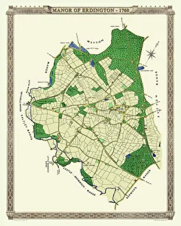
Old Map of The Manor of Erdington in Warwickshire 1760PL064
Old Map of Chester 1795 by John StockdaleAn interesting, very detailed, reproduction 18th century street plan of the City of Chester Engraved for and published John Stockdale
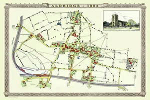
Old Map of the Village of Aldridge in Staffordshire1884PL001
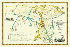
Old Map of the Collieries of Tipton, Sedgley and Wednesbury 1848PL005
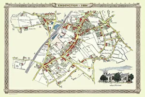
Old Map of the Village of Erdington in the West Midlands 1884PL007
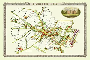
Old Map of Cannock Town in Staffordshire 1886PL004
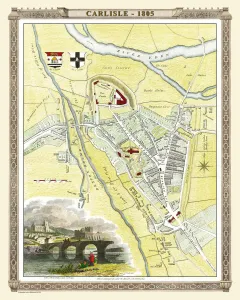
Old Map of Carlisle 1805 by Cole and RoperAn attractive and detailed early 19th century reproduction town plan of Carlisle 1805. First published by Cole and Roper as a finely engraved series of county maps
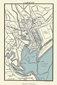
Old Map of Cardiff 1890 by A&C BlackJ133
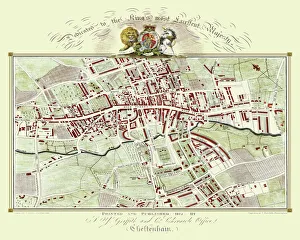
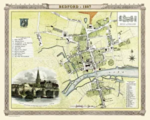
Old Map of Bedford 1807 by Cole and RoperAn attractive and detailed early 19th century reproduction town plan of Bedford, Bedfordshire. First published by Cole and Roper as a finely engraved series of county maps
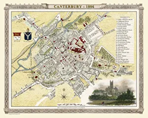
Old Map of Canterbury 1806 by Cole and RoperAn attractive and detailed early 19th century reproduction town plan of Canterbury 1806. First published by Cole and Roper as a finely engraved series of county maps
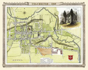
Old Map of Colchester 1805 by Cole and RoperAn attractive and detailed early 19th century reproduction town plan of Colchester 1805. First published by Cole and Roper as a finely engraved series of county maps
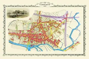
Old Map of the Town of Tamworth in Staffordshire 1885PL018
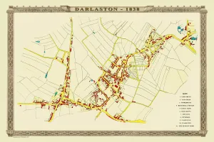
Old Map of the Town of Darlaston in the West Midlands 1838PL39
Old Map of the Royal Town of Sutton Coldfield 1884PL050
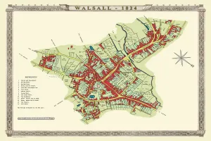
Old Map of Walsall 1824 by MasonJ022
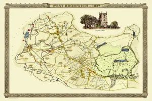
Old Map of West Bromwich in the West Midlands 1837PL021
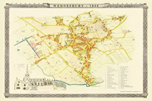
Old Map of Wednesbury Town in the Black Country 1846J023
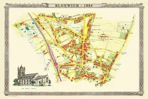
Old Map of the Village of Bloxwich near Walsall 1884PL002
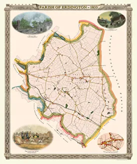
Old Map of The Parish of Erdington 1833J129
Old Map of the City of Bath 1836 by Thomas MouleThis is a fine decorative reproduction Map of The City of Bath from the First Edition series of Thomas Moule Maps, originally Published in 1836
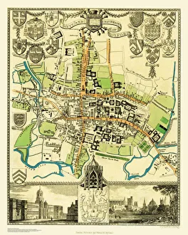
Old Map of the City Oxford 1836 by Thomas MouleThis is a fine decorative reproduction Map of The City of Oxford from the First Edition series of Thomas Moule Maps, originally Published in 1836
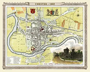
Old Map of Chester 1805 by Cole and RoperAn attractive and detailed early 19th century reproduction town plan of Chester 1805. First published by Cole and Roper as a finely engraved series of county maps
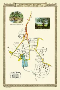
Old Map of the Royal Town of Sutton Coldfield 1765 by John SnapePL042
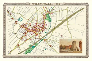
Old Map of the Town of Willenhall showing the Old Church of St Giles in 1838PL063
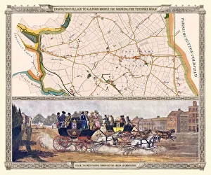
Old Map of the Turnpike Road u Erdington 1833 with Stagecoaches at "The Green"J130