Home > Maps of Africa and Oceana
Old Map of Polynesia, or Islands in the Pacific Ocean 1851 by John Tallis
Full Range of Prints and Gifts in Stock
Featured Maps of Africa and Oceana Image
Old Map of Western Australia and the Swan River 1851 by John Tallis
Full Range of Prints and Gifts in Stock
Maps of Africa and Oceana Gallery
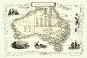
Maps of Africa, African Countries, Australia, New Zealand, Tasmania, Polynesian Islands
Choose from 15 pictures in our Maps of Africa and Oceana collection for your Wall Art or Photo Gift. All professionally made for Quick Shipping.
Categories
Folded Maps
Books & Atlases
Maps from the British Isles
British Town And City Plans
Old Views and Vistas
Maps of Africa and Oceana
> Old Maps of Australia PORTFOLIO
Maps of the Americas
Maps of Europe
Maps of Asia and Middle East
Maps Showing the World
Old Railway and Canal Map Collection
Pictorial Maps and Pictorial History
British History Related and Military
All Images

Old Map of Polynesia, or Islands in the Pacific Ocean 1851 by John Tallis
Full Range of Prints and Gifts in Stock

Old Map of Africa 1852 by Henry George Collins
This is a finely detailed map of Africa remastered from a rare Atlas of the World published in 1852 by Henry George Collins. Although these Henry Collins produced maps of the highest quality in his time unfortunately not the same could be said in terms of his business success. His maps were later obtained by the famous Stanford Map Company and used in their publications
© Mapseeker Publishing Ltd

Old Map of Western Australia and the Swan River 1851 by John Tallis
Full Range of Prints and Gifts in Stock