Home > Maps Showing the World > Maps of The World by Year PORTFOLIO
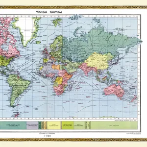
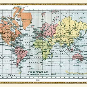
Old Map of the World 1871

![]()
Wall Art and Photo Gifts from MapSeeker
Old Map of the World 1871
THE WORLD THAT WAS 1871 - End of Franco-Prussian War; Germany unified, and Empire formed; Third Republic in France; suppression of the Paris Commune. British Columbia joins Canada. Chicago fires. Stanley meets Livingstone near Lake Tanganyika (oDr Livingstone, I presume?o)
Media ID 20347533
© Collins Bartholomew - Mapseeker Publishing Ltd
Map Of The World Old Map Of The World The World World Map
MADE IN THE UK
Safe Shipping with 30 Day Money Back Guarantee
FREE PERSONALISATION*
We are proud to offer a range of customisation features including Personalised Captions, Color Filters and Picture Zoom Tools
SECURE PAYMENTS
We happily accept a wide range of payment options so you can pay for the things you need in the way that is most convenient for you
* Options may vary by product and licensing agreement. Zoomed Pictures can be adjusted in the Basket.