Home > Maps from the British Isles > British Isles Map PORTFOLIO
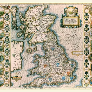
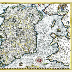
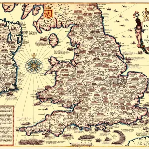
Old Map of The Invasions of England and Ireland by John Speed

![]()
Wall Art and Photo Gifts from MapSeeker
Old Map of The Invasions of England and Ireland by John Speed
A facimile of John Speeds historical map of the Invasions of England and Ireland originally published for the " Theatre of the Empire of Great Britain", an atlas to accompany " a history of Great Britain"
Media ID 20347973
© Mapseeker Publishing Ltd
Historic Map John Speed Map Speed Map Speede Map
FEATURES IN THESE COLLECTIONS
> Maps from the British Isles
> British Isles Map PORTFOLIO
> Maps from the British Isles
> England with Wales PORTFOLIO
> Maps from the British Isles
> Ireland and Provinces PORTFOLIO
MADE IN THE USA
Safe Shipping with 30 Day Money Back Guarantee
FREE PERSONALISATION*
We are proud to offer a range of customisation features including Personalised Captions, Color Filters and Picture Zoom Tools
SECURE PAYMENTS
We happily accept a wide range of payment options so you can pay for the things you need in the way that is most convenient for you
* Options may vary by product and licensing agreement. Zoomed Pictures can be adjusted in the Cart.