mail_outline sales@mediastorehouse.com
183 items
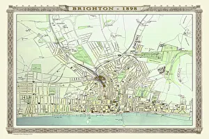
Old Map of Brighton 1898 from the Royal Atlas by BartholomewA fine very detailed plan of the Seaside Town of Brighton from 1898 remastered from an original contained within " The Royal Atlas of England and Wales" ; edited by J.G
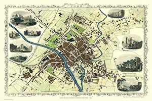
Old Map of York 1851 by John TallisThe River Ouse flows through the famous City of York, already its buildings are spreading outside its ancient walls. The 1851 John Tallis plan is illustrated with views of The Minster, Walmgate Bar
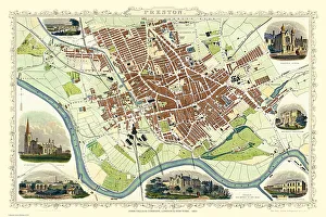
Old Map of Preston 1851 by John TallisThe River Ribble in Lancashire by John Tallis 1851 with a most rural presentation of Preston surrounded by numerous meadows and open fields. The plan is beautifully finished with seven illustrations
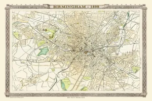
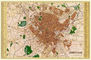
Old Map of Birmingham 1898 from the Royal Atlas by BartholomewA fine very detailed plan of the City of Birmingham remastered from an original contained within " The Royal Atlas of England and Wales" ; edited by J.G
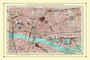
Old Street Map of London Central, East End and River Thames 1908Detailed colour Street Plan of London from 1908. The street map features London Central and the east End with the River Thames from Blackfriars Bridge to the London Docks
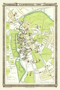
Old Map of Cambridge 1898 from the Royal Atlas by BartholomewA fine very detailed plan of the City of Cambridge from 1898 remastered from an original contained within " The Royal Atlas of England and Wales" ; edited by J.G
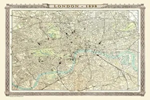
Old Map of London 1898 from the Royal Atlas by BartholomewA fine very detailed plan of the City of London remastered from an original contained within " The Royal Atlas of England and Wales" ; edited by J.G
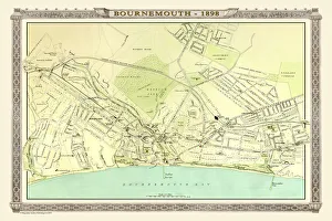
Old Map of Bournemouth 1898 from the Royal Atlas by BartholomewA fine very detailed plan of the Seaside Town of Bournemouth from 1898 remastered from an original contained within " The Royal Atlas of England and Wales" ; edited by J.G
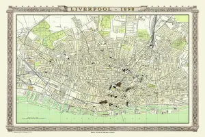
Old Map of Liverpool 1898 from the Royal Atlas by BartholomewA fine very detailed plan of the City of Liverpool remastered from an original contained within " The Royal Atlas of England and Wales" ; edited by J.G
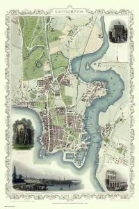
Old Map of Southampton 1851 by John TallisThe River Itchen dominates the 1851 John Tallis plan of Southampton in Hampshire with The Parks covering a great expanse to the top left
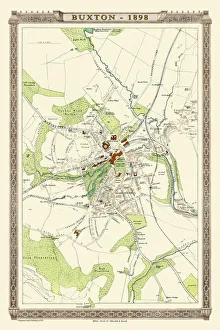
Old Map of Buxton 1898 from the Royal Atlas by BartholomewA fine very detailed plan of the Spa Town of Buxton from 1898 remastered from an original contained within " The Royal Atlas of England and Wales" ; edited by J.G
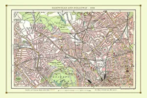
Old Street Map of Hamstead, Holloway and Islington 1908Detailed colour Street Plan of London from 1908 covering the area around Hamstead, Holloway and Islington. The image has been remastered from Bartholomews Handy Atlas of London and Suburbs 1908
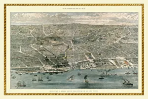
Birds Eye View of Liverpool In 1886This is a magnificent colour birds eye view of Liverpool from the Mersey in 1886, showing the then-new public buildings, at the time of Queen Victorias visit to the Liverpool Exhibition
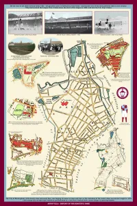
Aston Villa - History of the Beautiful NameThis is a captivating pictorial history map that traces the history of the famous name through rare antique maps and images back to 1820 where one such map shows the building " Aston Villa"
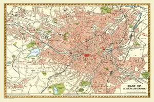
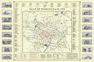
Old Map of Birmingham 1893 from the Comprehensive Gazetteer Atlas of England and WalesThis detailed reproduction plan of Birmingham has been re-worked from an antique originally published in the oComprehensive Gazetteer of England and Waleso 1893
Old Map of Birmingham 1883==
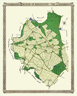
Old Map of The Manor of Erdington in Warwickshire 1760PL064
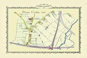
Old Map of Perrry Crofts near Tamworth 1884PL059
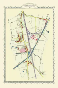
Old Map of Kettlebrook near Tamworth 1882PL057
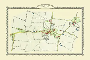
Old Map of the Village of Hurley in Warwickshire 1884PL056
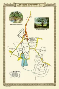
Old Map of the Royal Town of Sutton Coldfield 1765 by John SnapePL042
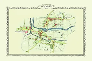
Old Map of the Village of Polesworth near Tamworth 1887PL60
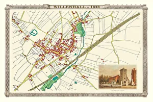
Old Map of the Town of Willenhall showing the Old Church of St Giles in 1838PL063
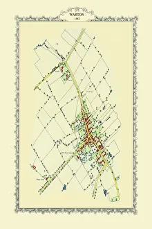
Old Map of the Village of Warton in the County of Warwickshire 1882PL062
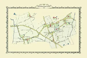
Old Map of the Village of Nether Whitacre in Warwickshire 1886PL058
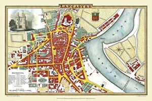
Old Map of Lancaster 1824 by Edward BainesThis is a fine detailed reproduction Map of The City of Lancaster, originally Published in 1836 by Edwward Baines
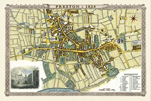
Old Map of Preston 1824 by Edward BainesThis is a fine detailed reproduction Map of The City of Preston from the First Edition series of Thomas Moule Maps, originally Published in 1836
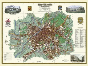
Old Map of Manchester and its Environs 1824 by William SwireJ128
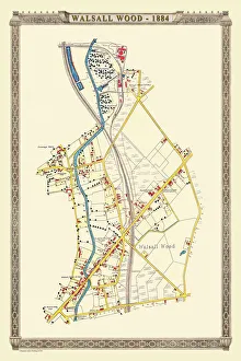
Old Map of the Village of Walsall Wood in Stafffordshire 1884PL38
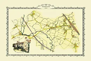
Old Map of Newton near West Bromwich showing Bishop Astburys Cottage 1884PL046
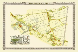
Old Map of Boldmere near Sutton Coldfield 1885PL045
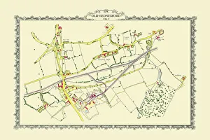
Old Map of the Mining Village of Hednesford in Staffordshire 1865PL032
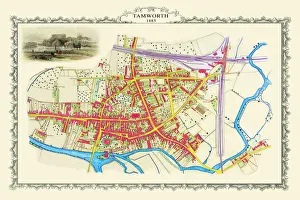
Old Map of the Town of Tamworth in Staffordshire 1885PL018
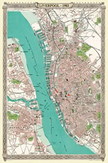
Old Map of Liverpool 1903J103
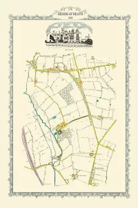
Old Map of Reddicap Heath near Sutton Coldfield 1884PL048
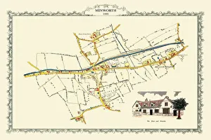
Old Map of the Village of Minworth in Warwickshire 1886PL034
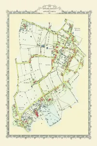
Old Map of Appleby Magna to Appleby Parva in Warwickshire 1885PL051
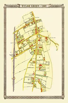
Old Map of Wylde Green near Erdington 1884PL044
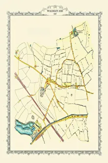
Old Map of Walmley Ash near Sutton Coldfield 1884PL049
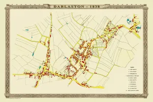
Old Map of the Town of Darlaston in the West Midlands 1838PL39
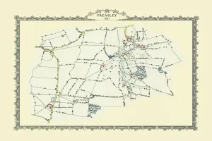
Old Map of the Village of Freasley near Tanmworth 1884PL054
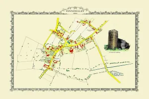
Old Map off the Village of Finningley in South Yorkshire 1884PL031
Old Map of Sheepy Magna to Sheepy Parva in Leicestershire 1885PL061
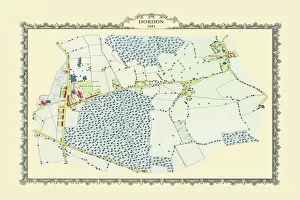
Old Map of the Village of Dordan in Warwickshire 1883PL053
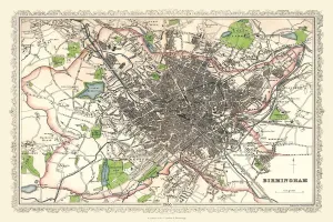
Old Map of Birmingham 1866 by Fullarton & CoThis detailed reproduction plan of Birmingham has been re-worked from an antique originally published in the 1860,s by Archibold Fullarton & Company
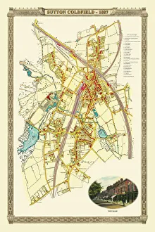
Old Map of the Royal Town of Sutton Coldfield 1884PL050
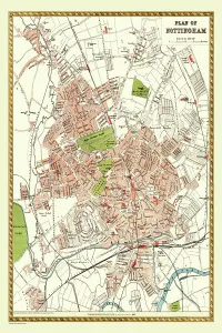
Old Map of Nottingham 1893 from the Comprehensive Gazetteer Atlas of England and WalesThis detailed reproduction plan of Nottingham has been re-worked from an antique originally published in the oComprehensive Gazetteer of England and Waleso 1893
Old Map of Birmingham 1832 by James DrakeJ069