Poster Print > British Town And City Plans > English & Welsh PORTFOLIO
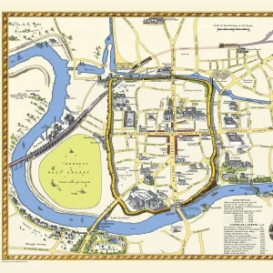
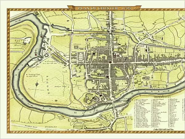
Poster Print : Old Map of Chester 1795 by John Stockdale

![]()
Poster Prints from MapSeeker
Old Map of Chester 1795 by John Stockdale
An interesting, very detailed, reproduction 18th century street plan of the City of Chester Engraved for and published John Stockdale, London 1795 for John Aikin s" A Description of the Country from Thirty to Forty Miles Round Manchester" The map covers from the Brewers Hall, River Dee and the Racecourse ( Roodee) to the west of the City to Flokersbrook Bridge, Horn Lane and the end of Foregate Street to the east. Main streets and buildings of interest, such as the Infirmary, the Castle & the Cathedral are also clearly named. Lower right is a reference key which further identifies many more buildings and streets
Media ID 20347086
Historic Map Old Town Plan Town Plan
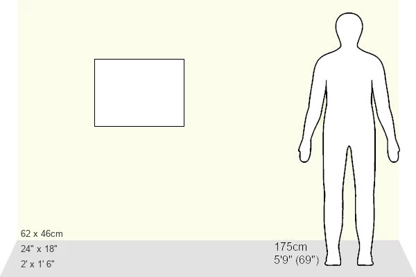
18x24 inch Poster Print
Poster prints are budget friendly enlarged prints in standard poster paper sizes. Printed on 150 gsm Matte Paper for a natural feel and supplied rolled in a tube. Great for framing and should last many years. To clean wipe with a microfiber, non-abrasive cloth or napkin. Our Archival Quality Photo Prints and Fine Art Paper Prints are printed on higher quality paper and the choice of which largely depends on your budget.
Poster prints are budget friendly enlarged prints in standard poster paper sizes (A0, A1, A2, A3 etc). Whilst poster paper is sometimes thinner and less durable than our other paper types, they are still ok for framing and should last many years. Our Archival Quality Photo Prints and Fine Art Paper Prints are printed on higher quality paper and the choice of which largely depends on your budget.
Estimated Product Size is 61.6cm x 46.3cm (24.3" x 18.2")
These are individually made so all sizes are approximate
Artwork printed orientated as per the preview above, with landscape (horizontal) orientation to match the source image.
MADE IN THE USA
Safe Shipping with 30 Day Money Back Guarantee
FREE PERSONALISATION*
We are proud to offer a range of customisation features including Personalised Captions, Color Filters and Picture Zoom Tools
SECURE PAYMENTS
We happily accept a wide range of payment options so you can pay for the things you need in the way that is most convenient for you
* Options may vary by product and licensing agreement. Zoomed Pictures can be adjusted in the Cart.