Home > British Town And City Plans > English & Welsh PORTFOLIO
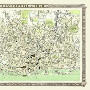
Old Map of Liverpool 1851 by John Tallis

![]()
Wall Art and Photo Gifts from MapSeeker
Old Map of Liverpool 1851 by John Tallis
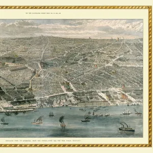
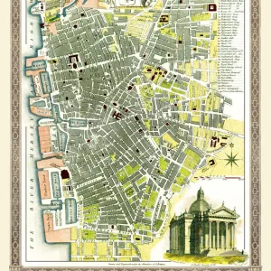
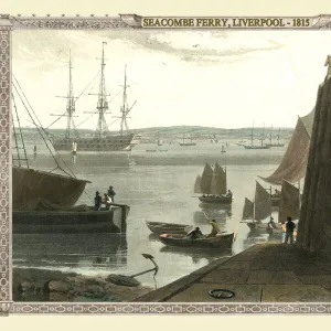
Running along the entire length of the plan of Liverpool in Lancashire by John Tallis 1851 is a most attractive view across the River Mersey from Birkenhead to the Victorian Liverpool skyline. The plan shows the extensive Liverpool Docks that now include Albert Dock. Other illustrations on the plan are the Custom House, St Georges Hall, the Sailors Home as well as steamboats and sailing ships
Media ID 20347872
City Of Liverpool Map Historic Liverpool Map Historic Map John Tallis John Tallis Map Liverpool Liverpool City Liverpool City Map Liverpool Map Liverpool Town Plan Map Of Liverpool Old Map Of Liverpool Old Town Plan Tallis Map Town Plan Of Liverpool
MADE IN THE UK
Safe Shipping with 30 Day Money Back Guarantee
FREE PERSONALISATION*
We are proud to offer a range of customisation features including Personalised Captions, Color Filters and Picture Zoom Tools
SECURE PAYMENTS
We happily accept a wide range of payment options so you can pay for the things you need in the way that is most convenient for you
* Options may vary by product and licensing agreement. Zoomed Pictures can be adjusted in the Basket.