Home > British Town And City Plans > Irish PORTFOLIO
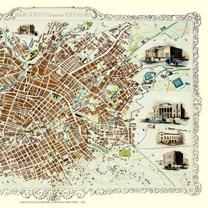
Old Map of Belfast 1851 by John Tallis

![]()
Wall Art and Photo Gifts from MapSeeker
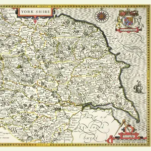
Old Map of Belfast 1851 by John Tallis
The River Lagan dominates the west side of this John Tallis 1851 plan of Belfast with Queens Bridge crossing into the town of Belfast in Northern Ireland. There are six splendid illustrations. These are of Queens College, Ulster Institution for the deaf, dumb and blind, Ulster Railway Station, Ballast Office, and a view across Queens Bridge to Belfast and the Court House
Media ID 20347878
Historic Map John Tallis John Tallis Map Old Town Plan Tallis Map
MADE IN THE UK
Safe Shipping with 30 Day Money Back Guarantee
FREE PERSONALISATION*
We are proud to offer a range of customisation features including Personalised Captions, Color Filters and Picture Zoom Tools
SECURE PAYMENTS
We happily accept a wide range of payment options so you can pay for the things you need in the way that is most convenient for you
* Options may vary by product and licensing agreement. Zoomed Pictures can be adjusted in the Basket.