mail_outline sales@mediastorehouse.com
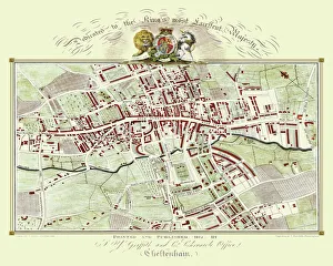
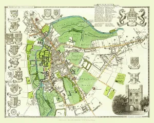
Old Map of Cheltenham 1825 by Griffith sFine reproduction in full colour of Griffiths new historical description of Cheltenham and its vicinity originally published in 1825
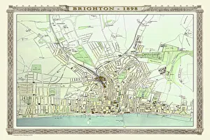
Old Map of Brighton 1898 from the Royal Atlas by BartholomewA fine very detailed plan of the Seaside Town of Brighton from 1898 remastered from an original contained within " The Royal Atlas of England and Wales" ; edited by J.G
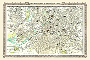
Old Map of Manchester and Salford 1898 from the Royal Atlas by BartholomewA fine very detailed plan of the City of Manchester and Salford remastered from an original contained within " The Royal Atlas of England and Wales" ; edited by J.G
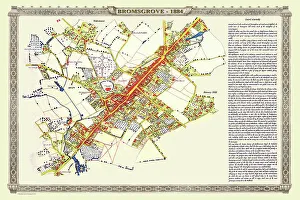
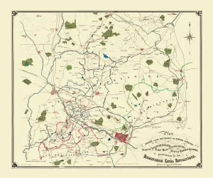
Old Map of the Town of Bromsgrove in Worcestershire 1884PL003
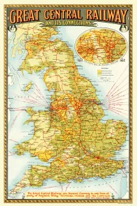
Old Map of the Great Central Railway and its Connections 1903This is a colourful and detailed reproduction map of " The Great Central Railway 1903" showing the lines and stations, with enlarged section showing the Northern Manufacturing Districts
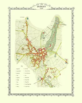
Old Map of Dudley 1835J037
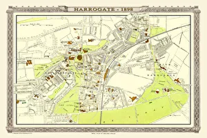
Old Map of Harrogate 1898 from the Royal Atlas by BartholomewA fine very detailed town plan of Harrogate from 1898 remastered from an original contained within " The Royal Atlas of England and Wales" ; edited by J.G
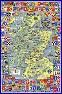
Pictorial History Map of Scotland 1963This is a wonderful pictorial map illustrating the history of Scotland drawn by Leslie Bullock and published in 1963 by Collins Bartholomew as a fold up map
John Hancoxs Map of the Birmingham Canal Navigations 1864This detailed map of the Birmingham Canal Navigations also shows the recently constructed Railways across the region, making it a valuable resource for Canal, Railway and Local History enthusiasts
Old Map of Village of Fazeley near Tamworth 1885PL025
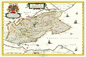
Old County Map of Fife 1654 by Johan Blaeu from the Atlas NovusThis detailed and most attractive reproduction map of Fife has been carefully art worked from a scan of an antique original
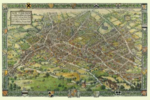
A Conjectural Picture Map of Birmingham In 1730This is a striking colourful picture map of Birmingham in 1730, originally imagined & drawn from city records by Bernard Sleigh and lettered by I.A. Ellis, 1923
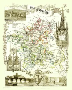
Old County Map of Worcestershire 1836 by Thomas MouleThis is a fine decorative reproduction County Map of Worcestershire from the First Edition series of Thomas Moule Maps, originally Published in 1836
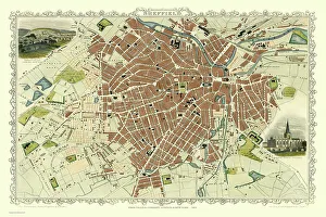
Old Map of Sheffield 1851 by John TallisA fine 1851 map by John Tallis of Victorian, industrial Sheffield in South Yorkshire that shows the steady growth of industry and housing to the left of the plan
Old Map of the City of Cambridge 1836 by Thomas MouleThis is a fine decorative reproduction Map of The City of Cambridge from the First Edition series of Thomas Moule Maps, originally Published in 1836
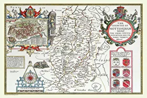
Old County Map of Nottinghamshire 1611 by John SpeedA facimile of John Speeds historical map of Nottinghamshire originally published for the " Theatre of the Empire of Great Britain"
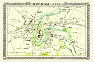
Old Map of Durham 1898 from the Royal Atlas by BartholomewA fine very detailed plan of the City of Durham remastered from an original contained within " The Royal Atlas of England and Wales" ; edited by J.G
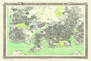
Old Map of Plymouth, Devonport and Stonehouse 1898 from the Royal Atlas by BartholomewA fine very detailed plan of the Port City of Plymouth with Devonport and Stonehouse, remastered from an original contained within " The Royal Atlas of England and Wales" ; edited by J.G
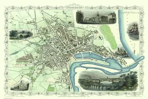
Old Map of Aberdeen 1851 by John TallisAberdeen in Scotland nestled on the River Dee with its famous Victorian Park and Harbour, John TallisAEs 1851 town plan perfectly captures this historic Scottish town during mid Victorian times
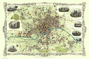
Old Map of Leeds 1851 by John TallisThis map of Leeds in West Yorkshire by John Tallis 1851 features the districts of Woodhouse Carr, Great Woodhouse, Little London, New Town, Little Woodhouse, New Wortley, Holbeck, and Hunslet
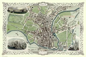
Old Map of Bath 1851 by John TallisThis is a splendid Victorian map by John Tallis 1851 of the historic Spa City of Bath in North East Somerset nestled between a bend on the River Avon
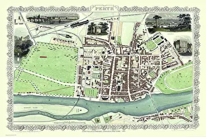
Old Map of Perth Scotland 1851 by John TallisThis 1851 John Tallis Victorian map of Perth in Scotland shows town sandwiched between the South Inch and North Inch. The plan shows only one bridge across the River Tay into Perth
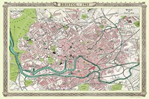
Old Map of Bristol 1903J104
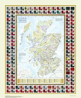
Map of the Clans and Tartans of ScotlandThis map of Scotland indicates the general sphere of influence held by the clans and considerable families at the beginning of the 17th century
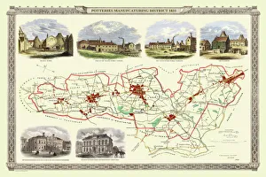
Old Map of Stoke on Trent and the Potteries 1831G148
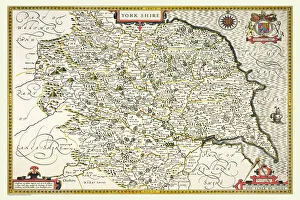
Old County Map of Yorkshire 1611 by John SpeedA facimile of John Speed's historical map of Yorkshire originally published for the "Theatre of the Empire of Great Britain", an atlas to accompany "a history of Great Britain"
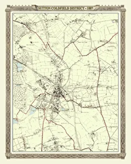
Old Map of the District of Sutton Coldfield in the West Midlands 1887PL016
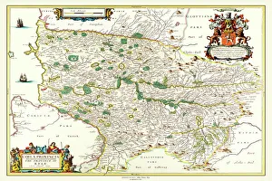
Old County Map of Kyle and Mid Ayrshire 1654 by johan Blaeu from the Atlas NovusThis detailed and most attractive reproduction map of Kyle and Mid Ayrshire has been carefully art worked from a scan of an antique original
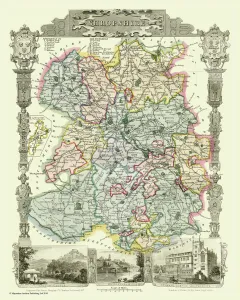
Old County Map of Shropshire 1836 by Thomas MouleThis is a fine decorative reproduction County Map of Shropshire from the First Edition series of Thomas Moule Maps, originally Published in 1836
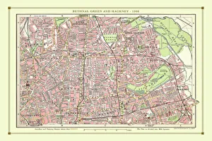
Old Street Map of Bethnal Green and Hackney 1908Detailed colour Street Plan of London from 1908 covering the area around Bethnal Green and Hackney. The image has been remastered from Bartholomews Handy Atlas of London and Suburbs 1908
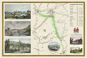
Old Railway Map of The Severn Valley Railway 1887This picturesque image captures the scenic route of the historic Severn Valley Railway as it was during Queen Victoria's Golden Jubilee year, 1887
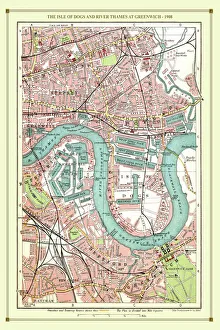
Old Street Map of The Isle of Dogs and River Thames at Greenwich 1908Detailed colour Street Plan of London from 1908 covering the area around The Isle of Dogs and The River Thames at Greenwich.The image has been remastered from Bartholomews Handy Atlas of London
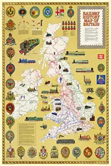
Pictorial History Railway Map of BritainThis is a wonderful large format pictorial map illustrating the history of the Railways of Britain up to its original publication date of 1974
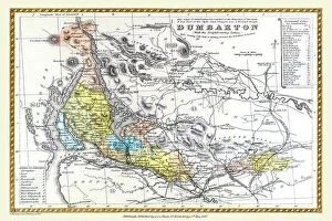
Old County Map of Dunbartonshire, formally called Dumbartonshire, Scotland 1847 by A&C BlackA finely detailed facimile remastered in full colour from an antique original map of "Dumbartonshire" featured in A&C Black's Atlas of 1847
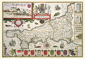
Old County Map of Cornwall 1611 by John SpeedA facimile of John Speed's historical map of Cornwall originally published for the "Theatre of the Empire of Great Britain", an atlas to accompany "a history of Great Britain"
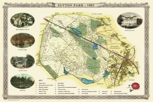
Old Map of Sutton Park near Sutton Coldfield 1885PL017
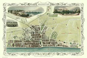
Old Map of Brighton 1851 by John TallisA most attractive Victorian plan of Brighton in Sussex by John Tallis 1851 showing its famous Chain Pier reaching out into the English Channel
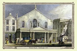
Theatre Royal , Edinburgh, 1831"Theatre Royal, Edinburgh" engraved by W.Wallis after a picture by Thomas Shepherd, published in Edinburgh in the Nineteenth Century, 1831
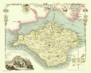
Old Map of The Isle of Wight 1836 by Thomas MouleThis is a fine decorative reproduction Map of The Isle of Wight from the First Edition series of Thomas Moule Maps, originally Published in 1836
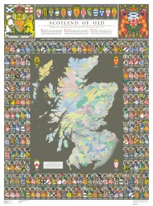
The Historic Map of Scotland "Scotland of Old"Now republished at its original full size, the Scotland of Old Map, also known as the Bartholomew Clan Map of Scotland, features aeThe LandsAE, aeThe ArmsAE, aeThe CrestsAE
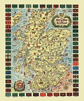
Pictorial Story Map of ScotlandThis map has been remastered from an original published by Colortext, it was one of a series they labelled aeStory MapAE. It combines pictorial images
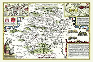
Old County Map of Hertfordshire 1611 by John SpeedA facimile of John Speed's historical map of Hertfordshire originally published for the "Theatre of the Empire of Great Britain"
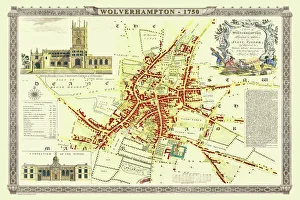
Old Map of Wolverhampton 1750 by Isaac TaylorJ066
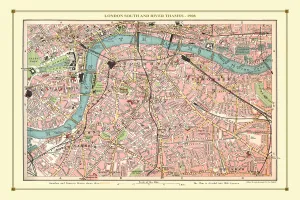
Old Street Map of London South and River Thames 1908Detailed colour Street Plan of London from 1908. The street map features London South wiith the River Thames from Vauxhall Bridge to the London Docks and features Westminster
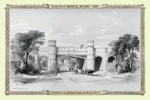
Views on the London to Birmingham Railway - Railway Bridge at Rugby 1839A finely detailed facimile remastered in full colour from an antique original map of "Dumbartonshire" featured in A&C Black's Atlas of 1847
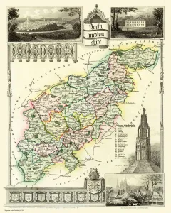
Old County Map of Northamptonshire 1836 by Thomas MouleThis is a fine decorative reproduction County Map of Northamptonshire from the First Edition series of Thomas Moule Maps, originally Published in 1836
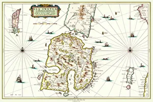
Old Map of the Isle of Islay Scotland 1654 by Johan Blaeu from the Atlas NovusThis detailed and most attractive reproduction map of The Isle of Islay has been carefully art worked from a scan of an antique original
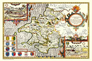
Old County Map of Pembrokeshire, Wales 1611 by John SpeedA facimile of John Speed's historical map of Pembrokeshire originally published for the "Theatre of the Empire of Great Britain"