Fine Art Print > British Town And City Plans > English & Welsh PORTFOLIO
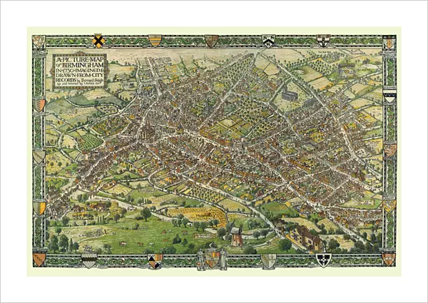
Fine Art Print : A Conjectural Picture Map of Birmingham In 1730

![]()
Fine Art Prints from MapSeeker
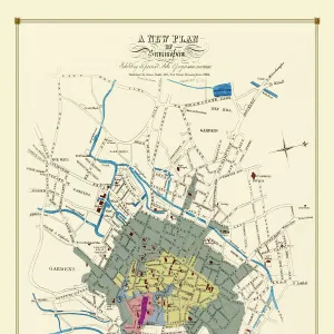
A Conjectural Picture Map of Birmingham In 1730
This is a striking colourful picture map of Birmingham in 1730, originally imagined & drawn from city records by Bernard Sleigh and lettered by I.A. Ellis, 1923. Originally printed by the Kynoch Press A.D. 1924, and published by Cornish Bros. Limited 39 New Street. This is a wonderfully detailed colourful pictorial map showing roads, the river Rea, principal buildings and the many dwellings, artisans workshops at a time when Birmingham rural aspect was about to transform into an industrial town rapidly growing outwards consuming the then far off villages that now form part of what is now the countries second city
Media ID 20347731
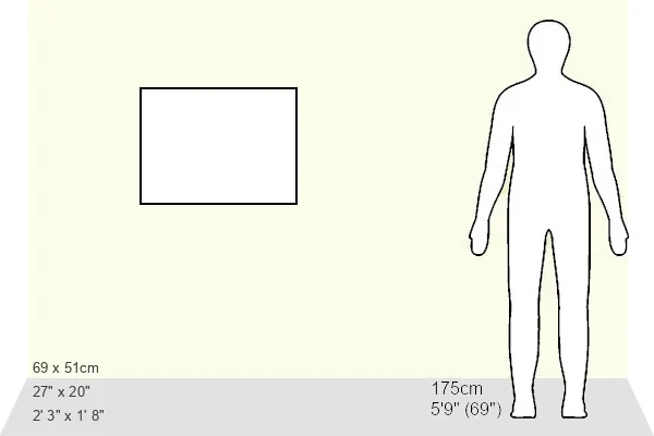
21"x14" (+3" Border) Fine Art Print
21x14 image printed on 27x20 Fine Art Rag Paper with 3" (76mm) white border. Our Fine Art Prints are printed on 300gsm 100% acid free, PH neutral paper with archival properties. This printing method is used by museums and art collections to exhibit photographs and art reproductions.
Our fine art prints are high-quality prints made using a paper called Photo Rag. This 100% cotton rag fibre paper is known for its exceptional image sharpness, rich colors, and high level of detail, making it a popular choice for professional photographers and artists. Photo rag paper is our clear recommendation for a fine art paper print. If you can afford to spend more on a higher quality paper, then Photo Rag is our clear recommendation for a fine art paper print.
Estimated Image Size (if not cropped) is 53.3cm x 35.5cm (21" x 14")
Estimated Product Size is 68.6cm x 50.8cm (27" x 20")
These are individually made so all sizes are approximate
Artwork printed orientated as per the preview above, with landscape (horizontal) orientation to match the source image.
FEATURES IN THESE COLLECTIONS
> British Town And City Plans
> English & Welsh PORTFOLIO
> Pictorial Maps and Pictorial History
MADE IN THE USA
Safe Shipping with 30 Day Money Back Guarantee
FREE PERSONALISATION*
We are proud to offer a range of customisation features including Personalised Captions, Color Filters and Picture Zoom Tools
SECURE PAYMENTS
We happily accept a wide range of payment options so you can pay for the things you need in the way that is most convenient for you
* Options may vary by product and licensing agreement. Zoomed Pictures can be adjusted in the Cart.