Framed Print > British Town And City Plans > English & Welsh PORTFOLIO
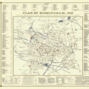
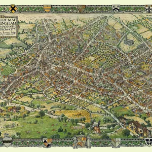
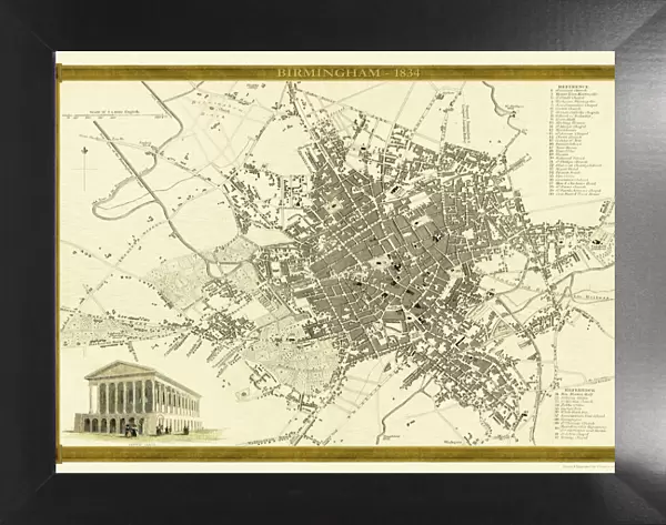
Framed Print : Old Map of Birmingham 1834 by John Dower and William Orr


![]()
Framed Photos from MapSeeker
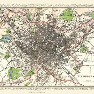
Old Map of Birmingham 1834 by John Dower and William Orr
A highly detailed reproduction city map of Birmingham originally published in London, 1834. Interestingly it shows the planned route of the Grand Junction Railway coming into the North of Birmingham, before the route was changed. Highly respected throughout England and Western Europe, William S. Orr was an early nineteenth century printseller and publisher, particularly of atlases and gazetteers. His maps of cities, counties and countries are noteworthy for their accuracy and very fine detailing. Indeed, few publishers from this period could compete with Orr for the large amount of information his maps contained. This original engraved map hails from Orrs 1834 Atlas, which contained not only all the regions of the world but plans of the primary cities as well. The engraving for the 1834 Atlas was entrusted mainly to the Pentonville artist, John Dower. Dower was well known for his maps and for his engravings of military scenes. So finely engraved is this map of Birmingham that one can only appreciate Dowers work with the aid of a magnifying lens. No finer example of early nineteenth century cartography exists than this engraved city map with its inset engraving of the Town Hall and reference key of major buildings. John Dower and William S. Orr were highly respected mapmakers, print sellers, and publishers of early 19th century London. Their work is known for is stunning accuracy and indeed, their work includes some of the most information rich maps of the period. In addition to his cartographic work, Dower is well known as an engraver of military scenes. Their primary work is the 1834 British Cyclopaedia
Media ID 20347146
Birmingham Birmingham City Birmingham City Map Birmingham Map Birmingham Town Plan City Of Birmingham Map Historic Birmingham Map Historic Map Map Of Birmingham Old Map Of Birmingham Old Town Plan Town Plan Of Birmingham
18"x14" Modern Frame
16x12 Print in an MDF Wooden Frame with 180 gsm Satin Finish Paper. Glazed using shatter proof thin plexiglass. Frame thickness is 1 inch and depth 0.75 inch. Fluted cardboard backing held with clips. Supplied ready to hang with sawtooth hanger and rubber bumpers. Spot clean with a damp cloth. Packaged foam wrapped in a card.
Contemporary Framed and Mounted Prints - Professionally Made and Ready to Hang
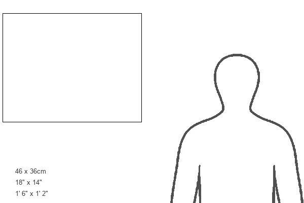
Estimated Image Size (if not cropped) is 40.6cm x 35.6cm (16" x 14")
Estimated Product Size is 45.7cm x 35.6cm (18" x 14")
These are individually made so all sizes are approximate
Artwork printed orientated as per the preview above, with landscape (horizontal) orientation to match the source image.
MADE IN THE USA
Safe Shipping with 30 Day Money Back Guarantee
FREE PERSONALISATION*
We are proud to offer a range of customisation features including Personalised Captions, Color Filters and Picture Zoom Tools
SECURE PAYMENTS
We happily accept a wide range of payment options so you can pay for the things you need in the way that is most convenient for you
* Options may vary by product and licensing agreement. Zoomed Pictures can be adjusted in the Cart.