Framed Print > British Town And City Plans > English & Welsh PORTFOLIO
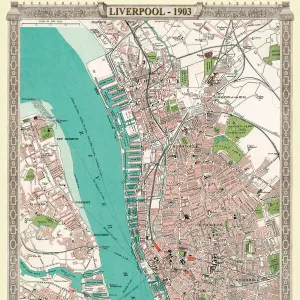
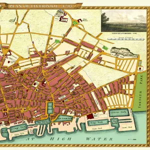
Framed Print : Old map of Liverpool 1650 by Thomas Kaye


![]()
Framed Photos from MapSeeker
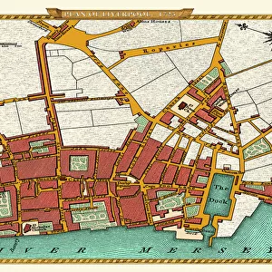
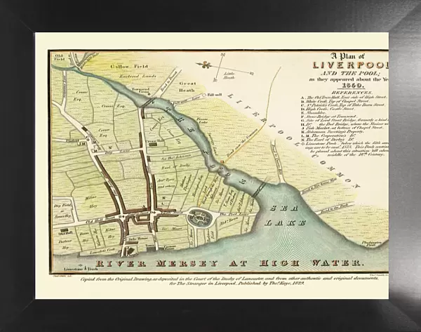
Old map of Liverpool 1650 by Thomas Kaye
An interesting map originally published in 1829 by Thomas Kaye, this reproduction map represents the town of Liverpool in 1650. Thomas made a copy from the original drawing of 1650 that was deposited in the Court of the Duchy of Lancaster as well as using other authentic and original documents. This fascinating plan shows Liverpool many years before it transformed into one of the largest and famous sea ports in the World. LiverpoolAEs long gone Castle is prominent along with other famous landmarks
Media ID 20346931
City Of Liverpool Map Historic Liverpool Map Historic Map Liverpool Liverpool City Liverpool City Map Liverpool Map Liverpool Town Plan Map Of Liverpool Old Map Of Liverpool Old Town Plan Town Plan Of Liverpool
18"x14" Modern Frame
16x12 Print in an MDF Wooden Frame with 180 gsm Satin Finish Paper. Glazed using shatter proof thin plexiglass. Frame thickness is 1 inch and depth 0.75 inch. Fluted cardboard backing held with clips. Supplied ready to hang with sawtooth hanger and rubber bumpers. Spot clean with a damp cloth. Packaged foam wrapped in a card.
Contemporary Framed and Mounted Prints - Professionally Made and Ready to Hang
Estimated Image Size (if not cropped) is 40.6cm x 35.6cm (16" x 14")
Estimated Product Size is 45.7cm x 35.6cm (18" x 14")
These are individually made so all sizes are approximate
Artwork printed orientated as per the preview above, with landscape (horizontal) orientation to match the source image.
MADE IN THE USA
Safe Shipping with 30 Day Money Back Guarantee
FREE PERSONALISATION*
We are proud to offer a range of customisation features including Personalised Captions, Color Filters and Picture Zoom Tools
SECURE PAYMENTS
We happily accept a wide range of payment options so you can pay for the things you need in the way that is most convenient for you
* Options may vary by product and licensing agreement. Zoomed Pictures can be adjusted in the Cart.