mail_outline sales@mediastorehouse.com
389 items
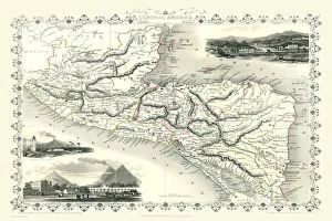
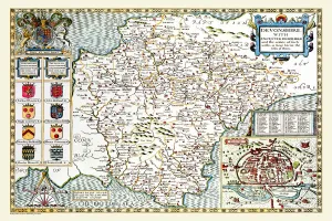
Old Map of Central America 1851 by John TallisA fine facimile artworked from an antique original map of Central America, issued as part of the 1851 edition of John Tallis and Companys " The Illustrated Atlas
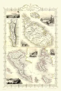
Gibraltar, Malta, and Ionian Isles 1851A fine facimile artworked from an antique original map of Gibraltar, Malta and Ionian Isles, issued as part of the 1851 edition of John Tallis and Companys " The Illustrated Atlas
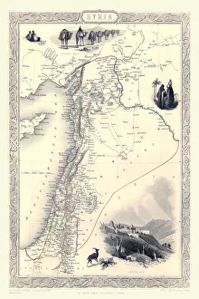
Syria 1851A fine facimile artworked from an antique original map of Syria, issued as part of the 1851 edition of John Tallis and Companys " The Illustrated Atlas and Modern History of the World"
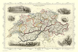
Switzerland 1851A fine facimile artworked from an antique original map of Switzerland, issued as part of the 1851 edition of John Tallis and Companys " The Illustrated Atlas and Modern History of the World"
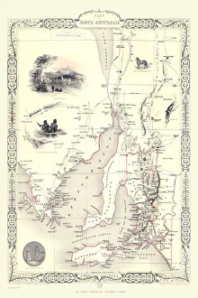
Part of South Australia 1851A fine facimile artworked from an antique original map of Part of South Australia, issued as part of the 1851 edition of John Tallis and Companys " The Illustrated Atlas
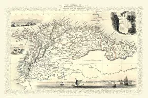
Old Map of Venezuela, New Granada, Equador and The Guayanas 1851 by John TallisA fine facimile artworked from an antique original map of Venezuela, New Granada, Equador and The Guayanas, issued as part of the 1851 edition of John Tallis
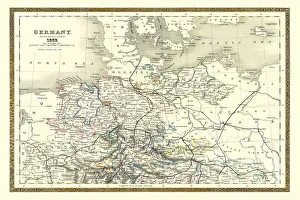
Old Map of Northern Germany 1852 by Henry George CollinsThis is a finely detailed map of Northern Germany remastered from a rare Atlas of the World published in 1852 by Henry George Collins
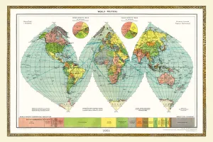
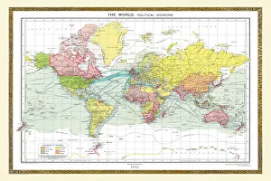
Old Map of the World 1951WMY1951
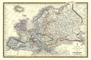
Old Map of Europe 1852 by Henry George CollinsThis is a finely detailed map of Europe remastered from a rare Atlas of the World published in 1852 by Henry George Collins
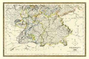
Old Map of Southern Germany 1852 by Henry George CollinsThis is a finely detailed map of Southern Germany remastered from a rare Atlas of the World published in 1852 by Henry George Collins
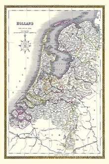
Old Map of Holland 1852 by Henry George CollinsThis is a finely detailed map of Holland remastered from a rare Atlas of the World published in 1852 by Henry George Collins
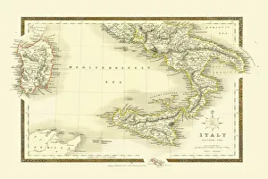
Old map of Southern Italy 1852 by Henry George CollinsThis is a finely detailed map of Southern Italy remastered from a rare Atlas of the World published in 1852 by Henry George Collins
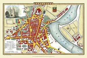
Old Map of Lancaster 1824 by Edward BainesThis is a fine detailed reproduction Map of The City of Lancaster, originally Published in 1836 by Edwward Baines
Old Map of the World 1931WMY1931
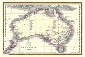
Old Map of Australia 1852 by Henry George CollinsThis is a finely detailed map of Australia remastered from a rare Atlas of the World published in 1852 by Henry George Collins
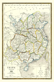
Old Map of China 1852 by Henry George CollinsThis is a finely detailed map of China remastered from a rare Atlas of the World published in 1852 by Henry George Collins
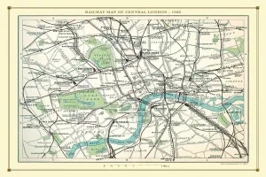
Old Map of the Railways of Central London 1908 by BartholomewRW0034
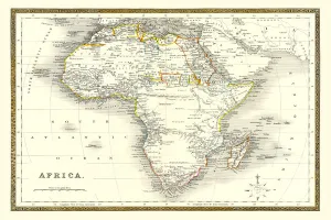
Old Map of Africa 1852 by Henry George CollinsThis is a finely detailed map of Africa remastered from a rare Atlas of the World published in 1852 by Henry George Collins
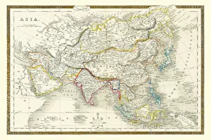
Old Map of Asia 1852 by Henry George CollinsThis is a finely detailed map of Asia remastered from a rare Atlas of the World published in 1852 by Henry George Collins
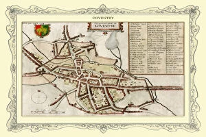
Old Map of Coventry 1730J102
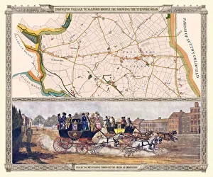
Old Map of the Turnpike Road u Erdington 1833 with Stagecoaches at "The Green"J130
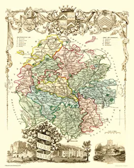
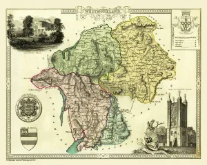
Old County Map of Herefordshire 1836 by Thomas MouleThis is a fine decorative reproduction County Map of Herefordshire from the First Edition series of Thomas Moule Maps, originally Published in 1836
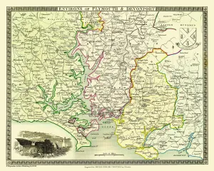
Old Map of the Environs of Plymouth and Devonport 1836 by Thomas MouleThis is a fine decorative reproduction Map of The Environs of Plymouth and Devonport from the First Edition series of Thomas Moule Maps, originally Published in 1836
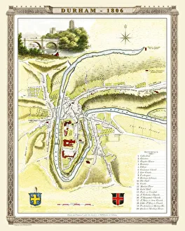
Old Map of Durham 1806 by Cole and RoperAn attractive and detailed early 19th century reproduction town plan of Durham 1805. First published by Cole and Roper as a finely engraved series of county maps
Old County Map of Westmoreland 1836 by Thomas MouleThis is a fine decorative reproduction County Map of Westmoreland from the First Edition series of Thomas Moule Maps, originally Published in 1836
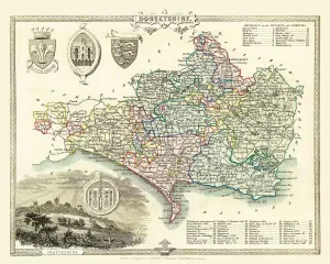
Old County Map of Dorsetshire 1836 by Thomas MouleThis is a fine decorative reproduction County Map of Dorsetshire from the First Edition series of Thomas Moule Maps, originally Published in 1836
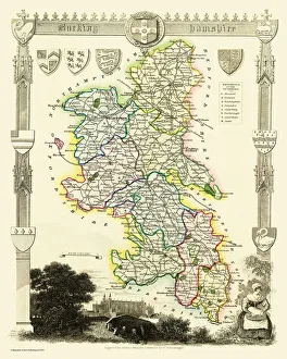
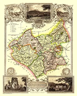
Old County Map of Buckinghamshire 1836 by Thomas MouleThis is a fine decorative reproduction County Map of Buckinghamshire from the First Edition series of Thomas Moule Maps, originally Published in 1836
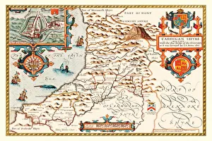
Old County Map of Cardiganshire 1611 by John SpeedA facimile of John Speeds historical map of Cardiganshire originally published for the " Theatre of the Empire of Great Britain"
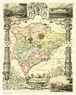
Old County Map of Rutlandshire 1836 by Thomas MouleThis is a fine decorative reproduction County Map of Rutlandshire from the First Edition series of Thomas Moule Maps, originally Published in 1836
Old County Map of Middlesex 1836 by Thomas MouleThis is a fine decorative reproduction County Map of Middlesex from the First Edition series of Thomas Moule Maps, originally Published in 1836
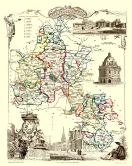
Old County Map of Oxfordshire 1836 by Thomas MouleThis is a fine decorative reproduction County Map of Oxfordshire from the First Edition series of Thomas Moule Maps, originally Published in 1836
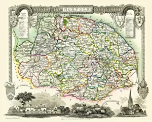
Old County Map of Norfolk 1836 by Thomas MouleThis is a fine decorative reproduction County Map of Norfolk from the First Edition series of Thomas Moule Maps, originally Published in 1836
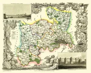
Old County Map of Leicestershire 1836 by Thomas MouleThis is a fine decorative reproduction County Map of Leicestershire from the First Edition series of Thomas Moule Maps, originally Published in 1836
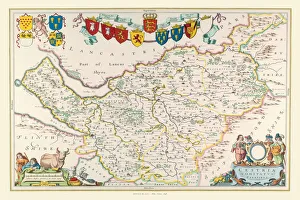
Old County Map of Cheshire 1648 by Johan Blaeu from the Atlas NovusThis detailed and most attractive reproduction map of Cheshire has been carefully art worked from a scan of an antique original
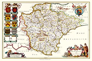
Old County Map of Devonshire 1648 by Johan Blaeu from the Atlas NovusThis detailed and most attractive reproduction map of Devonshire has been carefully art worked from a scan of an antique original
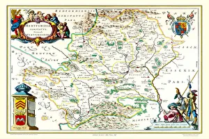
Old County Map of Hertfordshire 1648 by Johan Blaeu from the Atlas NovusThis detailed and most attractive reproduction map of Hertfordshire has been carefully art worked from a scan of an antique original
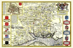
Old County Map of Hampshire 1611 by John SpeedA facimile of John Speeds historical map of Hampshire originally published for the " Theatre of the Empire of Great Britain", an atlas to accompany " a history of Great Britain"
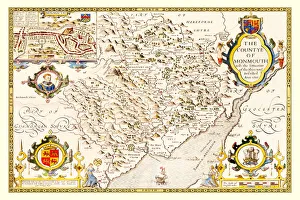
Old County Map of Monmouthshire 1611 by John SpeedA facimile of John Speeds historical map of Monmouthshire originally published for the " Theatre of the Empire of Great Britain"
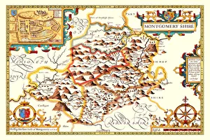
Old County Map of Montgomeryshire 1611 by John SpeedA facimile of John Speeds historical map of Montgomeryshire originally published for the " Theatre of the Empire of Great Britain"
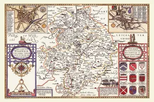
Old County Map of Warwickshire 1611 by John SpeedA facimile of John Speeds historical map of Warwickshire originally published for the " Theatre of the Empire of Great Britain", an atlas to accompany " a history of Great Britain"
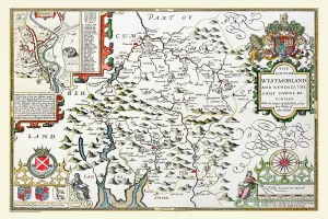
Old County Map of Westmorland 1611 by John SpeedA facimile of John Speeds historical map of Westmoreland originally published for the " Theatre of the Empire of Great Britain", an atlas to accompany " a history of Great Britain"
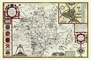
Old County Map of Worcestershire 1611 by John SpeedA facimile of John Speeds historical map of Worcestershire originally published for the " Theatre of the Empire of Great Britain"
Old County Map of Herefordshire 1611 by John SpeedA facimile of John Speeds historical map of Herefordshire originally published for the " Theatre of the Empire of Great Britain"
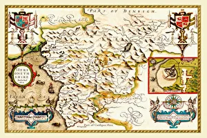
Old County Map of Merionethshire 1611 by John SpeedA facimile of John Speeds historical map of Merionethshire originally published for the " Theatre of the Empire of Great Britain"
Old County Map of Devonshire 1611 by John SpeedA facimile of John Speeds historical map of Devonshire originally published for the " Theatre of the Empire of Great Britain", an atlas to accompany " a history of Great Britain"
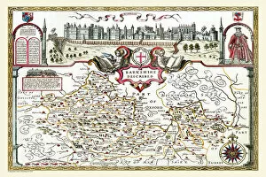
Old County Map of Berkshire 1611 by John SpeedA facimile of John Speeds historical map of Berkshire originally published for the " Theatre of the Empire of Great Britain", an atlas to accompany " a history of Great Britain"
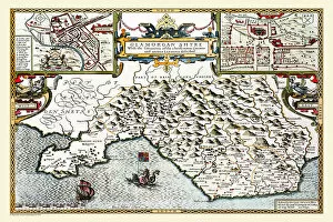
Old County Map of Glamorganshire, Wales 1611 by John SpeedA facimile of John Speeds historical map of Glamorganshire originally published for the " Theatre of the Empire of Great Britain"
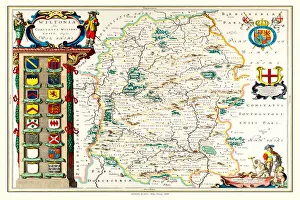
Old County Map of Wiltshire 1648 by Johan Blaeu from the Atlas NovusThis detailed and most attractive reproduction map of Wiltshire has been carefully art worked from a scan of an antique original