Home > British Town And City Plans > English & Welsh PORTFOLIO
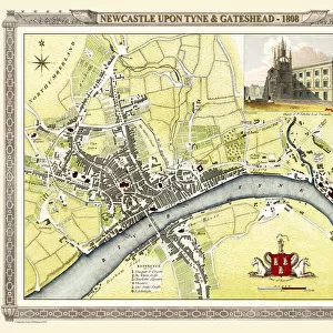
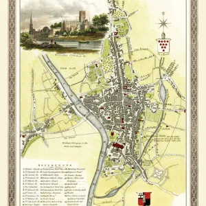
Old Map of Newcastle upon Tyne 1851 by John Tallis

![]()
Wall Art and Photo Gifts from MapSeeker
Old Map of Newcastle upon Tyne 1851 by John Tallis
Newcastle 1851, Gateshead is to the bottom of the John Tallis 1851 plan of Newcastle in Tyne and Wear with the famous High Level Railway crossing the River Tyne into Newcastle Central station. There are four attractive illustrations finishing the plan. These illustrations are the Railway Bridge, Central Station, the Castle and a view of the High Level Bridge from Gateshead to Newcastle
Media ID 20347620
Historic Map John Tallis John Tallis Map Old Town Plan Tallis Map
MADE IN THE UK
Safe Shipping with 30 Day Money Back Guarantee
FREE PERSONALISATION*
We are proud to offer a range of customisation features including Personalised Captions, Color Filters and Picture Zoom Tools
SECURE PAYMENTS
We happily accept a wide range of payment options so you can pay for the things you need in the way that is most convenient for you
* Options may vary by product and licensing agreement. Zoomed Pictures can be adjusted in the Basket.