Home > Maps from the British Isles > England and Counties PORTFOLIO
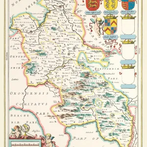
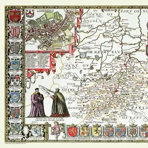
Old County Map of Buckinghamshire 1611 by John Speed

![]()
Wall Art and Photo Gifts from MapSeeker
Old County Map of Buckinghamshire 1611 by John Speed
A fine reproduction of John Speeds historical map of Buckinghamshire originally published for the " Theatre of the Empire of Great Britain", an atlas to accompany " a history of Great Britain".
At the top corner are town plans of Buckingham and, curiously, Reading. Speed has added a note, explaining that as there was not room for the Reading plan on his map of Berkshire, as it is " one of the most ancient and chiefest" towns in the county, he has added it to the Bucks one. On the bottom corners of the map are engraved arches, containing the coats of arms of the " honourable families" of the area and the Royal Arms. The boundaries of the hundreds, large estates, towns, some villages, hills and rivers and shown. The River Thames forms the southern boundary of the county
Media ID 20347763
© Mapseeker Publishing Ltd
County Map County Map Of England English County Map Historic Map John Speed Map Old County Map Old English County Map Speed Map Speede Map
MADE IN THE USA
Safe Shipping with 30 Day Money Back Guarantee
FREE PERSONALISATION*
We are proud to offer a range of customisation features including Personalised Captions, Color Filters and Picture Zoom Tools
SECURE PAYMENTS
We happily accept a wide range of payment options so you can pay for the things you need in the way that is most convenient for you
* Options may vary by product and licensing agreement. Zoomed Pictures can be adjusted in the Cart.