mail_outline sales@mediastorehouse.com
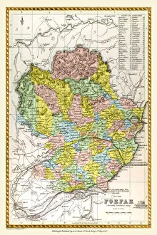
Old County Map of Forfar Scotland 1847 by A&C BlackA finely detailed facimile remastered in full colour from an antique original map of Forfar featured in A&C Blacks Atlas of 1847
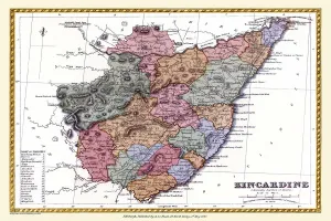
Old County Map of Kincardine Scotland 1847 by A&C BlackA finely detailed facimile remastered in full colour from an antique original map of Kincardine featured in A&C Blacks Atlas of 1847
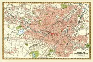
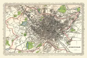
Old Map of Birmingham 1893 from the Comprehensive Gazetteer Atlas of England and WalesThis detailed reproduction plan of Birmingham has been re-worked from an antique originally published in the oComprehensive Gazetteer of England and Waleso 1893
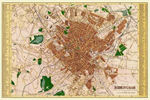
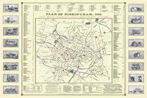
Old Map of Birmingham 1883==
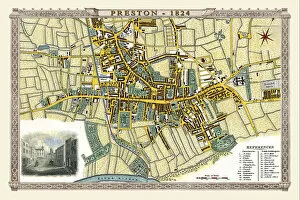
Old Map of Preston 1824 by Edward BainesThis is a fine detailed reproduction Map of The City of Preston from the First Edition series of Thomas Moule Maps, originally Published in 1836
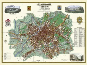
Old Map of Manchester and its Environs 1824 by William SwireJ128
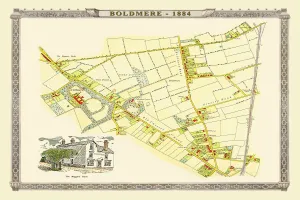
Old Map of Boldmere near Sutton Coldfield 1885PL045
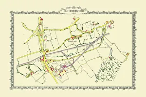
Old Map of the Mining Village of Hednesford in Staffordshire 1865PL032
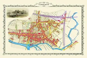
Old Map of the Town of Tamworth in Staffordshire 1885PL018
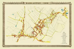
Old Map of the Town of Darlaston in the West Midlands 1838PL39
Old Map of Birmingham 1866 by Fullarton & CoThis detailed reproduction plan of Birmingham has been re-worked from an antique originally published in the 1860,s by Archibold Fullarton & Company
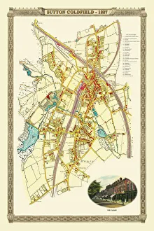
Old Map of the Royal Town of Sutton Coldfield 1884PL050
Old Map of Birmingham 1832 by James DrakeJ069
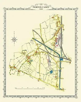
Old Map of the Village of Norton Canes in Staffordshire 1884PL033
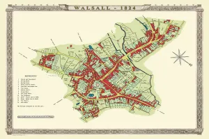
Old Map of Walsall 1824 by MasonJ022
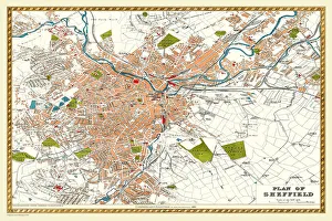
Old Map of Sheffield 1893 from the Comprehensive Gazetteer Atlas of England and WalesJ112
Old Map of the Village of Walmley near Sutton Coldfield 1886PL020
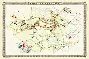
Old Map of the Village of Cheslyn Hay in Staffordshire 1884PL022
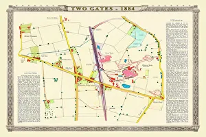
Old Map of the Village of Two Gates near Tamworth in Staffordshire 1884PL019
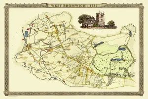
Old Map of West Bromwich in the West Midlands 1837PL021
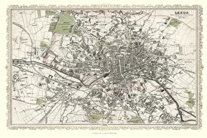
Old Map of Leeds 1866 by Fullarton & CoThis is an interesting and detailed reproduction Victorian town plan of Leeds which was originally published in John Marius Wilsons The Imperial Gazeteer of England and Wales (A.Fullarton & co)
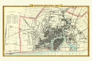
Old Map of Kingston Upon Hull 1862 by Fullarton & CoThis is an interesting and detailed reproduction Victorian town plan of Kingston-upon-Hull which was originally published in John Marius Wilsons The Imperial Gazeteer of England and Wales
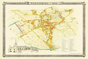
Old Map of Wednesbury Town in the Black Country 1846J023
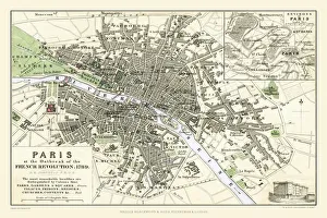
Paris at the Outbreak of the French Revolution 1789This is a detailed Plan of Paris showing the Parks, Gardens and Squares, Palaces, Bridges over the River Seine, Churches, Convents
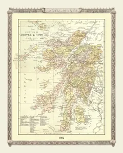
Old Map of the Counties of Argyll and Bute from the Philips Handy Atlas of 1882PHA003
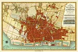
Old Map of Liverpool 1821 by J. GoreJ121
Old Map of Aston Manor near Birmingham 1796J122
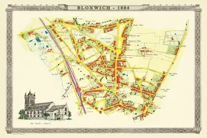
Old Map of the Village of Bloxwich near Walsall 1884PL002
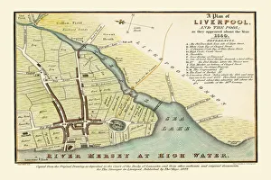
Old map of Liverpool 1650 by Thomas KayeAn interesting map originally published in 1829 by Thomas Kaye, this reproduction map represents the town of Liverpool in 1650
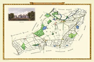
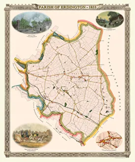
Old Map of The Parish of Erdington 1833J129
Old Map of the City of Bath 1836 by Thomas MouleThis is a fine decorative reproduction Map of The City of Bath from the First Edition series of Thomas Moule Maps, originally Published in 1836
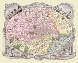
Old Map of the Environs of London 1836 by Thomas MouleThis is a fine decorative reproduction Map of The Environs of London from the First Edition series of Thomas Moule Maps, originally Published in 1836
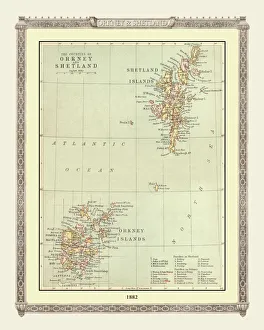
Old Map of the Orkney and Shetland Isles from the Philips Handy Atlas of 1882PHA022
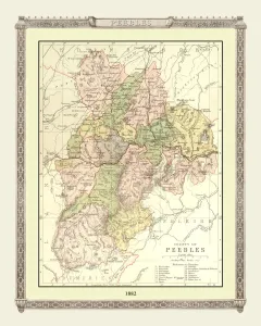
Old Map of the County of Peebles from the Philips Handy Atlas of 1882PHA023
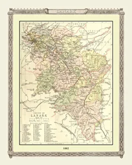
Old Map of the County of Lanark from the Philips Handy Atlas of 1882PHA020
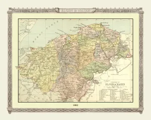
Old Map of the Counties of Elgin and Nairn from the Philips Handy Atlas of 1882PHA013
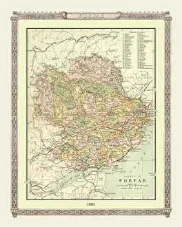
Old Map of the County of Forfar from the Philips Handy Atlas of 1882PHA015
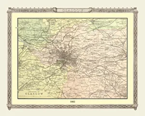
Old Map of the Environs of Glasgow from the Philips Handy Atlas of 1882PHA012
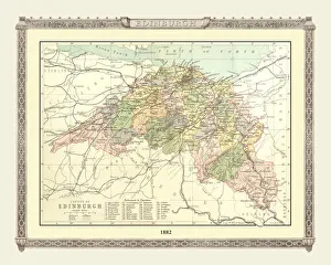
Old Map of the County of Edinburgh from the Philips Handy Atlas of 1882PHA010
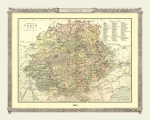
Old Map of the County of Perth from the Philips Handy Atlas of 1882PHA024
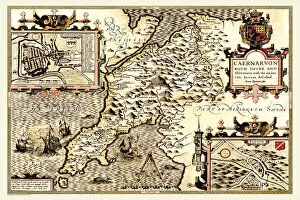
Old County Map of Caernarvonshire, Wales 1611 by John SpeedA facimile of John Speeds historical map of Caernarvonshire originally published for the " Theatre of the Empire of Great Britain"
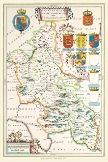
Old County Map of Buckinghamshire 1648 by Johan Blaeu from the Atlas NovusThis detailed and most attractive reproduction map of Buckinghamshire has been carefully art worked from a scan of an antique original
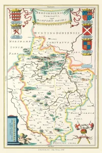
Old County Map of Bedfordshire 1648 by Johan Blaeu from the Atlas NovusThis detailed and most attractive reproduction map of Bedfordshire has been carefully art worked from a scan of an antique original
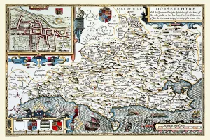
Old County Map of Dorsetshire 1611 by John SpeedA facimile of John Speeds historical map of Dorsetshire originally published for the " Theatre of the Empire of Great Britain", an atlas to accompany " a history of Great Britain"
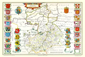
Old County Map of Cambridgeshire 1648 by Johan Blaeu from the Atlas NovusThis detailed and most attractive reproduction map of Cambridgeshire has been carefully art worked from a scan of an antique original
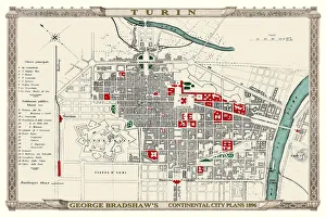
George Bradshaws Plan of Turin, Italy1896This is a very detailed Plan of Turin, which features streets, canals, principal buildings, railways and railway stations
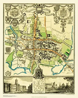
Old Map of the City Oxford 1836 by Thomas MouleThis is a fine decorative reproduction Map of The City of Oxford from the First Edition series of Thomas Moule Maps, originally Published in 1836
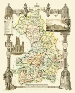
Old County Map of Cambridgeshire 1836 by Thomas MouleThis is a fine decorative reproduction County Map of Cambridgeshire from the First Edition series of Thomas Moule Maps, originally Published in 1836